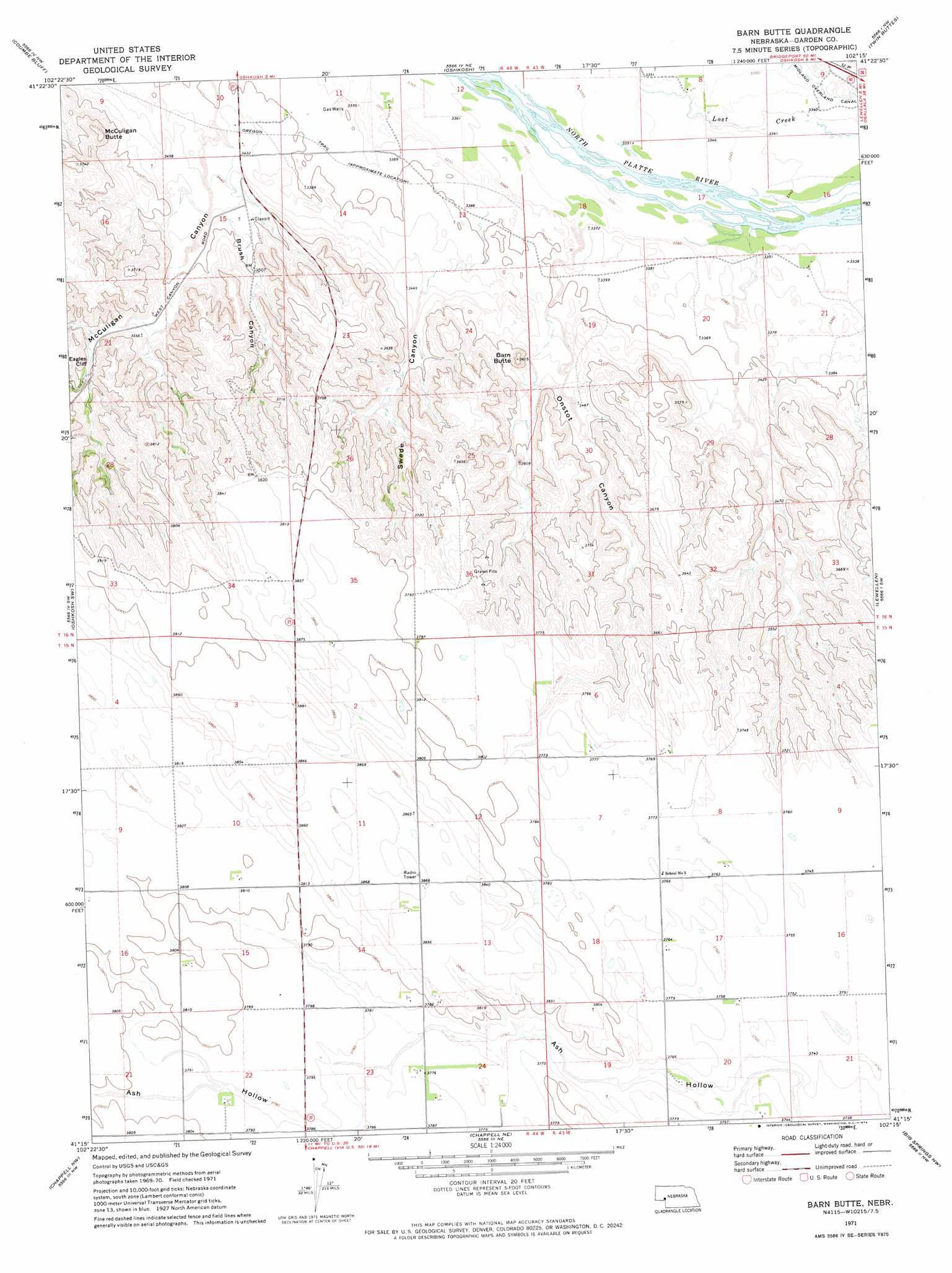
Barn Butte Topo Map Nebraska
To zoom in, hover over the map of Barn Butte
USGS Topo Quad 41102c3 - 1:24,000 scale
| Topo Map Name: | Barn Butte |
| USGS Topo Quad ID: | 41102c3 |
| Print Size: | ca. 21 1/4" wide x 27" high |
| Southeast Coordinates: | 41.25° N latitude / 102.25° W longitude |
| Map Center Coordinates: | 41.3125° N latitude / 102.3125° W longitude |
| U.S. State: | NE |
| Filename: | O41102C3.jpg |
| Download Map JPG Image: | Barn Butte topo map 1:24,000 scale |
| Map Type: | Topographic |
| Topo Series: | 7.5´ |
| Map Scale: | 1:24,000 |
| Source of Map Images: | United States Geological Survey (USGS) |
| Alternate Map Versions: |
Barn Butte NE 1971, updated 1974 Download PDF Buy paper map Barn Butte NE 2011 Download PDF Buy paper map Barn Butte NE 2014 Download PDF Buy paper map |
1:24,000 Topo Quads surrounding Barn Butte
Buske Ranch |
Sugar Loaf Hill |
Crescent Lake Se |
Gusher Spring |
Rackett Se |
Lisco |
Coumbe Bluff |
Oshkosh |
Twin Buttes |
Old Baldy |
Lisco Se |
Oskosh Sw |
Barn Butte |
Lewellen |
Ruthton |
Mount Vernon |
Chappell Nw |
Chappell Ne |
Big Springs Nw |
Big Springs Ne |
Lodgepole Se |
Chappell |
Chappell Se |
Barton |
Big Springs |
> Back to 41102a1 at 1:100,000 scale
> Back to 41102a1 at 1:250,000 scale
> Back to U.S. Topo Maps home
Barn Butte topo map: Gazetteer
Barn Butte: Cliffs
Eagles Cliff elevation 1103m 3618′Barn Butte: Parks
John Hollman Grave Historical Marker elevation 1044m 3425′Barn Butte: Summits
Barn Butte elevation 1093m 3585′McCuligan Butte elevation 1133m 3717′
Barn Butte: Valleys
Brush Canyon elevation 1055m 3461′McCuligan Canyon elevation 1037m 3402′
Onstot Canyon elevation 1049m 3441′
Swede Canyon elevation 1043m 3421′
Wild Horse Canyon elevation 1091m 3579′
Barn Butte digital topo map on disk
Buy this Barn Butte topo map showing relief, roads, GPS coordinates and other geographical features, as a high-resolution digital map file on DVD:
Eastern Wyoming & Western South Dakota
Buy digital topo maps: Eastern Wyoming & Western South Dakota