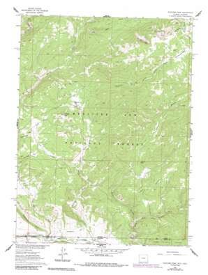
Fletcher Peak Topo Map Wyoming
To zoom in, hover over the map of Fletcher Peak
USGS Topo Quad 41107a1 - 1:24,000 scale
| Topo Map Name: | Fletcher Peak |
| USGS Topo Quad ID: | 41107a1 |
| Print Size: | ca. 21 1/4" wide x 27" high |
| Southeast Coordinates: | 41° N latitude / 107° W longitude |
| Map Center Coordinates: | 41.0625° N latitude / 107.0625° W longitude |
| U.S. States: | WY, CO |
| Filename: | o41107a1.jpg |
| Download Map JPG Image: | Fletcher Peak topo map 1:24,000 scale |
| Map Type: | Topographic |
| Topo Series: | 7.5´ |
| Map Scale: | 1:24,000 |
| Source of Map Images: | United States Geological Survey (USGS) |
| Alternate Map Versions: |
Fletcher Peak WY 1961, updated 1963 Download PDF Buy paper map Fletcher Peak WY 1961, updated 1971 Download PDF Buy paper map Fletcher Peak WY 1961, updated 1984 Download PDF Buy paper map Fletcher Peak WY 1961, updated 1984 Download PDF Buy paper map Fletcher Peak WY 2012 Download PDF Buy paper map Fletcher Peak WY 2015 Download PDF Buy paper map |
| FStopo: | US Forest Service topo Fletcher Peak is available: Download FStopo PDF Download FStopo TIF |
1:24,000 Topo Quads surrounding Fletcher Peak
> Back to 41107a1 at 1:100,000 scale
> Back to 41106a1 at 1:250,000 scale
> Back to U.S. Topo Maps home
Fletcher Peak topo map: Gazetteer
Fletcher Peak: Canals
Hackmaster Ditch elevation 2176m 7139′Fletcher Peak: Mines
North Fork Group Mine elevation 2342m 7683′Pease Placers Mine elevation 2316m 7598′
Standard Mine elevation 3106m 10190′
Standard Park Area Mine elevation 3122m 10242′
Three Forks Group Mine elevation 2316m 7598′
Fletcher Peak: Parks
Fletcher Park elevation 2441m 8008′Standard Park elevation 3096m 10157′
Fletcher Peak: Post Offices
Victoria Post Office (historical) elevation 2374m 7788′Fletcher Peak: Streams
Aspen Creek elevation 2546m 8353′Baby Lake Creek elevation 2464m 8083′
Cottonwood Creek elevation 2108m 6916′
Cottonwood Creek elevation 2108m 6916′
Deer Creek elevation 2094m 6870′
Deer Creek elevation 2094m 6870′
Haggarty Creek elevation 2471m 8106′
Karen Creek elevation 2332m 7650′
Little Snake River elevation 2094m 6870′
Mallard Creek elevation 2351m 7713′
Meadow Creek elevation 2635m 8645′
Rabbit Creek elevation 2476m 8123′
Roaring Fork elevation 2123m 6965′
Roaring Fork Little Snake River elevation 2123m 6965′
Sherard Creek elevation 2639m 8658′
Standard Creek elevation 2677m 8782′
West Branch North Fork Little Snake River elevation 2219m 7280′
Fletcher Peak: Summits
Fletcher Peak elevation 2633m 8638′Fletcher Peak: Valleys
Cherry Draw elevation 2107m 6912′Fletcher Peak digital topo map on disk
Buy this Fletcher Peak topo map showing relief, roads, GPS coordinates and other geographical features, as a high-resolution digital map file on DVD:
Eastern Wyoming & Western South Dakota
Buy digital topo maps: Eastern Wyoming & Western South Dakota


