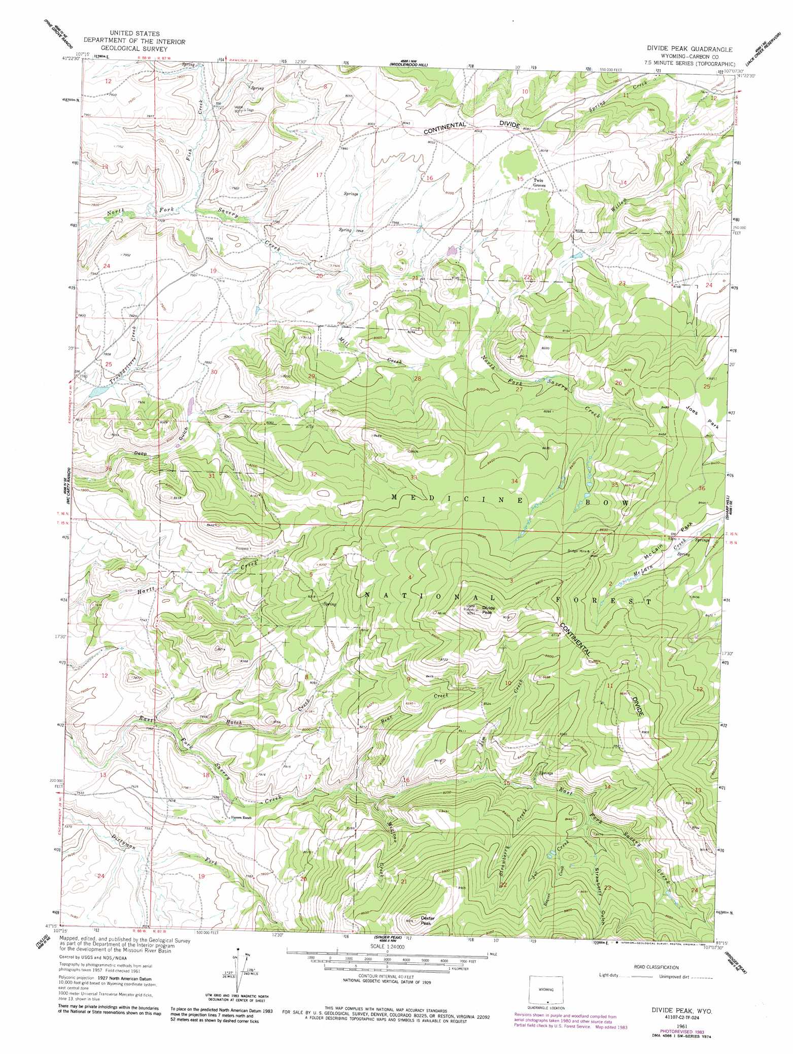
Divide Peak Topo Map Wyoming
To zoom in, hover over the map of Divide Peak
USGS Topo Quad 41107c2 - 1:24,000 scale
| Topo Map Name: | Divide Peak |
| USGS Topo Quad ID: | 41107c2 |
| Print Size: | ca. 21 1/4" wide x 27" high |
| Southeast Coordinates: | 41.25° N latitude / 107.125° W longitude |
| Map Center Coordinates: | 41.3125° N latitude / 107.1875° W longitude |
| U.S. State: | WY |
| Filename: | o41107c2.jpg |
| Download Map JPG Image: | Divide Peak topo map 1:24,000 scale |
| Map Type: | Topographic |
| Topo Series: | 7.5´ |
| Map Scale: | 1:24,000 |
| Source of Map Images: | United States Geological Survey (USGS) |
| Alternate Map Versions: |
Divide Peak WY 1961, updated 1963 Download PDF Buy paper map Divide Peak WY 1961, updated 1974 Download PDF Buy paper map Divide Peak WY 1961, updated 1984 Download PDF Buy paper map Divide Peak WY 1961, updated 1984 Download PDF Buy paper map Divide Peak WY 2012 Download PDF Buy paper map Divide Peak WY 2015 Download PDF Buy paper map |
| FStopo: | US Forest Service topo Divide Peak is available: Download FStopo PDF Download FStopo TIF |
1:24,000 Topo Quads surrounding Divide Peak
Bridge Pass |
La Marsh Creek West |
La Marsh Creek East |
Kindt Reservoir |
Overland Crossing |
Pole Gulch |
Pine Grove Ranch |
Middlewood Hill |
Jack Creek Reservoir |
Walck Ranch |
Ketchum Buttes |
Mccarty Ranch |
Divide Peak |
Sharp Hill |
Indian Rocks |
Browns Hill |
Tullis |
Singer Peak |
Bridger Peak |
Red Mountain |
Savery |
Grieve Reservoir |
Cottonwood Rim |
Fletcher Peak |
Solomon Creek |
> Back to 41107a1 at 1:100,000 scale
> Back to 41106a1 at 1:250,000 scale
> Back to U.S. Topo Maps home
Divide Peak topo map: Gazetteer
Divide Peak: Dams
Twin Groves Dam elevation 2427m 7962′Divide Peak: Flats
Joes Park elevation 2579m 8461′McLain Park elevation 2562m 8405′
Divide Peak: Mines
Bridger Mine elevation 2635m 8645′Divide Peak: Populated Places
Dexterville (historical) elevation 2294m 7526′Divide Peak: Post Offices
Dexterville Post Office (historical) elevation 2294m 7526′Divide Peak: Reservoirs
Twin Groves Reservoir elevation 2427m 7962′Divide Peak: Streams
Bear Creek elevation 2391m 7844′Beaver Creek elevation 2584m 8477′
Fish Creek elevation 2350m 7709′
Hatch Creek elevation 2322m 7618′
Jim Creek elevation 2486m 8156′
Joe Creek elevation 2534m 8313′
Mexican Creek elevation 2425m 7956′
Mill Creek elevation 2384m 7821′
Strawberry Creek elevation 2500m 8202′
Divide Peak: Summits
Dexter Peak elevation 2759m 9051′Divide Peak elevation 2766m 9074′
Divide Peak: Valleys
Strawberry Gulch elevation 2537m 8323′Divide Peak digital topo map on disk
Buy this Divide Peak topo map showing relief, roads, GPS coordinates and other geographical features, as a high-resolution digital map file on DVD:
Eastern Wyoming & Western South Dakota
Buy digital topo maps: Eastern Wyoming & Western South Dakota