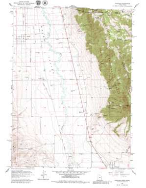
Portage Topo Map Utah
To zoom in, hover over the map of Portage
USGS Topo Quad 41112h2 - 1:24,000 scale
| Topo Map Name: | Portage |
| USGS Topo Quad ID: | 41112h2 |
| Print Size: | ca. 21 1/4" wide x 27" high |
| Southeast Coordinates: | 41.875° N latitude / 112.125° W longitude |
| Map Center Coordinates: | 41.9375° N latitude / 112.1875° W longitude |
| U.S. States: | UT, ID |
| Filename: | o41112h2.jpg |
| Download Map JPG Image: | Portage topo map 1:24,000 scale |
| Map Type: | Topographic |
| Topo Series: | 7.5´ |
| Map Scale: | 1:24,000 |
| Source of Map Images: | United States Geological Survey (USGS) |
| Alternate Map Versions: |
Portage UT 1964, updated 1966 Download PDF Buy paper map Portage UT 1964, updated 1980 Download PDF Buy paper map Portage UT 2011 Download PDF Buy paper map Portage UT 2014 Download PDF Buy paper map |
| FStopo: | US Forest Service topo Portage is available: Download FStopo PDF Download FStopo TIF |
1:24,000 Topo Quads surrounding Portage
> Back to 41112e1 at 1:100,000 scale
> Back to 41112a1 at 1:250,000 scale
> Back to U.S. Topo Maps home
Portage topo map: Gazetteer
Portage: Forests
Caribou National Forest elevation 2076m 6811′Portage: Populated Places
Plymouth elevation 1368m 4488′Portage elevation 1331m 4366′
Washakie elevation 1335m 4379′
Portage: Reservoirs
Mound Spring elevation 1342m 4402′Portage: Springs
Elgrove Spring elevation 1594m 5229′Mountain Spring elevation 1381m 4530′
Oregon Springs elevation 1362m 4468′
Portage: Summits
Gunsight Peak elevation 2493m 8179′Sheep Dip Mountain elevation 2133m 6998′
Sheep Dip Mountain elevation 2147m 7043′
Portage: Valleys
Bishop Canyon elevation 1467m 4812′Broad Canyon elevation 1380m 4527′
Castlegate Canyon elevation 1630m 5347′
Cedar Canyon elevation 1395m 4576′
Elgrove Canyon elevation 1554m 5098′
Gardner Canyon elevation 1583m 5193′
Johnson Canyon elevation 1392m 4566′
Left Fork Dutchmans Canyon elevation 1577m 5173′
Little Canyon elevation 1451m 4760′
Little Canyon elevation 1442m 4730′
Malad Valley elevation 1331m 4366′
Malad Valley elevation 1331m 4366′
Mine Hollow elevation 1553m 5095′
Precipitous Canyon elevation 1458m 4783′
Right Fork Dutchmans Canyon elevation 1606m 5269′
Ruff Canyon elevation 1403m 4603′
Water Hollow elevation 1356m 4448′
Wood Canyon elevation 1611m 5285′
Portage digital topo map on disk
Buy this Portage topo map showing relief, roads, GPS coordinates and other geographical features, as a high-resolution digital map file on DVD:


