Wilkins Topo Map Nevada
To zoom in, hover over the map of Wilkins
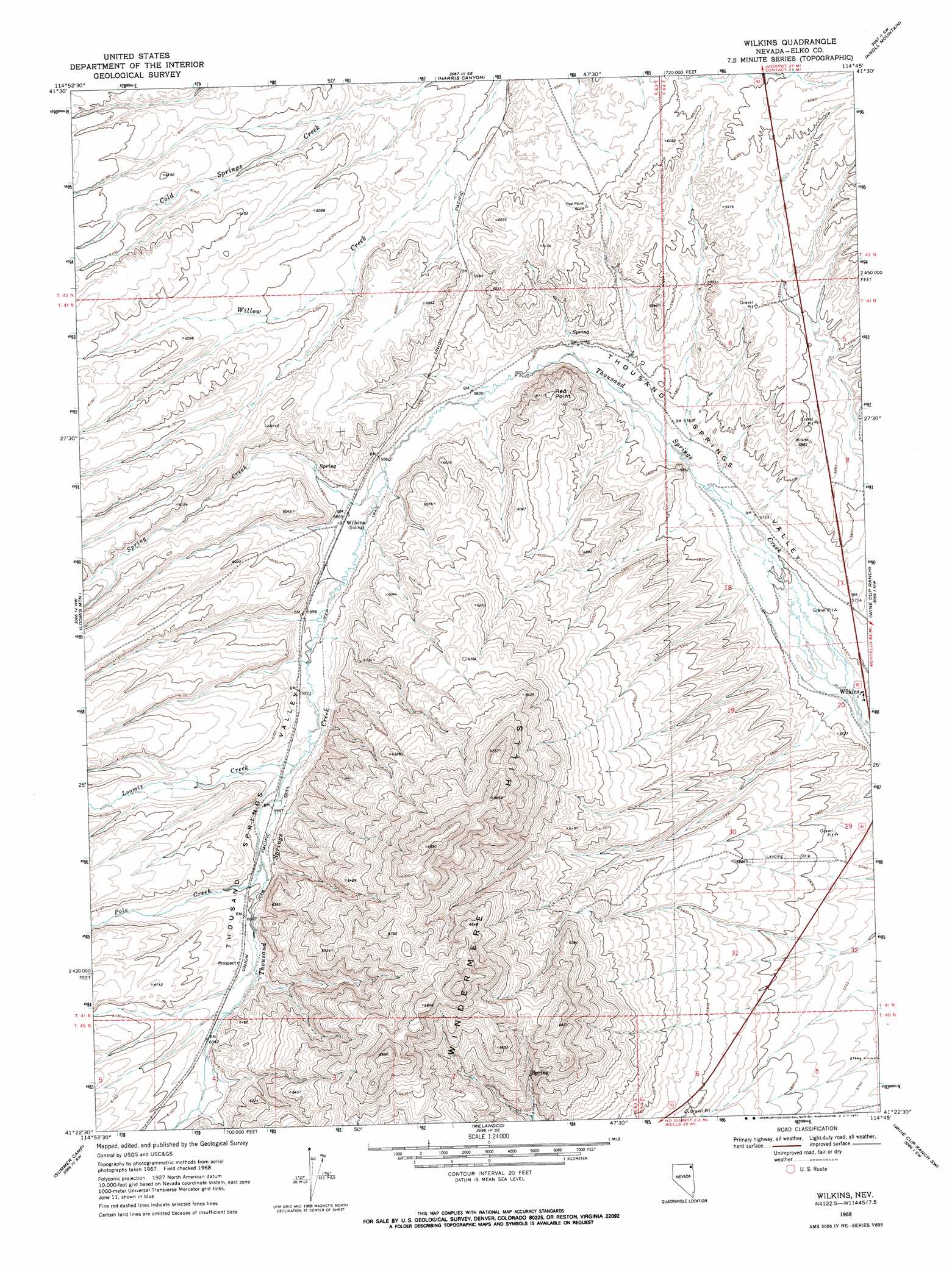
USGS Topo Quad 41114d7 - 1:24,000 scale
| Topo Map Name: | Wilkins |
| USGS Topo Quad ID: | 41114d7 |
| Print Size: | ca. 21 1/4" wide x 27" high |
| Southeast Coordinates: | 41.375° N latitude / 114.75° W longitude |
| Map Center Coordinates: | 41.4375° N latitude / 114.8125° W longitude |
| U.S. State: | NV |
| Filename: | o41114d7.jpg |
| Download Map JPG Image: | Wilkins topo map 1:24,000 scale |
| Map Type: | Topographic |
| Topo Series: | 7.5´ |
| Map Scale: | 1:24,000 |
| Source of Map Images: | United States Geological Survey (USGS) |
| Alternate Map Versions: |
Wilkins NV 1968, updated 1971 Download PDF Buy paper map Wilkins NV 2012 Download PDF Buy paper map Wilkins NV 2014 Download PDF Buy paper map |
1:24,000 Topo Quads surrounding Wilkins
Gilmer Ranch |
Hubbard Basin |
Henry |
Blanchard Mountain |
Texas Spring |
Stormy Peak |
Boies Reservoir |
Harris Canyon |
Knoll Mountain |
Knoll Mountain Se |
Black Butte Ne |
Loomis Mountain |
Wilkins |
Wine Cup Ranch |
Wine Cup Ranch Ne |
Black Butte |
Summer Camp |
Melandco |
Wine Cup Ranch Sw |
Wine Cup Ranch Se |
Metropolis |
Oxley Peak |
Wells Peak |
Holborn |
Pequop |
> Back to 41114a1 at 1:100,000 scale
> Back to 41114a1 at 1:250,000 scale
> Back to U.S. Topo Maps home
Wilkins topo map: Gazetteer
Wilkins: Populated Places
Wilkins elevation 1732m 5682′Wilkins: Post Offices
Wilkins Post Office (historical) elevation 1732m 5682′Wilkins: Streams
Loomis Creek elevation 1812m 5944′Pole Creek elevation 1824m 5984′
Spring Creek elevation 1785m 5856′
Wilkins: Summits
Red Point elevation 1852m 6076′Wilkins: Wells
Brush Creek Well elevation 1751m 5744′Wilkins digital topo map on disk
Buy this Wilkins topo map showing relief, roads, GPS coordinates and other geographical features, as a high-resolution digital map file on DVD: