Stormy Peak Topo Map Nevada
To zoom in, hover over the map of Stormy Peak
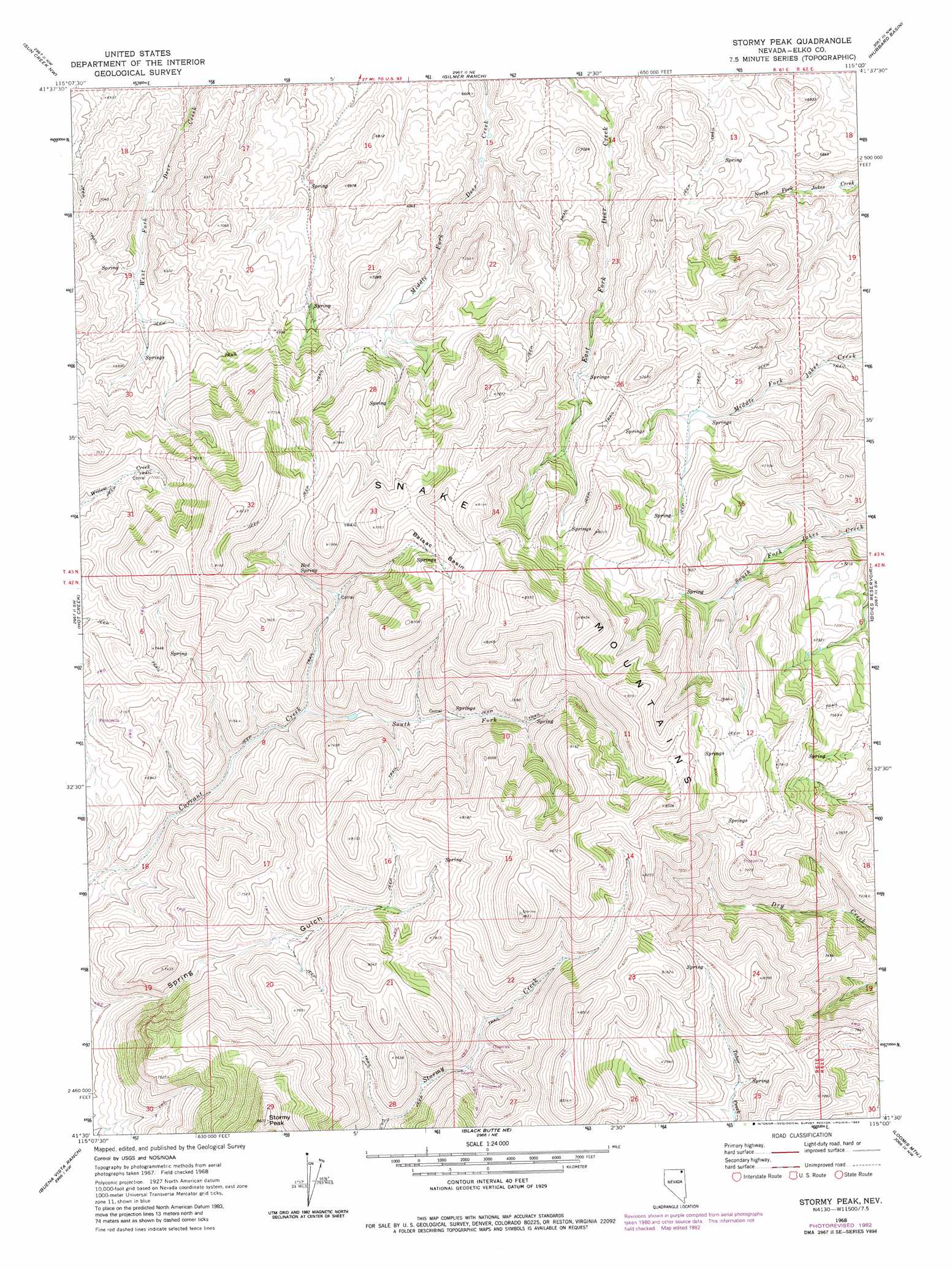
USGS Topo Quad 41115e1 - 1:24,000 scale
| Topo Map Name: | Stormy Peak |
| USGS Topo Quad ID: | 41115e1 |
| Print Size: | ca. 21 1/4" wide x 27" high |
| Southeast Coordinates: | 41.5° N latitude / 115° W longitude |
| Map Center Coordinates: | 41.5625° N latitude / 115.0625° W longitude |
| U.S. State: | NV |
| Filename: | o41115e1.jpg |
| Download Map JPG Image: | Stormy Peak topo map 1:24,000 scale |
| Map Type: | Topographic |
| Topo Series: | 7.5´ |
| Map Scale: | 1:24,000 |
| Source of Map Images: | United States Geological Survey (USGS) |
| Alternate Map Versions: |
Stormy Peak NV 1968, updated 1972 Download PDF Buy paper map Stormy Peak NV 1968, updated 1983 Download PDF Buy paper map Stormy Peak NV 2012 Download PDF Buy paper map Stormy Peak NV 2014 Download PDF Buy paper map |
1:24,000 Topo Quads surrounding Stormy Peak
Gods Pocket Peak |
Goat Creek |
Buckhorn Ridge |
Twin Meadows Ranch |
Contact |
Marys River Basin Ne |
Sun Creek Nw |
Gilmer Ranch |
Hubbard Basin |
Henry |
Marys River Basin Se |
Hot Creek |
Stormy Peak |
Boies Reservoir |
Harris Canyon |
Hanks Creek Ne |
Buena Vista Ranch |
Black Butte Ne |
Loomis Mountain |
Wilkins |
Hot Springs Creek |
Black Butte Sw |
Black Butte |
Summer Camp |
Melandco |
> Back to 41115e1 at 1:100,000 scale
> Back to 41114a1 at 1:250,000 scale
> Back to U.S. Topo Maps home
Stormy Peak topo map: Gazetteer
Stormy Peak: Basins
Balsac Basin elevation 2354m 7723′Stormy Peak: Ranges
Snake Mountains elevation 2603m 8540′Stormy Peak: Springs
Red Spring elevation 2206m 7237′Stormy Peak: Streams
South Fork Currant Creek elevation 2083m 6833′Stormy Peak: Summits
Stormy Peak elevation 2626m 8615′Stormy Peak digital topo map on disk
Buy this Stormy Peak topo map showing relief, roads, GPS coordinates and other geographical features, as a high-resolution digital map file on DVD: