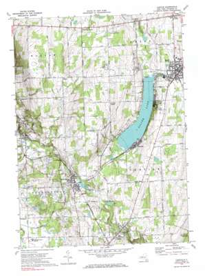
Castile Topo Map New York
To zoom in, hover over the map of Castile
USGS Topo Quad 42078f1 - 1:24,000 scale
| Topo Map Name: | Castile |
| USGS Topo Quad ID: | 42078f1 |
| Print Size: | ca. 21 1/4" wide x 27" high |
| Southeast Coordinates: | 42.625° N latitude / 78° W longitude |
| Map Center Coordinates: | 42.6875° N latitude / 78.0625° W longitude |
| U.S. State: | NY |
| Filename: | o42078f1.jpg |
| Download Map JPG Image: | Castile topo map 1:24,000 scale |
| Map Type: | Topographic |
| Topo Series: | 7.5´ |
| Map Scale: | 1:24,000 |
| Source of Map Images: | United States Geological Survey (USGS) |
| Alternate Map Versions: |
Castile NY 1943, updated 1960 Download PDF Buy paper map Castile NY 1972, updated 1974 Download PDF Buy paper map Castile NY 1972, updated 1985 Download PDF Buy paper map Castile NY 2010 Download PDF Buy paper map Castile NY 2013 Download PDF Buy paper map Castile NY 2016 Download PDF Buy paper map |
1:24,000 Topo Quads surrounding Castile
> Back to 42078e1 at 1:100,000 scale
> Back to 42078a1 at 1:250,000 scale
> Back to U.S. Topo Maps home
Castile topo map: Gazetteer
Castile: Airports
Perry-Warsaw Airport elevation 474m 1555′Castile: Lakes
Silver Lake elevation 413m 1354′Castile: Parks
Perry Village Park elevation 427m 1400′Silver Lake Institute Historic District elevation 424m 1391′
Silver Lake State Park elevation 433m 1420′
Village Park elevation 449m 1473′
Castile: Populated Places
Castile elevation 413m 1354′Chace elevation 424m 1391′
Fairview elevation 421m 1381′
Newburg elevation 364m 1194′
Oatka elevation 461m 1512′
Perry elevation 418m 1371′
Perry Center elevation 425m 1394′
Rock Glen elevation 398m 1305′
Silver Lake elevation 419m 1374′
Silver Lake Junction elevation 430m 1410′
Silver Springs elevation 431m 1414′
Sucker Brook elevation 427m 1400′
West Perry elevation 438m 1437′
West Perry Center elevation 477m 1564′
Castile: Streams
Cotton Creek elevation 398m 1305′Silver Lake Inlet elevation 413m 1354′
Sucker Brook elevation 420m 1377′
Castile: Summits
Oak Hill elevation 518m 1699′Castile digital topo map on disk
Buy this Castile topo map showing relief, roads, GPS coordinates and other geographical features, as a high-resolution digital map file on DVD:


