Ann Arbor West Topo Map Michigan
To zoom in, hover over the map of Ann Arbor West
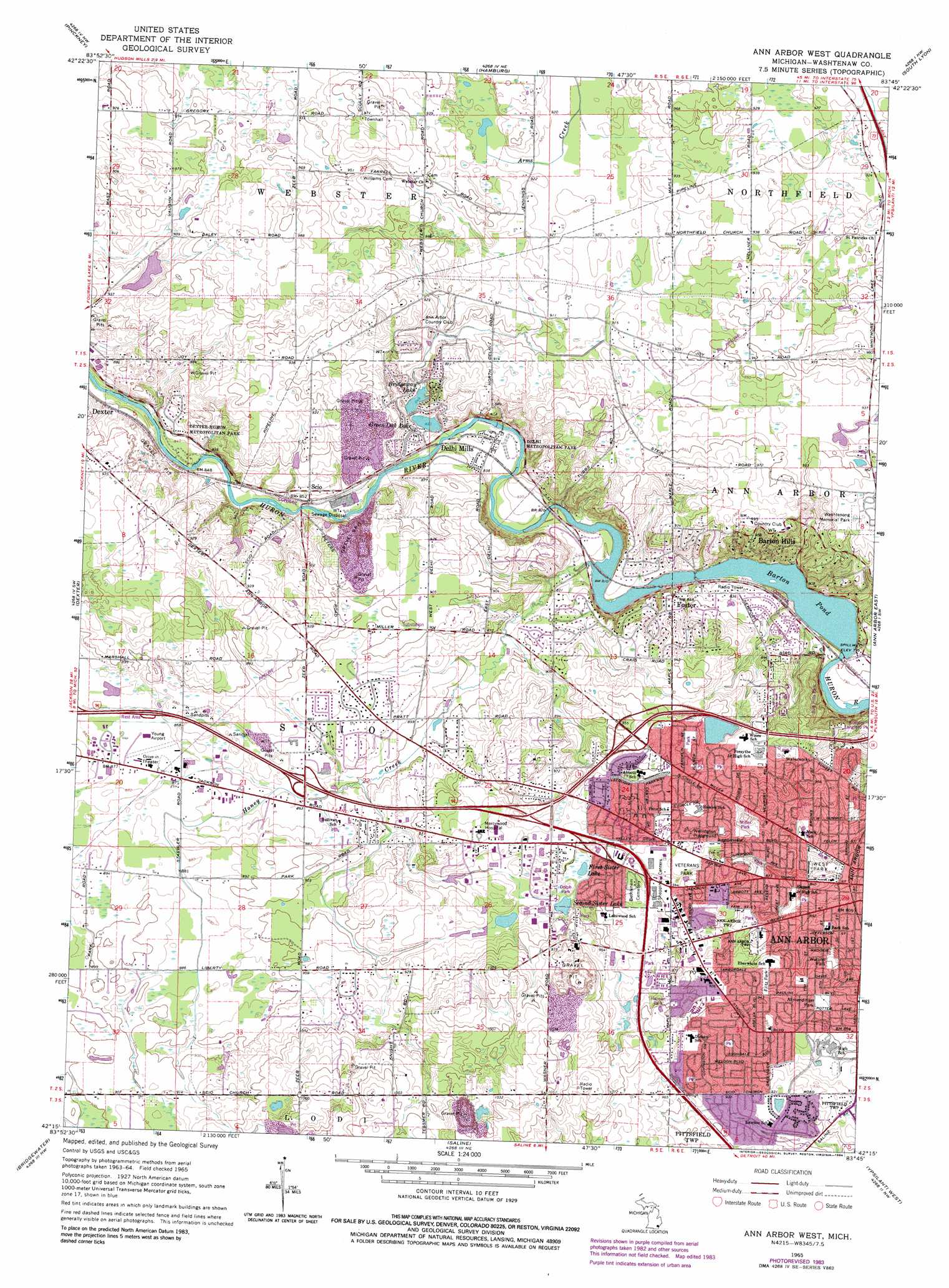
USGS Topo Quad 42083c7 - 1:24,000 scale
| Topo Map Name: | Ann Arbor West |
| USGS Topo Quad ID: | 42083c7 |
| Print Size: | ca. 21 1/4" wide x 27" high |
| Southeast Coordinates: | 42.25° N latitude / 83.75° W longitude |
| Map Center Coordinates: | 42.3125° N latitude / 83.8125° W longitude |
| U.S. State: | MI |
| Filename: | o42083c7.jpg |
| Download Map JPG Image: | Ann Arbor West topo map 1:24,000 scale |
| Map Type: | Topographic |
| Topo Series: | 7.5´ |
| Map Scale: | 1:24,000 |
| Source of Map Images: | United States Geological Survey (USGS) |
| Alternate Map Versions: |
Ann Arbor West MI 1965, updated 1967 Download PDF Buy paper map Ann Arbor West MI 1965, updated 1977 Download PDF Buy paper map Ann Arbor West MI 1965, updated 1984 Download PDF Buy paper map Ann Arbor West MI 2011 Download PDF Buy paper map Ann Arbor West MI 2014 Download PDF Buy paper map Ann Arbor West MI 2017 Download PDF Buy paper map |
1:24,000 Topo Quads surrounding Ann Arbor West
Parkers Corners |
Howell |
Brighton |
Kent Lake |
Milford |
Gregory |
Pinckney |
Hamburg |
South Lyon |
Salem |
Chelsea |
Dexter |
Ann Arbor West |
Ann Arbor East |
Denton |
Manchester |
Bridgewater |
Saline |
Ypsilanti West |
Ypsilanti East |
Tipton |
Tecumseh North |
Macon |
Milan |
Maybee |
> Back to 42083a1 at 1:100,000 scale
> Back to 42082a1 at 1:250,000 scale
> Back to U.S. Topo Maps home
Ann Arbor West topo map: Gazetteer
Ann Arbor West: Lakes
Bridgeway Lake elevation 258m 846′First Sister Lake elevation 277m 908′
Green Oak Lake elevation 254m 833′
Second Sister Lake elevation 277m 908′
Ann Arbor West: Parks
Allmendinger Park elevation 280m 918′Delhi Metropolitan Park elevation 247m 810′
Dexter Huron Metropolitan Park elevation 266m 872′
Fritz Park elevation 281m 921′
Wellington Playground elevation 281m 921′
West Park elevation 243m 797′
Wurster Park elevation 271m 889′
Ann Arbor West: Populated Places
Barton Hills elevation 290m 951′Delhi Mills elevation 253m 830′
Foster elevation 259m 849′
Scio elevation 266m 872′
Ann Arbor West: Reservoirs
Barton Pond elevation 242m 793′Ann Arbor West: Streams
Honey Creek elevation 247m 810′Ann Arbor West digital topo map on disk
Buy this Ann Arbor West topo map showing relief, roads, GPS coordinates and other geographical features, as a high-resolution digital map file on DVD:
 map DVD")