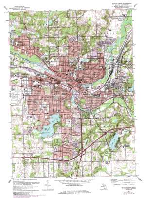
Battle Creek Topo Map Michigan
To zoom in, hover over the map of Battle Creek
USGS Topo Quad 42085c2 - 1:24,000 scale
| Topo Map Name: | Battle Creek |
| USGS Topo Quad ID: | 42085c2 |
| Print Size: | ca. 21 1/4" wide x 27" high |
| Southeast Coordinates: | 42.25° N latitude / 85.125° W longitude |
| Map Center Coordinates: | 42.3125° N latitude / 85.1875° W longitude |
| U.S. State: | MI |
| Filename: | o42085c2.jpg |
| Download Map JPG Image: | Battle Creek topo map 1:24,000 scale |
| Map Type: | Topographic |
| Topo Series: | 7.5´ |
| Map Scale: | 1:24,000 |
| Source of Map Images: | United States Geological Survey (USGS) |
| Alternate Map Versions: |
Battle Creek MI 1947, updated 1955 Download PDF Buy paper map Battle Creek MI 1961, updated 1962 Download PDF Buy paper map Battle Creek MI 1961, updated 1973 Download PDF Buy paper map Battle Creek MI 1961, updated 1985 Download PDF Buy paper map Battle Creek MI 2011 Download PDF Buy paper map Battle Creek MI 2014 Download PDF Buy paper map Battle Creek MI 2016 Download PDF Buy paper map |
1:24,000 Topo Quads surrounding Battle Creek
> Back to 42085a1 at 1:100,000 scale
> Back to 42084a1 at 1:250,000 scale
> Back to U.S. Topo Maps home
Battle Creek topo map: Gazetteer
Battle Creek: Airports
Leila Hospital Helistop elevation 263m 862′Battle Creek: Canals
Romans Drain elevation 251m 823′Battle Creek: Islands
Clark Island elevation 282m 925′Vince Island elevation 283m 928′
Ward Island elevation 278m 912′
Battle Creek: Lakes
Beadle Lake elevation 270m 885′Dexter Lake elevation 260m 853′
Goguac Lake elevation 278m 912′
Hall Lake elevation 260m 853′
Hamlin Lake elevation 260m 853′
Lower Mill Pond elevation 250m 820′
Mud Lake elevation 258m 846′
Spring Lakes elevation 257m 843′
Battle Creek: Parks
Bailey Park elevation 254m 833′Barnes Park elevation 277m 908′
Fell Park elevation 250m 820′
Irving Park elevation 255m 836′
Kolb Park elevation 256m 839′
Leila Arboretum elevation 254m 833′
McCrae Park elevation 280m 918′
Piper Park elevation 257m 843′
Post Park elevation 268m 879′
Watsh Field elevation 249m 816′
Willard Park elevation 282m 925′
Battle Creek: Populated Places
Battle Creek elevation 256m 839′Beadle Lake elevation 274m 898′
Brownlee Park elevation 267m 875′
Greenfield Park elevation 267m 875′
Lakeview elevation 285m 935′
Maplehurst elevation 258m 846′
Morgan Corners elevation 271m 889′
Old Mill Gardens elevation 284m 931′
Orchard Park elevation 265m 869′
Springfield elevation 269m 882′
Springfield Place elevation 285m 935′
Sunrise Heights elevation 260m 853′
Urbandale elevation 251m 823′
Verona Park elevation 265m 869′
Battle Creek: Streams
Barnum Creek elevation 274m 898′Battle Creek elevation 250m 820′
Brickyard Creek elevation 262m 859′
Harper Creek elevation 256m 839′
Minges Brook elevation 253m 830′
Wanadoga Creek elevation 254m 833′
Willow Creek elevation 256m 839′
Battle Creek digital topo map on disk
Buy this Battle Creek topo map showing relief, roads, GPS coordinates and other geographical features, as a high-resolution digital map file on DVD:
Northern Illinois, Northern Indiana & Southwestern Michigan
Buy digital topo maps: Northern Illinois, Northern Indiana & Southwestern Michigan


