Covert Topo Map Michigan
To zoom in, hover over the map of Covert
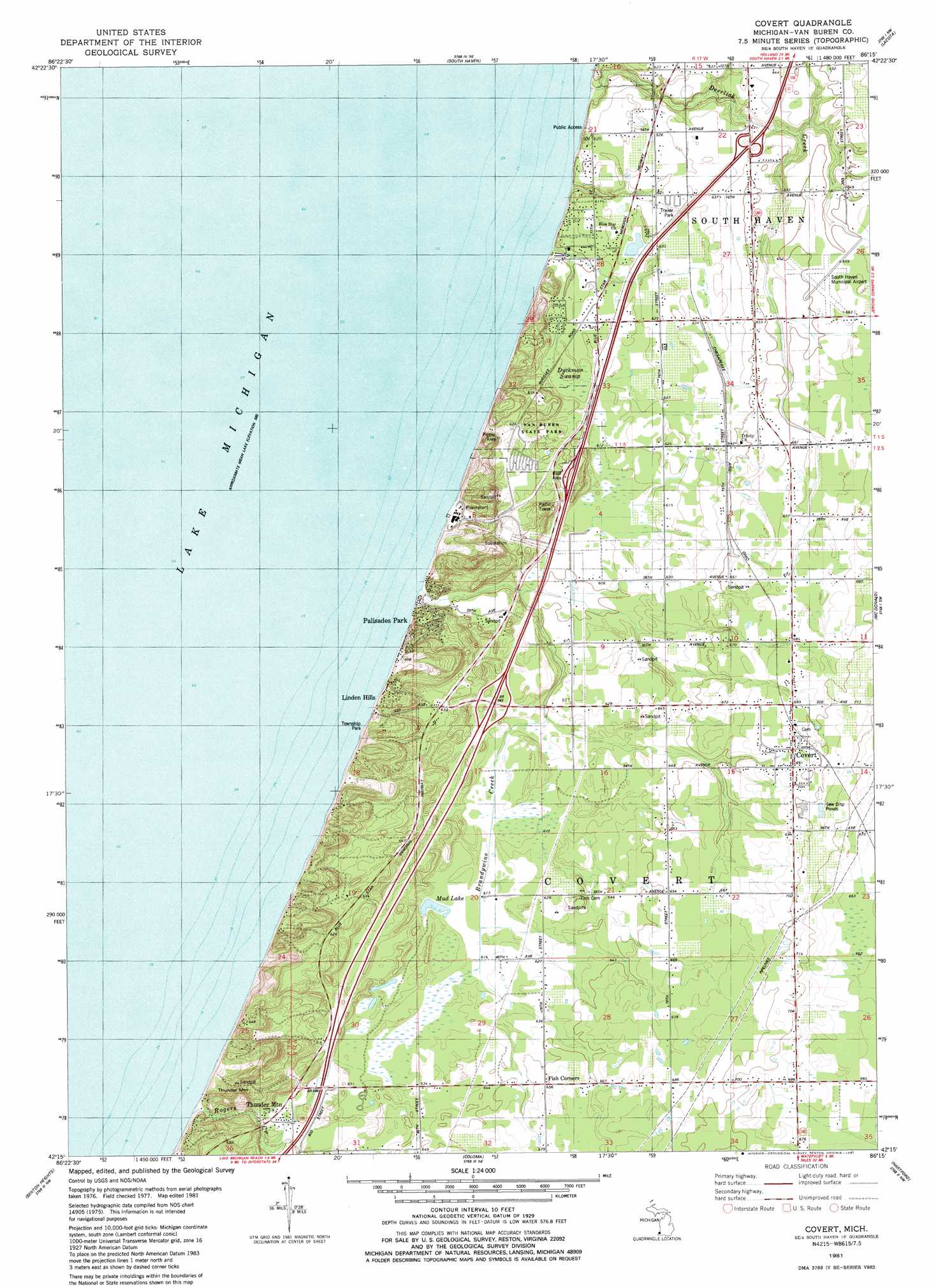
USGS Topo Quad 42086c3 - 1:24,000 scale
| Topo Map Name: | Covert |
| USGS Topo Quad ID: | 42086c3 |
| Print Size: | ca. 21 1/4" wide x 27" high |
| Southeast Coordinates: | 42.25° N latitude / 86.25° W longitude |
| Map Center Coordinates: | 42.3125° N latitude / 86.3125° W longitude |
| U.S. State: | MI |
| Filename: | o42086c3.jpg |
| Download Map JPG Image: | Covert topo map 1:24,000 scale |
| Map Type: | Topographic |
| Topo Series: | 7.5´ |
| Map Scale: | 1:24,000 |
| Source of Map Images: | United States Geological Survey (USGS) |
| Alternate Map Versions: |
Covert MI 1981, updated 1982 Download PDF Buy paper map Covert MI 2011 Download PDF Buy paper map Covert MI 2014 Download PDF Buy paper map Covert MI 2017 Download PDF Buy paper map |
1:24,000 Topo Quads surrounding Covert
Glenn |
Fennville |
|||
South Haven |
Lacota |
Pullman |
||
Covert |
Mcdonald |
Bangor |
||
Benton Heights |
Coloma |
Hartford |
Lawrence |
|
Stevensville |
Benton Harbor |
Sodus |
Sister Lakes |
Twin Lakes |
> Back to 42086a1 at 1:100,000 scale
> Back to 42086a1 at 1:250,000 scale
> Back to U.S. Topo Maps home
Covert topo map: Gazetteer
Covert: Airports
Consumers Power Company Heliport elevation 184m 603′South Haven Area Regional Airport elevation 200m 656′
South Haven Municipal Airport elevation 199m 652′
Covert: Crossings
Interchange 13 elevation 192m 629′Interchange 18 elevation 191m 626′
Covert: Lakes
Mud Lake elevation 196m 643′Covert: Parks
Covert Library Historical Marker elevation 207m 679′Covert Township Park elevation 199m 652′
Covert: Populated Places
Braywood elevation 208m 682′Covert elevation 210m 688′
Crystal Beach elevation 177m 580′
Fish Corners elevation 200m 656′
Linden Hills elevation 184m 603′
Mitchell Brothers Mobile Home Park elevation 191m 626′
Palisades Park elevation 177m 580′
Wildwood elevation 177m 580′
Covert: Post Offices
Covert Post Office elevation 211m 692′Packard Post Office (historical) elevation 200m 656′
Pallisades Park Post Office (historical) elevation 177m 580′
Covert: Streams
Brandywine Creek elevation 177m 580′Deerlick Creek elevation 177m 580′
Rogers Creek elevation 177m 580′
Covert: Summits
Thunder Mountain elevation 210m 688′Covert: Swamps
Dyckman Swamp elevation 187m 613′Covert digital topo map on disk
Buy this Covert topo map showing relief, roads, GPS coordinates and other geographical features, as a high-resolution digital map file on DVD:
Northern Illinois, Northern Indiana & Southwestern Michigan
Buy digital topo maps: Northern Illinois, Northern Indiana & Southwestern Michigan