Sodus Topo Map Michigan
To zoom in, hover over the map of Sodus
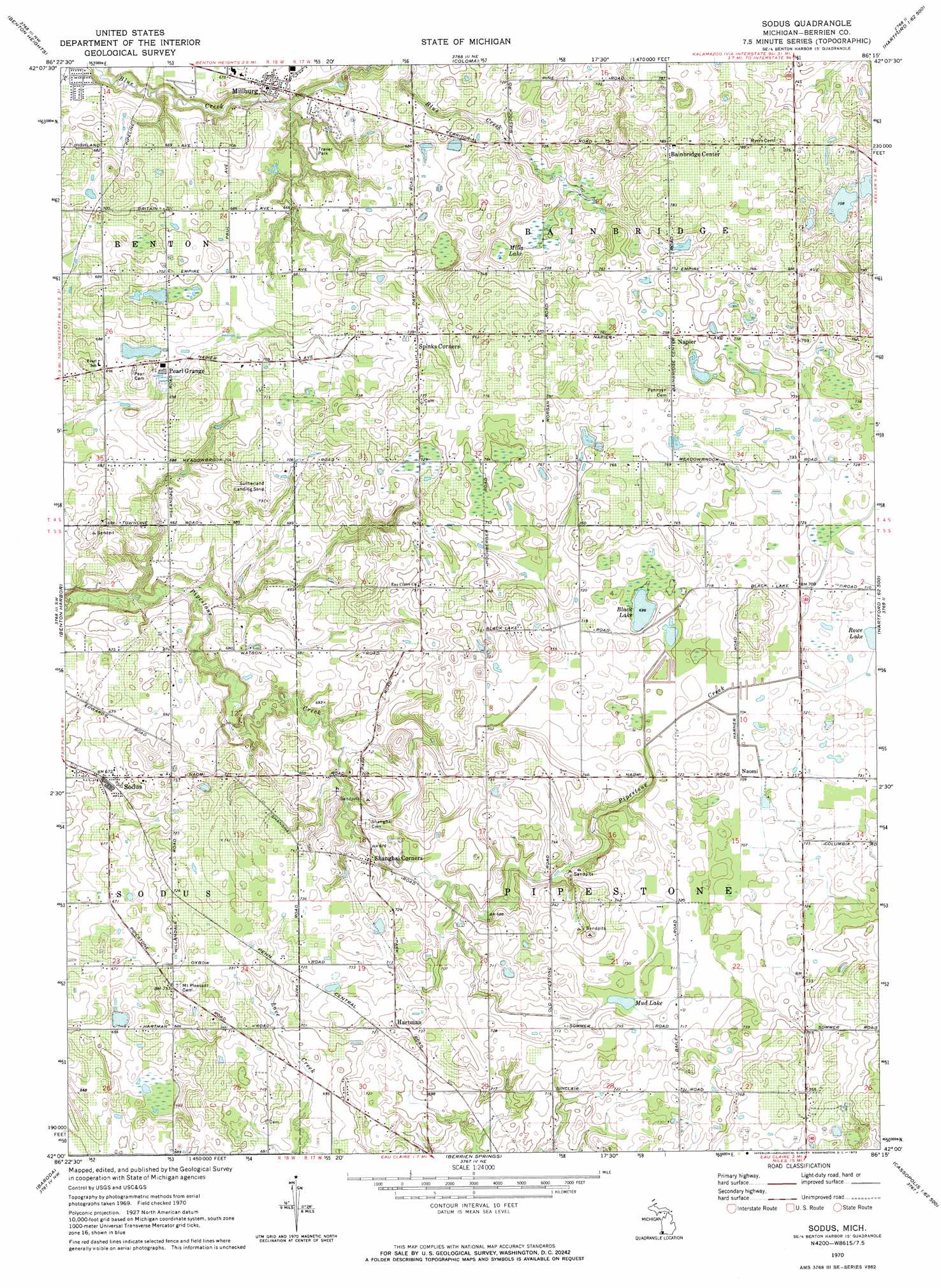
USGS Topo Quad 42086a3 - 1:24,000 scale
| Topo Map Name: | Sodus |
| USGS Topo Quad ID: | 42086a3 |
| Print Size: | ca. 21 1/4" wide x 27" high |
| Southeast Coordinates: | 42° N latitude / 86.25° W longitude |
| Map Center Coordinates: | 42.0625° N latitude / 86.3125° W longitude |
| U.S. State: | MI |
| Filename: | o42086a3.jpg |
| Download Map JPG Image: | Sodus topo map 1:24,000 scale |
| Map Type: | Topographic |
| Topo Series: | 7.5´ |
| Map Scale: | 1:24,000 |
| Source of Map Images: | United States Geological Survey (USGS) |
| Alternate Map Versions: |
Sodus MI 1970, updated 1973 Download PDF Buy paper map Sodus MI 2011 Download PDF Buy paper map Sodus MI 2014 Download PDF Buy paper map Sodus MI 2017 Download PDF Buy paper map |
1:24,000 Topo Quads surrounding Sodus
Covert |
Mcdonald |
Bangor |
||
Benton Heights |
Coloma |
Hartford |
Lawrence |
|
Stevensville |
Benton Harbor |
Sodus |
Sister Lakes |
Twin Lakes |
Bridgman |
Baroda |
Berrien Springs |
Sumnerville |
Dowagiac |
Three Oaks |
Galien |
Niles West |
Niles East |
Edwardsburg |
> Back to 42086a1 at 1:100,000 scale
> Back to 42086a1 at 1:250,000 scale
> Back to U.S. Topo Maps home
Sodus topo map: Gazetteer
Sodus: Lakes
Black Lake elevation 212m 695′Mud Lake elevation 217m 711′
Sodus: Populated Places
Bainbridge Center elevation 239m 784′Hartman elevation 225m 738′
Millburg elevation 210m 688′
Naomi elevation 217m 711′
Napier elevation 230m 754′
Pearl Grange elevation 212m 695′
Shanghai Corners elevation 219m 718′
Sodus elevation 205m 672′
Spinks Corners elevation 224m 734′
Sodus: Post Offices
Bainbridge Post Office (historical) elevation 239m 784′Hartman Post Office (historical) elevation 225m 738′
Millburg Post Office (historical) elevation 210m 688′
Naomi Post Office (historical) elevation 217m 711′
Penyann Post Office (historical) elevation 234m 767′
Pipestone Post Office (historical) elevation 220m 721′
Sodus Post Office elevation 202m 662′
Spinks Corners Post Office (historical) elevation 224m 734′
Sodus: Swamps
Mills Lake elevation 210m 688′Sodus digital topo map on disk
Buy this Sodus topo map showing relief, roads, GPS coordinates and other geographical features, as a high-resolution digital map file on DVD:
Northern Illinois, Northern Indiana & Southwestern Michigan
Buy digital topo maps: Northern Illinois, Northern Indiana & Southwestern Michigan