Marengo North Topo Map Illinois
To zoom in, hover over the map of Marengo North
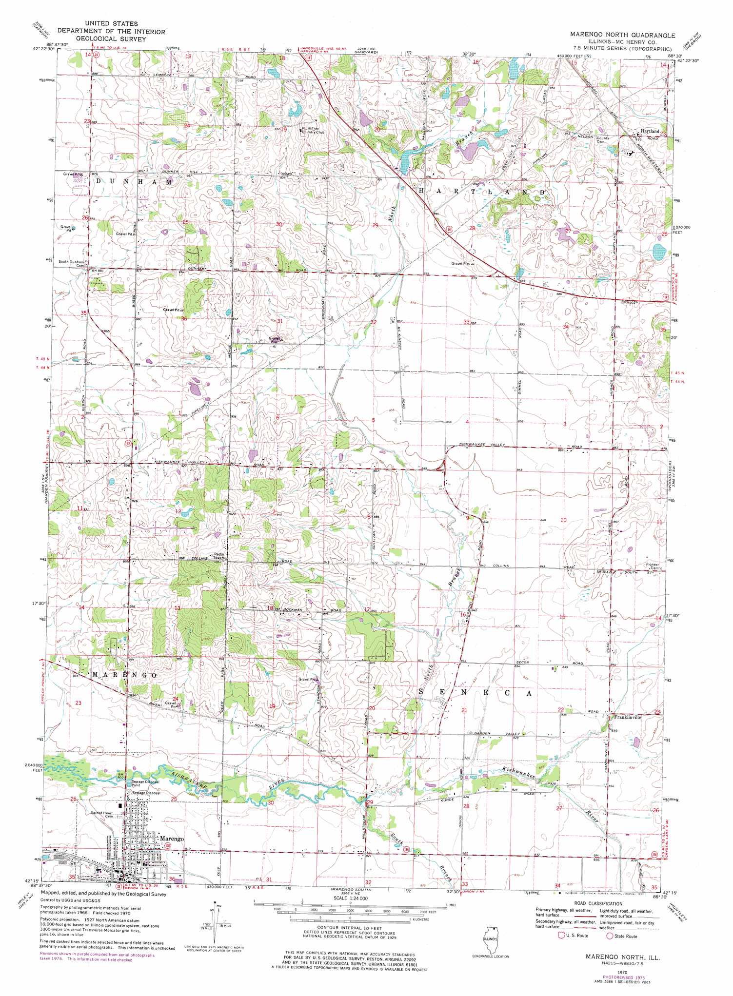
USGS Topo Quad 42088c5 - 1:24,000 scale
| Topo Map Name: | Marengo North |
| USGS Topo Quad ID: | 42088c5 |
| Print Size: | ca. 21 1/4" wide x 27" high |
| Southeast Coordinates: | 42.25° N latitude / 88.5° W longitude |
| Map Center Coordinates: | 42.3125° N latitude / 88.5625° W longitude |
| U.S. State: | IL |
| Filename: | o42088c5.jpg |
| Download Map JPG Image: | Marengo North topo map 1:24,000 scale |
| Map Type: | Topographic |
| Topo Series: | 7.5´ |
| Map Scale: | 1:24,000 |
| Source of Map Images: | United States Geological Survey (USGS) |
| Alternate Map Versions: |
Marengo North IL 1970, updated 1972 Download PDF Buy paper map Marengo North IL 1970, updated 1977 Download PDF Buy paper map Marengo North IL 2012 Download PDF Buy paper map Marengo North IL 2015 Download PDF Buy paper map |
1:24,000 Topo Quads surrounding Marengo North
Clinton |
Sharon |
Walworth |
Lake Geneva |
Genoa City |
Belvidere Ne |
Capron |
Harvard |
Hebron |
Richmond |
Belvidere North |
Garden Prairie |
Marengo North |
Woodstock |
Mchenry |
Belvidere South |
Riley |
Marengo South |
Huntley |
Crystal Lake |
Kirkland |
Genoa |
Hampshire |
Pingree Grove |
Elgin |
> Back to 42088a1 at 1:100,000 scale
> Back to 42088a1 at 1:250,000 scale
> Back to U.S. Topo Maps home
Marengo North topo map: Gazetteer
Marengo North: Airports
Aerogrange Airport elevation 250m 820′Hunter Airport elevation 280m 918′
Marengo North: Populated Places
Franklinville elevation 255m 836′Hartland elevation 281m 921′
Marengo North: Streams
North Branch Kishwaukee River elevation 247m 810′South Branch Kishwaukee River elevation 246m 807′
Marengo North digital topo map on disk
Buy this Marengo North topo map showing relief, roads, GPS coordinates and other geographical features, as a high-resolution digital map file on DVD:
Northern Illinois, Northern Indiana & Southwestern Michigan
Buy digital topo maps: Northern Illinois, Northern Indiana & Southwestern Michigan