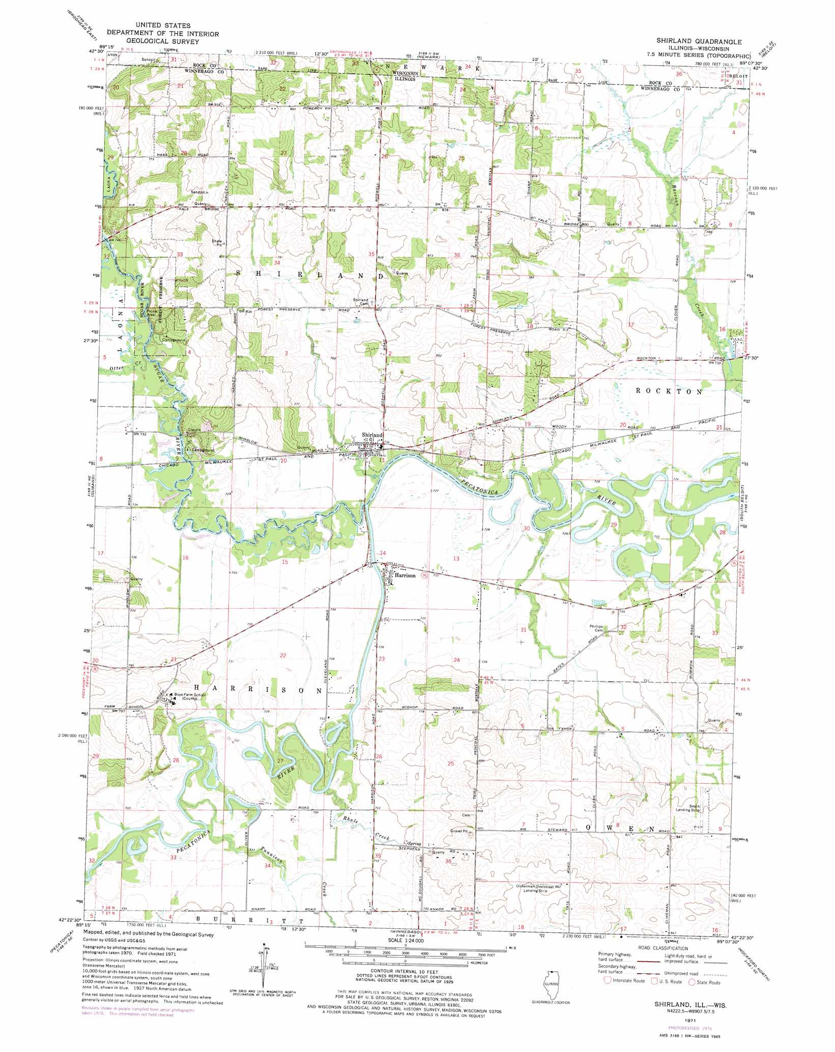
Shirland Topo Map Illinois
To zoom in, hover over the map of Shirland
USGS Topo Quad 42089d2 - 1:24,000 scale
| Topo Map Name: | Shirland |
| USGS Topo Quad ID: | 42089d2 |
| Print Size: | ca. 21 1/4" wide x 27" high |
| Southeast Coordinates: | 42.375° N latitude / 89.125° W longitude |
| Map Center Coordinates: | 42.4375° N latitude / 89.1875° W longitude |
| U.S. States: | IL, WI |
| Filename: | o42089d2.jpg |
| Download Map JPG Image: | Shirland topo map 1:24,000 scale |
| Map Type: | Topographic |
| Topo Series: | 7.5´ |
| Map Scale: | 1:24,000 |
| Source of Map Images: | United States Geological Survey (USGS) |
| Alternate Map Versions: |
Shirland IL 1971, updated 1973 Download PDF Buy paper map Shirland IL 1971, updated 1977 Download PDF Buy paper map Shirland IL 2012 Download PDF Buy paper map Shirland IL 2015 Download PDF Buy paper map |
1:24,000 Topo Quads surrounding Shirland
Albany |
Orfordville |
Footville |
Janesville West |
Janesville East |
Brodhead West |
Brodhead East |
Newark |
Beloit |
Shopiere |
Davis |
Durand |
Shirland |
South Beloit |
Belvidere Nw |
Ridott |
Pecatonica |
Winnebago |
Rockford North |
Caledonia |
German Valley |
Seward |
Kishwaukee |
Rockford South |
Cherry Valley |
> Back to 42089a1 at 1:100,000 scale
> Back to 42088a1 at 1:250,000 scale
> Back to U.S. Topo Maps home
Shirland topo map: Gazetteer
Shirland: Airports
Darrington Airport elevation 262m 859′Severson Airport elevation 244m 800′
Shirland: Forests
Sugar River Forest Preserve elevation 240m 787′Shirland: Parks
Colored Sands Bluff Nature Preserve elevation 239m 784′Colored Sands Forest Preserve elevation 239m 784′
Shirland: Populated Places
Harrison elevation 222m 728′Shirland elevation 225m 738′
Shirland: Post Offices
Shirland Post Office elevation 224m 734′Shirland: Streams
East Fork Raccoon Creek elevation 223m 731′Otter Creek elevation 222m 728′
Rhule Creek elevation 220m 721′
Sugar River elevation 219m 718′
Timothy Creek elevation 219m 718′
Tunnison Creek elevation 222m 728′
Shirland digital topo map on disk
Buy this Shirland topo map showing relief, roads, GPS coordinates and other geographical features, as a high-resolution digital map file on DVD:
Northern Illinois, Northern Indiana & Southwestern Michigan
Buy digital topo maps: Northern Illinois, Northern Indiana & Southwestern Michigan