Cheney Topo Map Iowa
To zoom in, hover over the map of Cheney
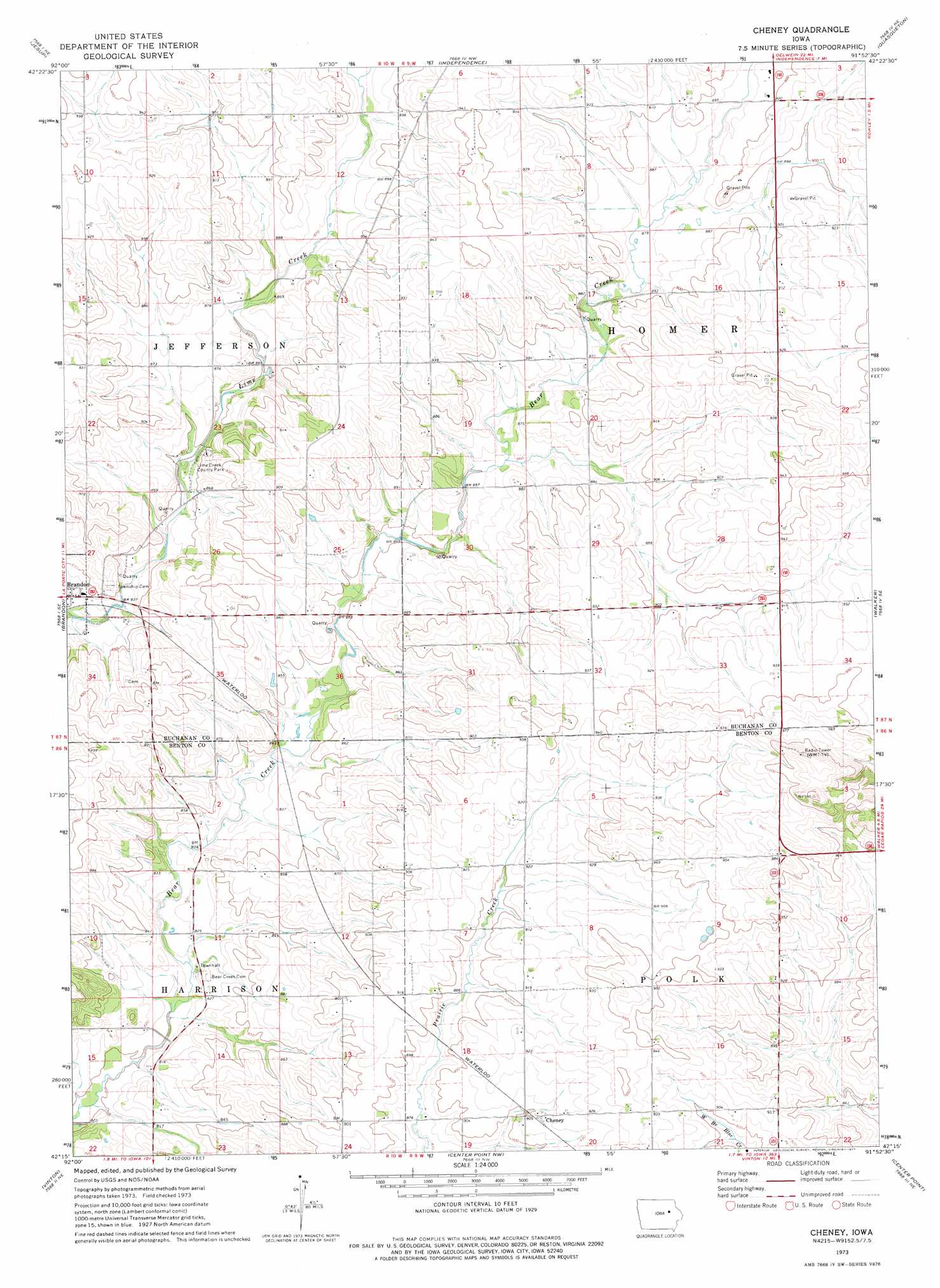
USGS Topo Quad 42091c8 - 1:24,000 scale
| Topo Map Name: | Cheney |
| USGS Topo Quad ID: | 42091c8 |
| Print Size: | ca. 21 1/4" wide x 27" high |
| Southeast Coordinates: | 42.25° N latitude / 91.875° W longitude |
| Map Center Coordinates: | 42.3125° N latitude / 91.9375° W longitude |
| U.S. State: | IA |
| Filename: | o42091c8.jpg |
| Download Map JPG Image: | Cheney topo map 1:24,000 scale |
| Map Type: | Topographic |
| Topo Series: | 7.5´ |
| Map Scale: | 1:24,000 |
| Source of Map Images: | United States Geological Survey (USGS) |
| Alternate Map Versions: |
Cheney IA 1973, updated 1977 Download PDF Buy paper map Cheney IA 2010 Download PDF Buy paper map Cheney IA 2013 Download PDF Buy paper map Cheney IA 2015 Download PDF Buy paper map |
1:24,000 Topo Quads surrounding Cheney
Dunkerton |
Littleton |
Hazleton |
Oelwein Se |
Lamont |
Gilbertville |
Jesup |
Independence |
Quasqueton |
Winthrop |
La Porte City |
Brandon |
Cheney |
Walker |
Troy Mills |
Garrison |
Vinton |
Center Point Nw |
Center Point |
Lafayette |
Keystone North |
Van Horne |
Center Point Sw |
Shellsburg |
Cedar Rapids North |
> Back to 42091a1 at 1:100,000 scale
> Back to 42090a1 at 1:250,000 scale
> Back to U.S. Topo Maps home
Cheney topo map: Gazetteer
Cheney: Parks
Bearbower Sand Prairie Area elevation 279m 915′Kounty Pond - Hoffman Woods Area elevation 258m 846′
Lime Creek County Park elevation 257m 843′
Polk Township Wildlife Area elevation 278m 912′
Cheney: Populated Places
Cheney elevation 279m 915′Hamerville elevation 279m 915′
Cheney: Post Offices
Burke Post Office (historical) elevation 250m 820′Hamerville Post Office (historical) elevation 279m 915′
Likins Post Office (historical) elevation 279m 915′
Cheney digital topo map on disk
Buy this Cheney topo map showing relief, roads, GPS coordinates and other geographical features, as a high-resolution digital map file on DVD: