Vail Topo Map Iowa
To zoom in, hover over the map of Vail
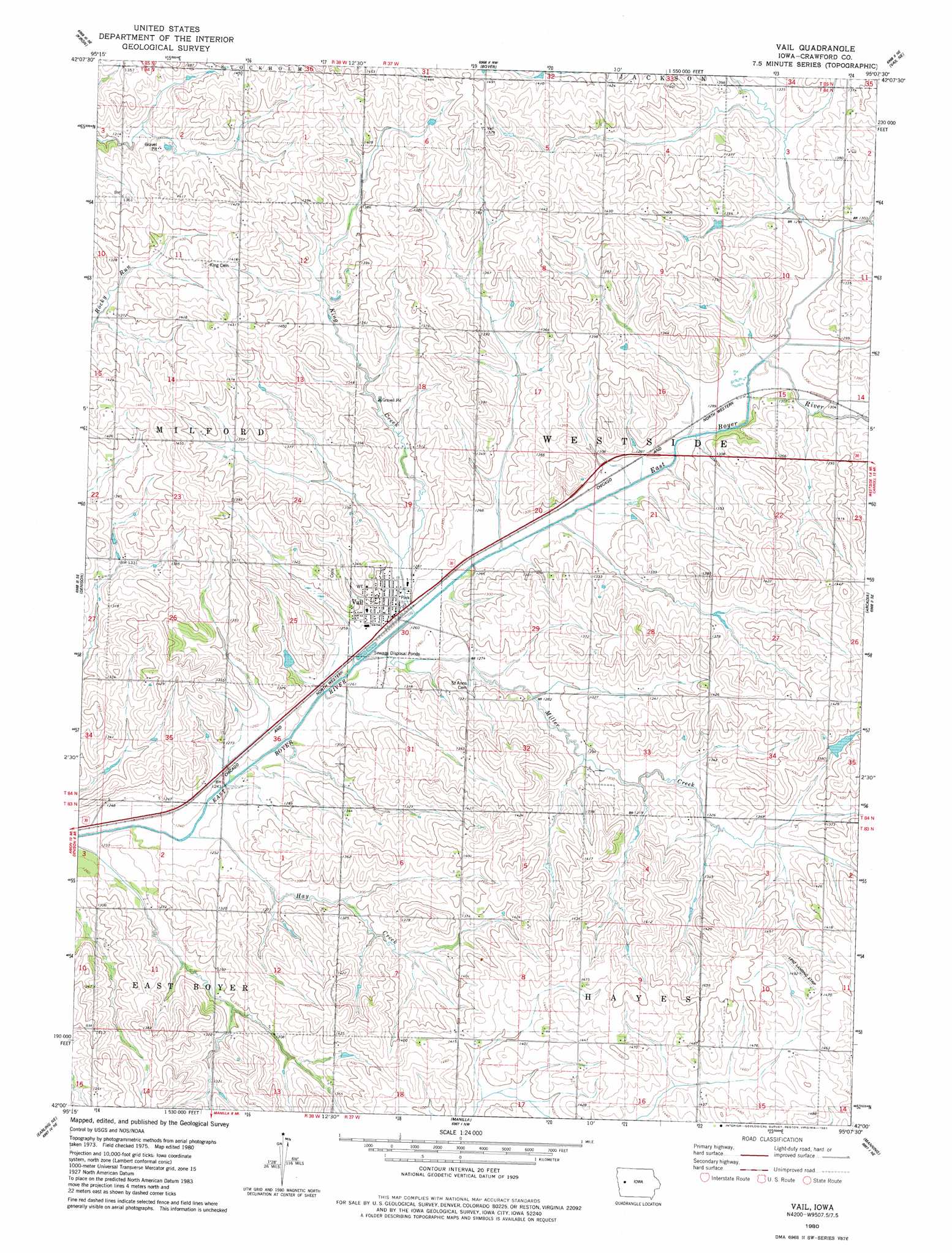
USGS Topo Quad 42095a2 - 1:24,000 scale
| Topo Map Name: | Vail |
| USGS Topo Quad ID: | 42095a2 |
| Print Size: | ca. 21 1/4" wide x 27" high |
| Southeast Coordinates: | 42° N latitude / 95.125° W longitude |
| Map Center Coordinates: | 42.0625° N latitude / 95.1875° W longitude |
| U.S. State: | IA |
| Filename: | o42095a2.jpg |
| Download Map JPG Image: | Vail topo map 1:24,000 scale |
| Map Type: | Topographic |
| Topo Series: | 7.5´ |
| Map Scale: | 1:24,000 |
| Source of Map Images: | United States Geological Survey (USGS) |
| Alternate Map Versions: |
Vail IA 1980, updated 1981 Download PDF Buy paper map Vail IA 2010 Download PDF Buy paper map Vail IA 2013 Download PDF Buy paper map Vail IA 2015 Download PDF Buy paper map |
1:24,000 Topo Quads surrounding Vail
Ida Grove |
Odebolt West |
Odebolt East |
Lake View |
Grant City |
Schleswig |
Kiron |
Boyer |
Vail Ne |
Breda |
Denison Sw |
Denison |
Vail |
Arcadia |
Carroll West |
Dow City |
Earling Ne |
Manilla |
Manning |
Templeton |
Earling |
Defiance |
Irwin |
Manning Se |
Gray |
> Back to 42095a1 at 1:100,000 scale
> Back to 42094a1 at 1:250,000 scale
> Back to U.S. Topo Maps home
Vail topo map: Gazetteer
Vail: Airports
Lenz Landing Strip elevation 453m 1486′Vail: Parks
Schrader Wildlife Area elevation 435m 1427′Vail: Populated Places
Vail elevation 384m 1259′Vail: Post Offices
Vail Post Office elevation 384m 1259′Vail: Streams
Hay Creek elevation 375m 1230′King Creek elevation 379m 1243′
Miller Creek elevation 378m 1240′
Vail digital topo map on disk
Buy this Vail topo map showing relief, roads, GPS coordinates and other geographical features, as a high-resolution digital map file on DVD: