Earling Topo Map Iowa
To zoom in, hover over the map of Earling
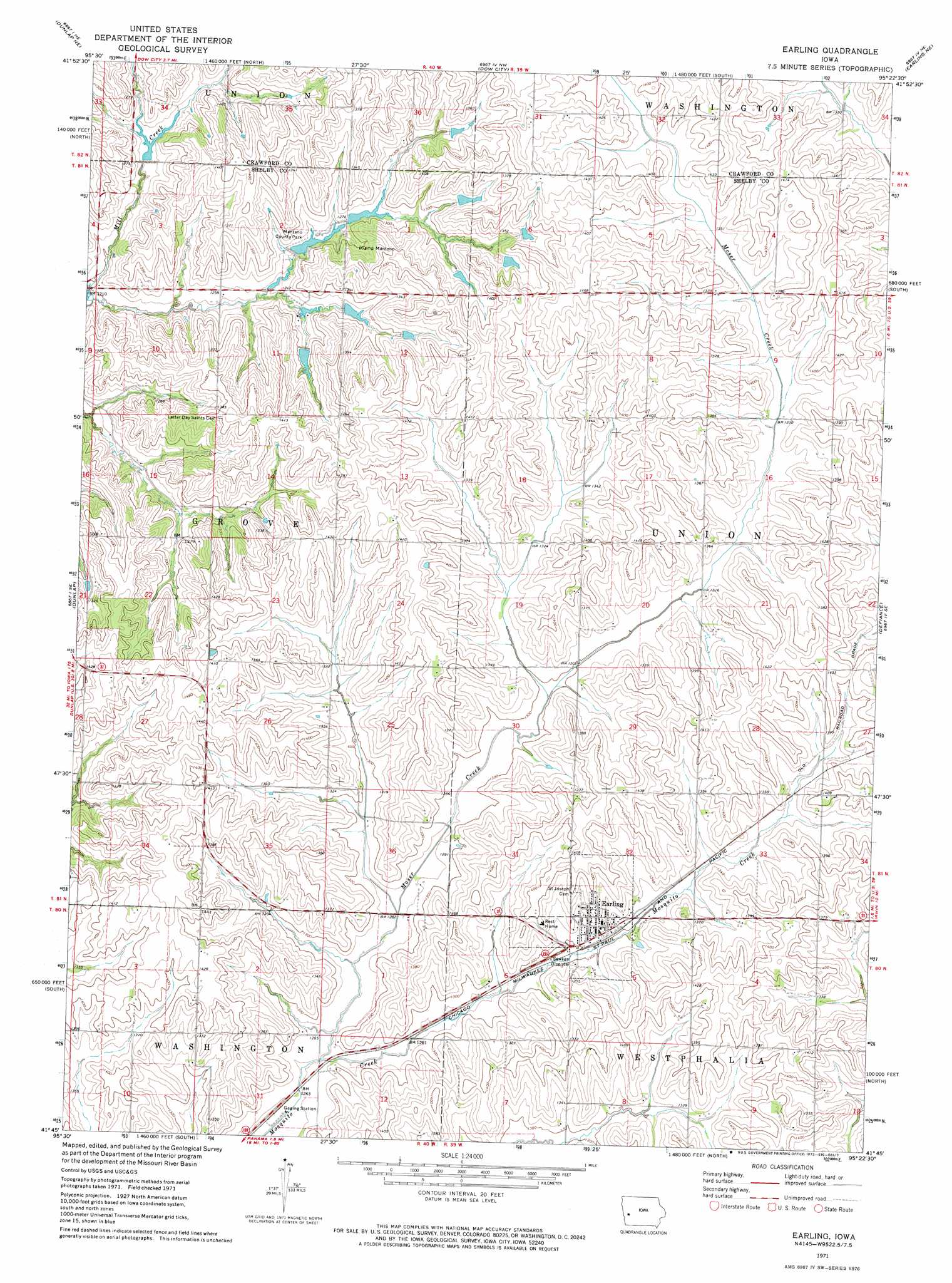
USGS Topo Quad 41095g4 - 1:24,000 scale
| Topo Map Name: | Earling |
| USGS Topo Quad ID: | 41095g4 |
| Print Size: | ca. 21 1/4" wide x 27" high |
| Southeast Coordinates: | 41.75° N latitude / 95.375° W longitude |
| Map Center Coordinates: | 41.8125° N latitude / 95.4375° W longitude |
| U.S. State: | IA |
| Filename: | o41095g4.jpg |
| Download Map JPG Image: | Earling topo map 1:24,000 scale |
| Map Type: | Topographic |
| Topo Series: | 7.5´ |
| Map Scale: | 1:24,000 |
| Source of Map Images: | United States Geological Survey (USGS) |
| Alternate Map Versions: |
Earling IA 1971, updated 1973 Download PDF Buy paper map Earling IA 2010 Download PDF Buy paper map Earling IA 2013 Download PDF Buy paper map Earling IA 2015 Download PDF Buy paper map |
1:24,000 Topo Quads surrounding Earling
Ute |
Charter Oak |
Denison Sw |
Denison |
Vail |
Dunlap Nw |
Dunlap Ne |
Dow City |
Earling Ne |
Manilla |
Dunlap Sw |
Dunlap |
Earling |
Defiance |
Irwin |
Woodbine |
Portsmouth |
Panama |
Harlan |
Jacksonville |
Hard Scratch |
Persia |
Shelby |
Corley |
Prairie Rose Lake |
> Back to 41095e1 at 1:100,000 scale
> Back to 41094a1 at 1:250,000 scale
> Back to U.S. Topo Maps home
Earling topo map: Gazetteer
Earling: Parks
Manteno County Park elevation 391m 1282′Rosenow Timber Recreation Area elevation 426m 1397′
Schimerowski Recreation Area elevation 402m 1318′
Earling: Populated Places
Earling elevation 409m 1341′Earling: Post Offices
Earling Post Office elevation 409m 1341′Pomo Post Office (historical) elevation 395m 1295′
Shelby Post Office (historical) elevation 446m 1463′
Shelbyville Post Office (historical) elevation 426m 1397′
Earling: Streams
Moser Creek elevation 384m 1259′Earling digital topo map on disk
Buy this Earling topo map showing relief, roads, GPS coordinates and other geographical features, as a high-resolution digital map file on DVD: