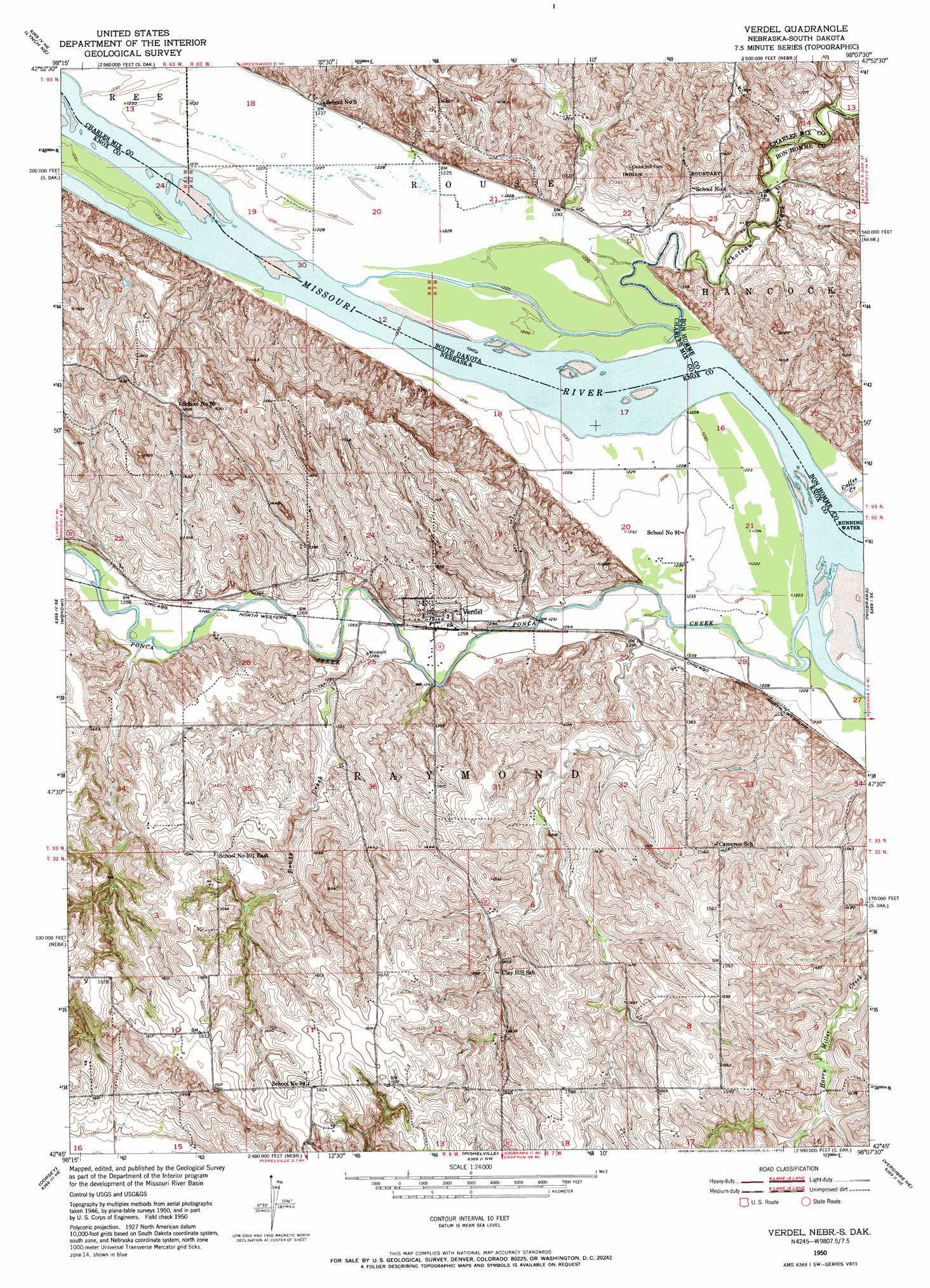
Verdel Topo Map Nebraska
To zoom in, hover over the map of Verdel
USGS Topo Quad 42098g2 - 1:24,000 scale
| Topo Map Name: | Verdel |
| USGS Topo Quad ID: | 42098g2 |
| Print Size: | ca. 21 1/4" wide x 27" high |
| Southeast Coordinates: | 42.75° N latitude / 98.125° W longitude |
| Map Center Coordinates: | 42.8125° N latitude / 98.1875° W longitude |
| U.S. States: | NE, SD |
| Filename: | O42098G2.jpg |
| Download Map JPG Image: | Verdel topo map 1:24,000 scale |
| Map Type: | Topographic |
| Topo Series: | 7.5´ |
| Map Scale: | 1:24,000 |
| Source of Map Images: | United States Geological Survey (USGS) |
| Alternate Map Versions: |
Verdel NE 1950, updated 1952 Download PDF Buy paper map Verdel NE 1950, updated 1973 Download PDF Buy paper map Verdel NE 1950, updated 1973 Download PDF Buy paper map Verdel NE 2011 Download PDF Buy paper map Verdel NE 2014 Download PDF Buy paper map |
1:24,000 Topo Quads surrounding Verdel
Wagner Sw |
Wagner |
Dante |
Avon |
Haucks Lake |
Marty |
Lynch Ne |
Niobrara Nw |
Niobrara Ne |
Kingsburg |
Lynch |
Monowi |
Verdel |
Niobrara |
Springfield |
Dorsey Nw |
Dorsey |
Pishelville |
Verdigre Ne |
Sparta |
Dorsey Sw |
Star |
Walnut |
Verdigre |
Center West |
> Back to 42098e1 at 1:100,000 scale
> Back to 42098a1 at 1:250,000 scale
> Back to U.S. Topo Maps home
Verdel topo map: Gazetteer
Verdel: Cliffs
Chouteau Bluffs (historical) elevation 371m 1217′Verdel: Parks
Verdel Landing State Recreation Area elevation 376m 1233′Verdel: Populated Places
Verdel elevation 386m 1266′Verdel: Post Offices
Verdel Post Office elevation 386m 1266′Verdel: Streams
Bull Creek elevation 372m 1220′Choteau Creek elevation 371m 1217′
Coffee Creek elevation 371m 1217′
Dewey Creek elevation 381m 1250′
Ponca Creek elevation 371m 1217′
Verdel digital topo map on disk
Buy this Verdel topo map showing relief, roads, GPS coordinates and other geographical features, as a high-resolution digital map file on DVD: