Wolf Butte Topo Map Nebraska
To zoom in, hover over the map of Wolf Butte
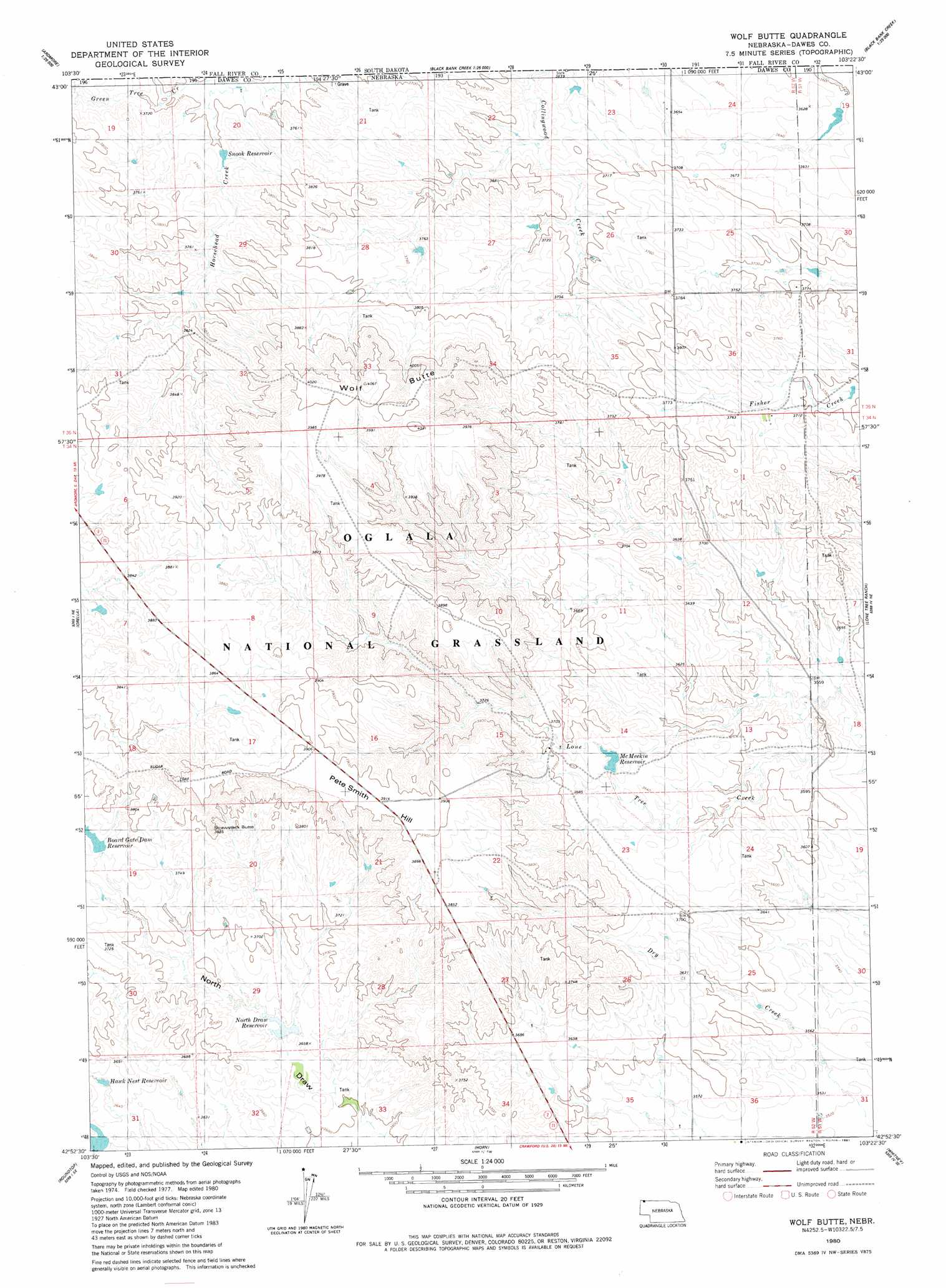
USGS Topo Quad 42103h4 - 1:24,000 scale
| Topo Map Name: | Wolf Butte |
| USGS Topo Quad ID: | 42103h4 |
| Print Size: | ca. 21 1/4" wide x 27" high |
| Southeast Coordinates: | 42.875° N latitude / 103.375° W longitude |
| Map Center Coordinates: | 42.9375° N latitude / 103.4375° W longitude |
| U.S. State: | NE |
| Filename: | O42103H4.jpg |
| Download Map JPG Image: | Wolf Butte topo map 1:24,000 scale |
| Map Type: | Topographic |
| Topo Series: | 7.5´ |
| Map Scale: | 1:24,000 |
| Source of Map Images: | United States Geological Survey (USGS) |
| Alternate Map Versions: |
Wolf Butte NE 1980, updated 1981 Download PDF Buy paper map Wolf Butte NE 2011 Download PDF Buy paper map Wolf Butte NE 2014 Download PDF Buy paper map |
| FStopo: | US Forest Service topo Wolf Butte is available: Download FStopo PDF Download FStopo TIF |
1:24,000 Topo Quads surrounding Wolf Butte
Rumford |
Heppner |
Lone Well Creek West |
Lone Well Creek East |
Oelrichs |
Ardmore |
Ardmore Se |
Black Banks Creek West |
Black Banks Creek East |
Oelrichs Sw |
Montrose |
Orella |
Wolf Butte |
Lone Tree Ranch |
Wayside |
Five Points |
Roundtop |
Horn |
Whitney |
Trunk Butte |
Andrews |
Smiley Canyon |
Crawford |
Crow Butte |
Chimney Butte |
> Back to 42103e1 at 1:100,000 scale
> Back to 42102a1 at 1:250,000 scale
> Back to U.S. Topo Maps home
Wolf Butte topo map: Gazetteer
Wolf Butte: Dams
Boardgate Dam elevation 1141m 3743′McMeekin Dam elevation 1117m 3664′
Moody Dam elevation 1107m 3631′
North Draw Dam Number 2 elevation 1110m 3641′
Snook Dam-1 Dam elevation 1133m 3717′
Wolf Butte: Reservoirs
Board Gate Dam Reservoir elevation 1141m 3743′Boardgate Reservoir elevation 1141m 3743′
Hawk Nest Reservoir elevation 1109m 3638′
McMeekin Reservoir elevation 1117m 3664′
McMeekin Reservoir elevation 1115m 3658′
Moody North Draw Reservoir elevation 1110m 3641′
Moody Reservoir elevation 1107m 3631′
North Draw Reservoir elevation 1109m 3638′
Snook Reservoir elevation 1132m 3713′
Snook Reservoir elevation 1133m 3717′
Wolf Butte: Streams
Green Tree Creek elevation 1125m 3690′Wolf Butte: Summits
Pete Smith Hill elevation 1164m 3818′Strawstack Butte elevation 1175m 3854′
Wolf Butte elevation 1239m 4064′
Wolf Butte digital topo map on disk
Buy this Wolf Butte topo map showing relief, roads, GPS coordinates and other geographical features, as a high-resolution digital map file on DVD:
Eastern Wyoming & Western South Dakota
Buy digital topo maps: Eastern Wyoming & Western South Dakota