Washakie Park Topo Map Wyoming
To zoom in, hover over the map of Washakie Park
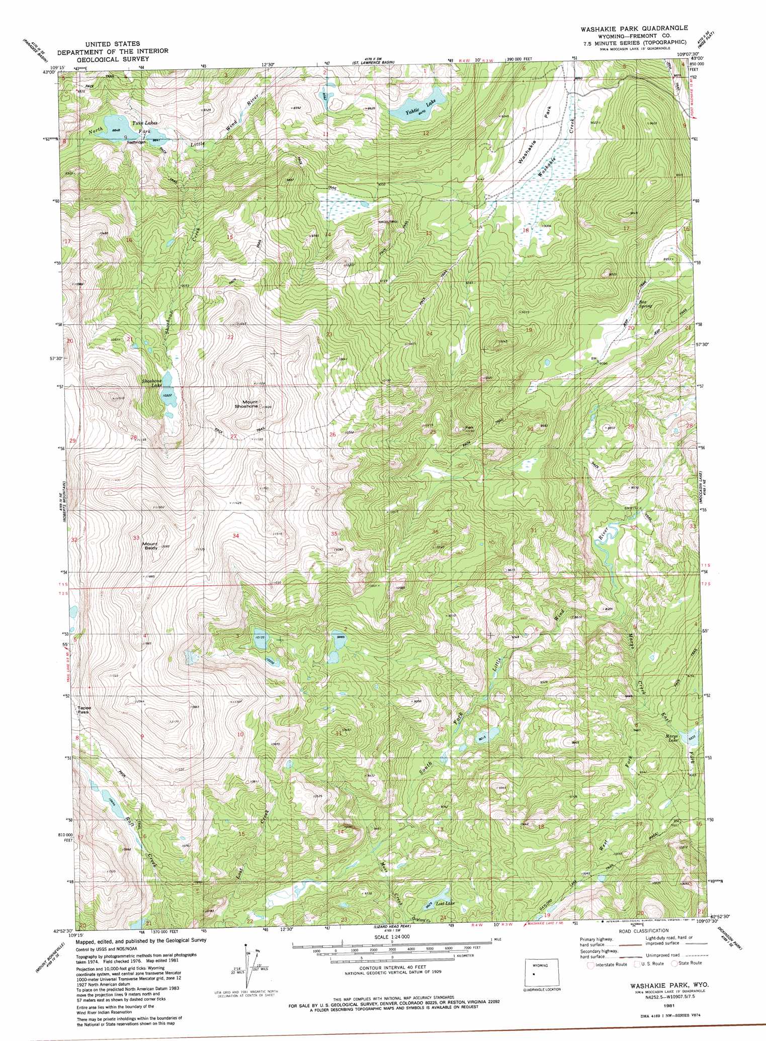
USGS Topo Quad 42109h2 - 1:24,000 scale
| Topo Map Name: | Washakie Park |
| USGS Topo Quad ID: | 42109h2 |
| Print Size: | ca. 21 1/4" wide x 27" high |
| Southeast Coordinates: | 42.875° N latitude / 109.125° W longitude |
| Map Center Coordinates: | 42.9375° N latitude / 109.1875° W longitude |
| U.S. State: | WY |
| Filename: | o42109h2.jpg |
| Download Map JPG Image: | Washakie Park topo map 1:24,000 scale |
| Map Type: | Topographic |
| Topo Series: | 7.5´ |
| Map Scale: | 1:24,000 |
| Source of Map Images: | United States Geological Survey (USGS) |
| Alternate Map Versions: |
Washakie Park WY 1981, updated 1984 Download PDF Buy paper map Washakie Park WY 2012 Download PDF Buy paper map Washakie Park WY 2015 Download PDF Buy paper map |
1:24,000 Topo Quads surrounding Washakie Park
Bob Lakes |
Kirkland Park |
Bull Lake West |
Bull Lake East |
Argo Butte |
Alpine Lake |
Paradise Basin |
Saint Lawrence Basin |
Wise Flat |
Fort Washakie |
Halls Mountain |
Roberts Mountain |
Washakie Park |
Moccasin Lake |
Wind River |
Raid Lake |
Mount Bonneville |
Lizard Head Peak |
Dickinson Park |
Mount Arter |
Pocket Creek Lake |
Big Sandy Opening |
Temple Peak |
Sweetwater Gap |
Cony Mountain |
> Back to 42109e1 at 1:100,000 scale
> Back to 42108a1 at 1:250,000 scale
> Back to U.S. Topo Maps home
Washakie Park topo map: Gazetteer
Washakie Park: Flats
Washakie Park elevation 2737m 8979′Washakie Park: Lakes
Lost Lake elevation 2997m 9832′Marys Lake elevation 2847m 9340′
Shoshone Lake elevation 3148m 10328′
Twin Lakes elevation 2698m 8851′
Yahtic Lake elevation 2583m 8474′
Washakie Park: Springs
Box Spring elevation 2759m 9051′Washakie Park: Streams
East Fork Marys Creek elevation 2769m 9084′Gaylord Creek elevation 2973m 9753′
Lost Creek elevation 2868m 9409′
Marys Creek elevation 2513m 8244′
Moss Creek elevation 2826m 9271′
Shoshone Creek elevation 2638m 8654′
West Fork Marys Creek elevation 2769m 9084′
Washakie Park: Summits
Mount Baldy elevation 3681m 12076′Mount Shoshone elevation 3526m 11568′
Washakie Park digital topo map on disk
Buy this Washakie Park topo map showing relief, roads, GPS coordinates and other geographical features, as a high-resolution digital map file on DVD: