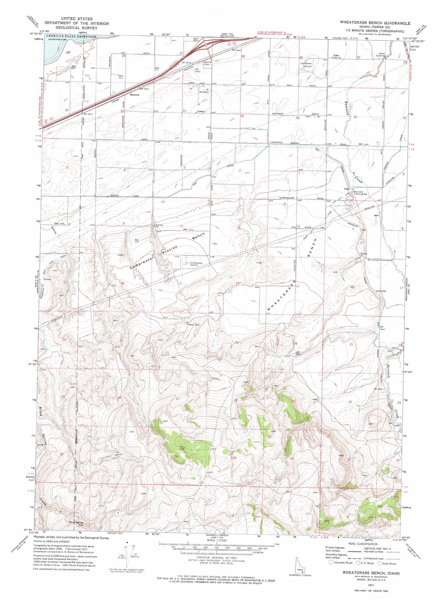
Wheatgrass Bench Topo Map Idaho
To zoom in, hover over the map of Wheatgrass Bench
USGS Topo Quad 42112g6 - 1:24,000 scale
| Topo Map Name: | Wheatgrass Bench |
| USGS Topo Quad ID: | 42112g6 |
| Print Size: | ca. 21 1/4" wide x 27" high |
| Southeast Coordinates: | 42.75° N latitude / 112.625° W longitude |
| Map Center Coordinates: | 42.8125° N latitude / 112.6875° W longitude |
| U.S. State: | ID |
| Filename: | o42112g6.jpg |
| Download Map JPG Image: | Wheatgrass Bench topo map 1:24,000 scale |
| Map Type: | Topographic |
| Topo Series: | 7.5´ |
| Map Scale: | 1:24,000 |
| Source of Map Images: | United States Geological Survey (USGS) |
| Alternate Map Versions: |
Wheatgrass Bench ID 1971, updated 1974 Download PDF Buy paper map Wheatgrass Bench ID 2010 Download PDF Buy paper map Wheatgrass Bench ID 2013 Download PDF Buy paper map |
1:24,000 Topo Quads surrounding Wheatgrass Bench
Coffee Point Sw |
Big Fill Reservoir |
Springfield |
Pingree |
Fort Hall |
American Falls Nw |
Aberdeen |
Schiller |
Michaud |
Pocatello North |
American Falls Sw |
American Falls |
Wheatgrass Bench |
Michaud Creek |
Pocatello South |
Neeley |
Indian Springs |
Sawmill Creek |
Flatiron Hill |
Clifton Creek |
Rockland West |
Rockland East |
Bannock Peak |
Pauline |
Bradley Mountain |
> Back to 42112e1 at 1:100,000 scale
> Back to 42112a1 at 1:250,000 scale
> Back to U.S. Topo Maps home
Wheatgrass Bench topo map: Gazetteer
Wheatgrass Bench: Beaches
Compressor Station Bench elevation 1409m 4622′Wheatgrass Bench elevation 1393m 4570′
Wheatgrass Bench: Canals
Bannock Canal elevation 1367m 4484′Bannock Drain elevation 1350m 4429′
Big Siphon Wasteway elevation 1365m 4478′
E 10.5 Lateral elevation 1364m 4475′
Owl Canal elevation 1355m 4445′
Wheatgrass Bench: Crossings
Arbon Crossing elevation 1343m 4406′Wheatgrass Bench: Populated Places
Bannock elevation 1345m 4412′Wheatgrass Bench: Springs
Blind Spring elevation 1552m 5091′Wheatgrass Bench digital topo map on disk
Buy this Wheatgrass Bench topo map showing relief, roads, GPS coordinates and other geographical features, as a high-resolution digital map file on DVD: