Stiff Tree Draw Topo Map Idaho
To zoom in, hover over the map of Stiff Tree Draw
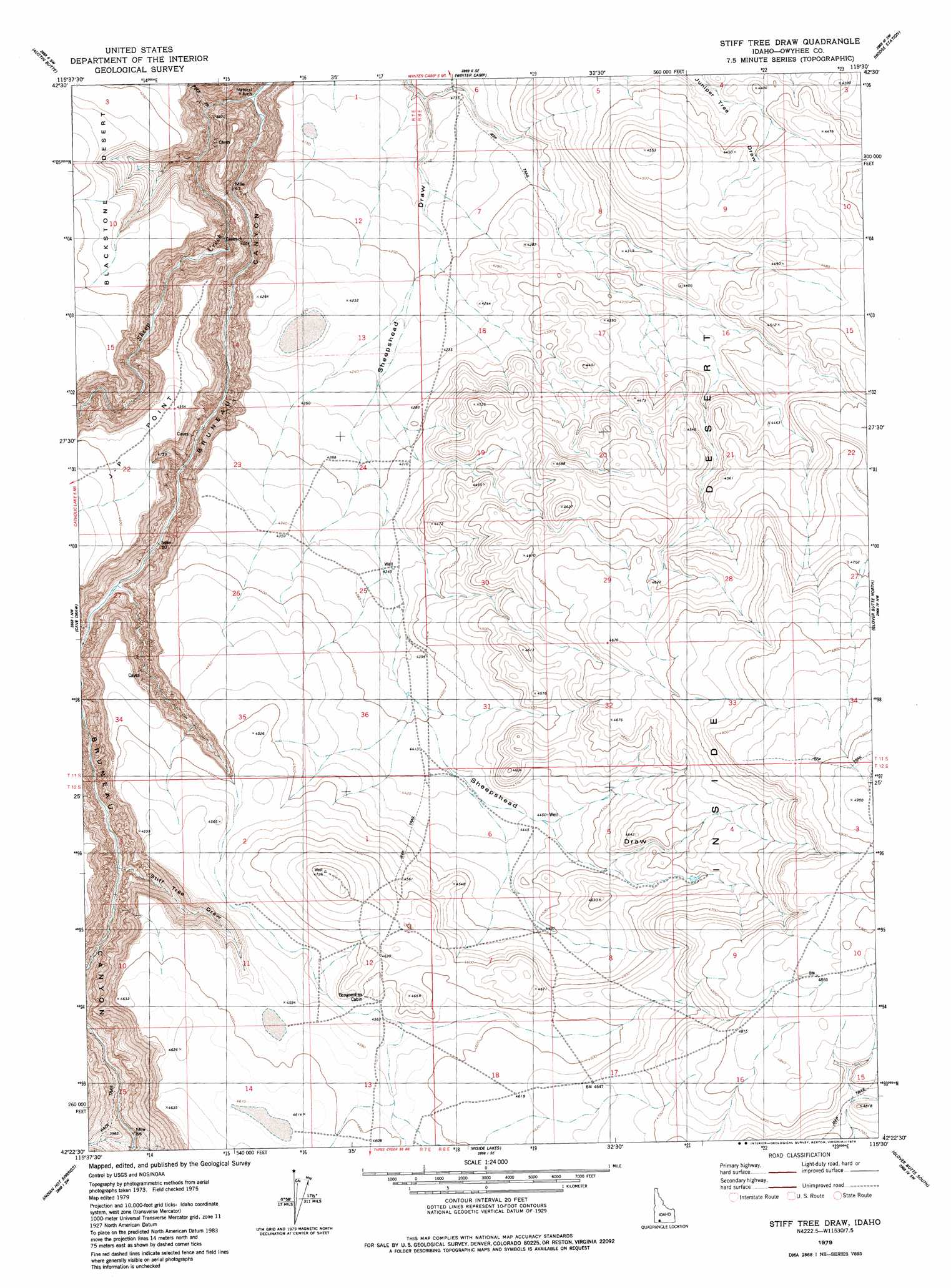
USGS Topo Quad 42115d5 - 1:24,000 scale
| Topo Map Name: | Stiff Tree Draw |
| USGS Topo Quad ID: | 42115d5 |
| Print Size: | ca. 21 1/4" wide x 27" high |
| Southeast Coordinates: | 42.375° N latitude / 115.5° W longitude |
| Map Center Coordinates: | 42.4375° N latitude / 115.5625° W longitude |
| U.S. State: | ID |
| Filename: | o42115d5.jpg |
| Download Map JPG Image: | Stiff Tree Draw topo map 1:24,000 scale |
| Map Type: | Topographic |
| Topo Series: | 7.5´ |
| Map Scale: | 1:24,000 |
| Source of Map Images: | United States Geological Survey (USGS) |
| Alternate Map Versions: |
Stiff Tree Draw ID 1979, updated 1979 Download PDF Buy paper map Stiff Tree Draw ID 1979, updated 1979 Download PDF Buy paper map Stiff Tree Draw ID 2010 Download PDF Buy paper map Stiff Tree Draw ID 2013 Download PDF Buy paper map |
1:24,000 Topo Quads surrounding Stiff Tree Draw
Broken Wagon Flat |
Crowbar Gulch |
Pot Hole Butte |
Black Butte West |
Black Butte East |
Table Butte |
Austin Butte |
Winter Camp |
Hodge Station |
Crows Nest Butte |
Blackstone Reservoir |
Cave Draw |
Stiff Tree Draw |
Clover Butte North |
Juniper Ranch |
Buster Butte |
Indian Hot Springs |
Inside Lakes |
Clover Butte South |
Juniper Butte |
Antelope Creek |
Triguero Lake |
The Arch |
Poison Butte |
Mosquito Lake Butte |
> Back to 42115a1 at 1:100,000 scale
> Back to 42114a1 at 1:250,000 scale
> Back to U.S. Topo Maps home
Stiff Tree Draw topo map: Gazetteer
Stiff Tree Draw: Capes
J-P Point elevation 1336m 4383′Stiff Tree Draw: Streams
Sheep Creek elevation 1041m 3415′Stiff Tree Draw: Valleys
Sheepshead Draw elevation 1247m 4091′Stiff Tree Draw elevation 1092m 3582′
Stiff Tree Draw digital topo map on disk
Buy this Stiff Tree Draw topo map showing relief, roads, GPS coordinates and other geographical features, as a high-resolution digital map file on DVD: