Cave Draw Topo Map Idaho
To zoom in, hover over the map of Cave Draw
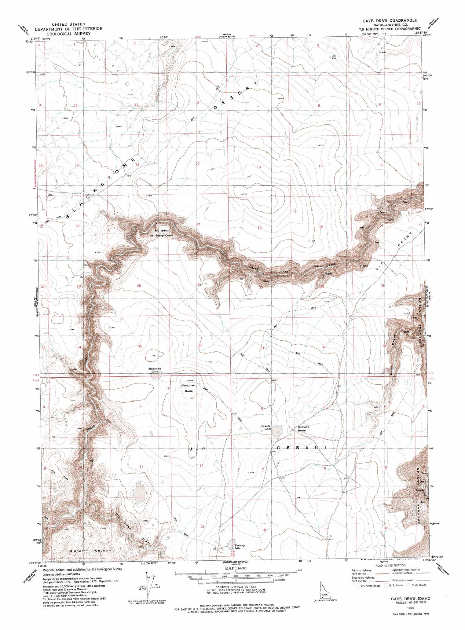
USGS Topo Quad 42115d6 - 1:24,000 scale
| Topo Map Name: | Cave Draw |
| USGS Topo Quad ID: | 42115d6 |
| Print Size: | ca. 21 1/4" wide x 27" high |
| Southeast Coordinates: | 42.375° N latitude / 115.625° W longitude |
| Map Center Coordinates: | 42.4375° N latitude / 115.6875° W longitude |
| U.S. State: | ID |
| Filename: | o42115d6.jpg |
| Download Map JPG Image: | Cave Draw topo map 1:24,000 scale |
| Map Type: | Topographic |
| Topo Series: | 7.5´ |
| Map Scale: | 1:24,000 |
| Source of Map Images: | United States Geological Survey (USGS) |
| Alternate Map Versions: |
Cave Draw ID 1979, updated 1983 Download PDF Buy paper map Cave Draw ID 2010 Download PDF Buy paper map Cave Draw ID 2013 Download PDF Buy paper map |
1:24,000 Topo Quads surrounding Cave Draw
Hole In Rock |
Broken Wagon Flat |
Crowbar Gulch |
Pot Hole Butte |
Black Butte West |
Wickahoney Crossing |
Table Butte |
Austin Butte |
Winter Camp |
Hodge Station |
Grasmere |
Blackstone Reservoir |
Cave Draw |
Stiff Tree Draw |
Clover Butte North |
Grasmere Reservoir |
Buster Butte |
Indian Hot Springs |
Inside Lakes |
Clover Butte South |
Buckhorn |
Antelope Creek |
Triguero Lake |
The Arch |
Poison Butte |
> Back to 42115a1 at 1:100,000 scale
> Back to 42114a1 at 1:250,000 scale
> Back to U.S. Topo Maps home
Cave Draw topo map: Gazetteer
Cave Draw: Areas
Bighorn Country elevation 1382m 4534′Cave Draw: Bends
Big Bend of Sheep Creek elevation 1193m 3914′Cave Draw: Lakes
Barinaga Lake elevation 1463m 4799′Catholic Lake elevation 1455m 4773′
Monument Lake elevation 1462m 4796′
Cave Draw: Plains
Blackstone Desert elevation 1391m 4563′Cave Draw: Streams
Louse Creek elevation 1285m 4215′Cave Draw: Summits
Catholic Butte elevation 1458m 4783′Monument Butte elevation 1479m 4852′
Cave Draw: Valleys
Big Lake Draw elevation 1270m 4166′Cave Draw elevation 1083m 3553′
Cave Draw digital topo map on disk
Buy this Cave Draw topo map showing relief, roads, GPS coordinates and other geographical features, as a high-resolution digital map file on DVD: