Triguero Lake Topo Map Idaho
To zoom in, hover over the map of Triguero Lake
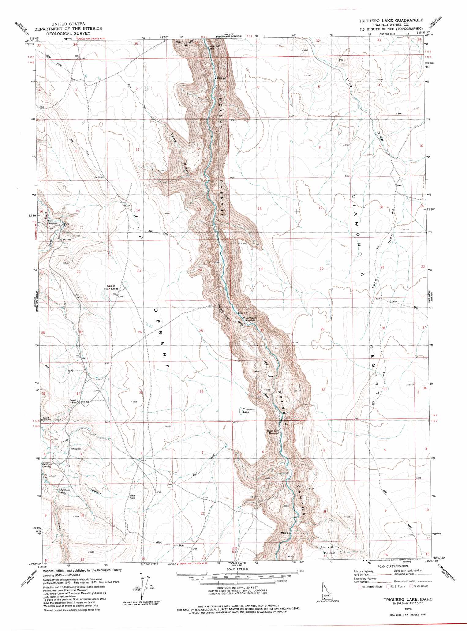
USGS Topo Quad 42115b6 - 1:24,000 scale
| Topo Map Name: | Triguero Lake |
| USGS Topo Quad ID: | 42115b6 |
| Print Size: | ca. 21 1/4" wide x 27" high |
| Southeast Coordinates: | 42.125° N latitude / 115.625° W longitude |
| Map Center Coordinates: | 42.1875° N latitude / 115.6875° W longitude |
| U.S. State: | ID |
| Filename: | o42115b6.jpg |
| Download Map JPG Image: | Triguero Lake topo map 1:24,000 scale |
| Map Type: | Topographic |
| Topo Series: | 7.5´ |
| Map Scale: | 1:24,000 |
| Source of Map Images: | United States Geological Survey (USGS) |
| Alternate Map Versions: |
Triguero Lake ID 1979, updated 1979 Download PDF Buy paper map Triguero Lake ID 2010 Download PDF Buy paper map Triguero Lake ID 2013 Download PDF Buy paper map |
1:24,000 Topo Quads surrounding Triguero Lake
Grasmere |
Blackstone Reservoir |
Cave Draw |
Stiff Tree Draw |
Clover Butte North |
Grasmere Reservoir |
Buster Butte |
Indian Hot Springs |
Inside Lakes |
Clover Butte South |
Buckhorn |
Antelope Creek |
Triguero Lake |
The Arch |
Poison Butte |
Indian Hay Meadows |
Black Leg Creek |
Triplet Butte |
Cowan Reservoir |
Dishpan |
Winter Ridge |
Hicks Mountain |
Big Table |
Bearpaw Mountain |
Jarbidge North |
> Back to 42115a1 at 1:100,000 scale
> Back to 42114a1 at 1:250,000 scale
> Back to U.S. Topo Maps home
Triguero Lake topo map: Gazetteer
Triguero Lake: Lakes
Triguero Lake elevation 1583m 5193′Upper Twin Lakes elevation 1604m 5262′
Triguero Lake: Trails
Batt Trail elevation 1403m 4603′Triguero Trail elevation 1388m 4553′
Triguero Lake: Valleys
Long Draw elevation 1264m 4146′Triguero Lake: Wells
Cat Creek Well elevation 1557m 5108′Triguero Lake digital topo map on disk
Buy this Triguero Lake topo map showing relief, roads, GPS coordinates and other geographical features, as a high-resolution digital map file on DVD: