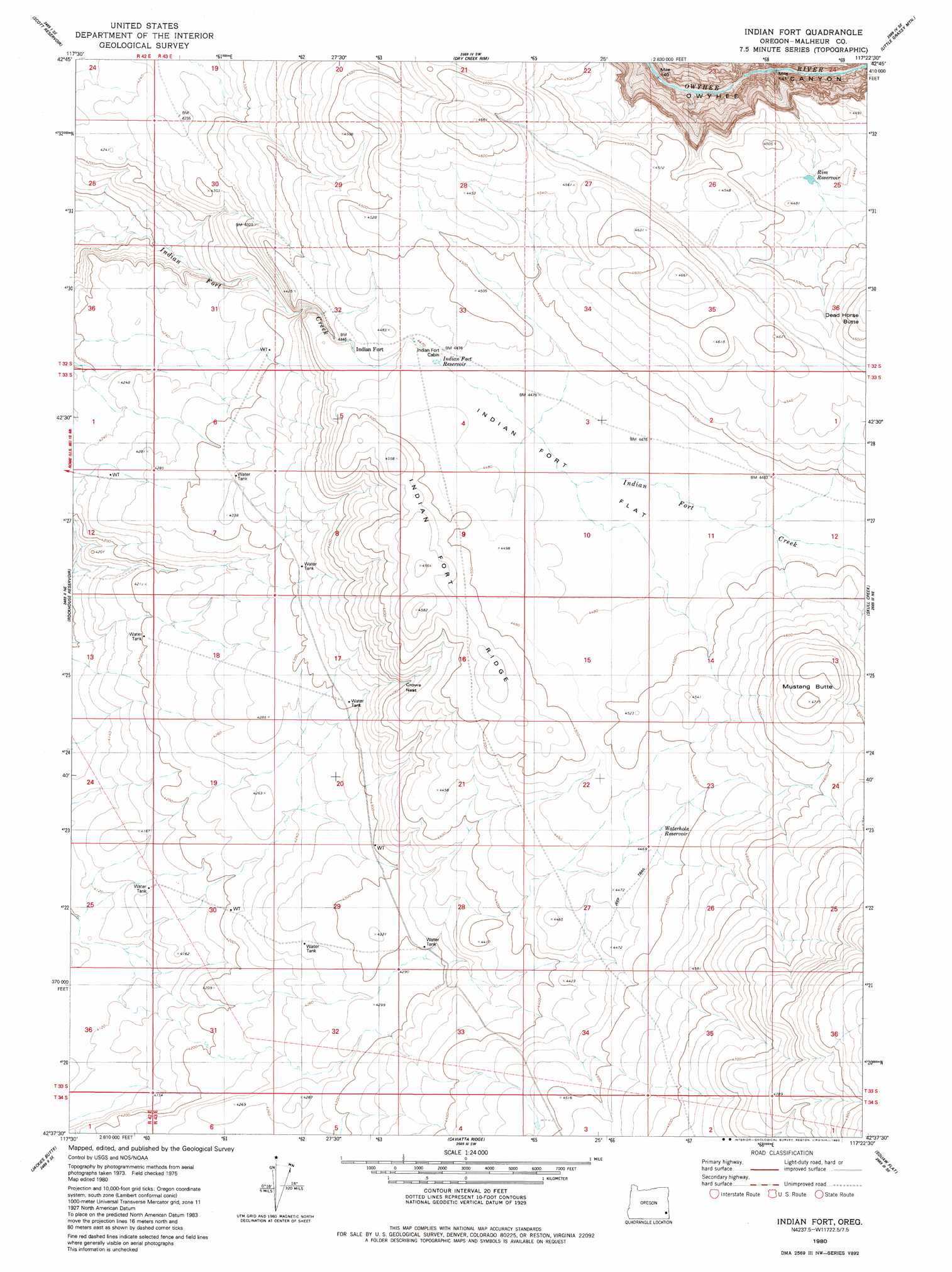
Indian Fort Topo Map Oregon
To zoom in, hover over the map of Indian Fort
USGS Topo Quad 42117f4 - 1:24,000 scale
| Topo Map Name: | Indian Fort |
| USGS Topo Quad ID: | 42117f4 |
| Print Size: | ca. 21 1/4" wide x 27" high |
| Southeast Coordinates: | 42.625° N latitude / 117.375° W longitude |
| Map Center Coordinates: | 42.6875° N latitude / 117.4375° W longitude |
| U.S. State: | OR |
| Filename: | o42117f4.jpg |
| Download Map JPG Image: | Indian Fort topo map 1:24,000 scale |
| Map Type: | Topographic |
| Topo Series: | 7.5´ |
| Map Scale: | 1:24,000 |
| Source of Map Images: | United States Geological Survey (USGS) |
| Alternate Map Versions: |
Indian Fort OR 1980, updated 1980 Download PDF Buy paper map Indian Fort OR 2011 Download PDF Buy paper map Indian Fort OR 2014 Download PDF Buy paper map |
1:24,000 Topo Quads surrounding Indian Fort
Owyhee Butte |
Arock |
Threemile Hill |
Danner |
Antelope Reservoir |
Rome |
Scott Reservoir |
Dry Creek Rim |
Little Grassy Mountain |
Juniper Ridge |
The Basin |
Rockhouse Reservoir |
Indian Fort |
Skull Creek |
Whitehorse Butte |
Bowden Ranch |
Jackies Butte |
Caviatta Ridge |
Squaw Flat |
Three Forks |
Battle Creek Ranch |
Rattlesnake Canyon |
Peacock Lake |
No Crossing Crossing |
Drummond Basin |
> Back to 42117e1 at 1:100,000 scale
> Back to 42116a1 at 1:250,000 scale
> Back to U.S. Topo Maps home
Indian Fort topo map: Gazetteer
Indian Fort: Basins
Crows Nest elevation 1339m 4393′Indian Fort: Flats
Indian Fort Flat elevation 1365m 4478′Indian Fort: Reservoirs
Indian Fort Reservoir elevation 1363m 4471′Little Peacock Reservoir elevation 1384m 4540′
Rim Reservoir elevation 1360m 4461′
Water Hole Reservoir elevation 1366m 4481′
Indian Fort: Ridges
Indian Fort Ridge elevation 1397m 4583′Indian Fort: Summits
Mustang Butte elevation 1435m 4708′Indian Fort digital topo map on disk
Buy this Indian Fort topo map showing relief, roads, GPS coordinates and other geographical features, as a high-resolution digital map file on DVD: