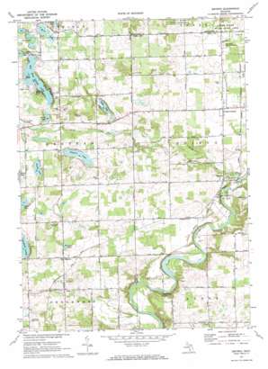
Smyrna Topo Map Michigan
To zoom in, hover over the map of Smyrna
USGS Topo Quad 43085a3 - 1:24,000 scale
| Topo Map Name: | Smyrna |
| USGS Topo Quad ID: | 43085a3 |
| Print Size: | ca. 21 1/4" wide x 27" high |
| Southeast Coordinates: | 43° N latitude / 85.25° W longitude |
| Map Center Coordinates: | 43.0625° N latitude / 85.3125° W longitude |
| U.S. State: | MI |
| Filename: | o43085a3.jpg |
| Download Map JPG Image: | Smyrna topo map 1:24,000 scale |
| Map Type: | Topographic |
| Topo Series: | 7.5´ |
| Map Scale: | 1:24,000 |
| Source of Map Images: | United States Geological Survey (USGS) |
| Alternate Map Versions: |
Smyrna MI 1972, updated 1974 Download PDF Buy paper map Smyrna MI 2011 Download PDF Buy paper map Smyrna MI 2014 Download PDF Buy paper map Smyrna MI 2017 Download PDF Buy paper map |
1:24,000 Topo Quads surrounding Smyrna
> Back to 43085a1 at 1:100,000 scale
> Back to 43084a1 at 1:250,000 scale
> Back to U.S. Topo Maps home
Smyrna topo map: Gazetteer
Smyrna: Bridges
Whites Bridge elevation 216m 708′Smyrna: Lakes
Big Pine Island Lake elevation 252m 826′Byrne Lake elevation 247m 810′
Green Lake elevation 247m 810′
Hart Lake elevation 264m 866′
Hull Lake elevation 257m 843′
Lewis Lake elevation 258m 846′
Scally Lake elevation 257m 843′
Slayton Lake elevation 253m 830′
Tower Lake elevation 252m 826′
Twin Lakes elevation 257m 843′
Smyrna: Parks
Alton Pioneer Village Historical Marker elevation 251m 823′Byrne Park elevation 277m 908′
Moseley School Historical Marker elevation 262m 859′
Smyrna Historical Marker elevation 250m 820′
Vergennes District Number One Schoolhouse Historical Marker elevation 244m 800′
White's Bridge Historical Marker elevation 218m 715′
Smyrna: Populated Places
Alton elevation 246m 807′Cooks Corners elevation 252m 826′
Lakeside Mobile Home Community elevation 273m 895′
Moseley elevation 261m 856′
Smyrna elevation 249m 816′
Wellington Estates Mobile Home Park elevation 250m 820′
Smyrna: Post Offices
Ashley Post Office (historical) elevation 289m 948′Otisco Post Office (historical) elevation 253m 830′
Smyrna Post Office (historical) elevation 249m 816′
Vergennes Post Office (historical) elevation 246m 807′
Smyrna: Streams
Seely Creek elevation 228m 748′Smyrna digital topo map on disk
Buy this Smyrna topo map showing relief, roads, GPS coordinates and other geographical features, as a high-resolution digital map file on DVD:


