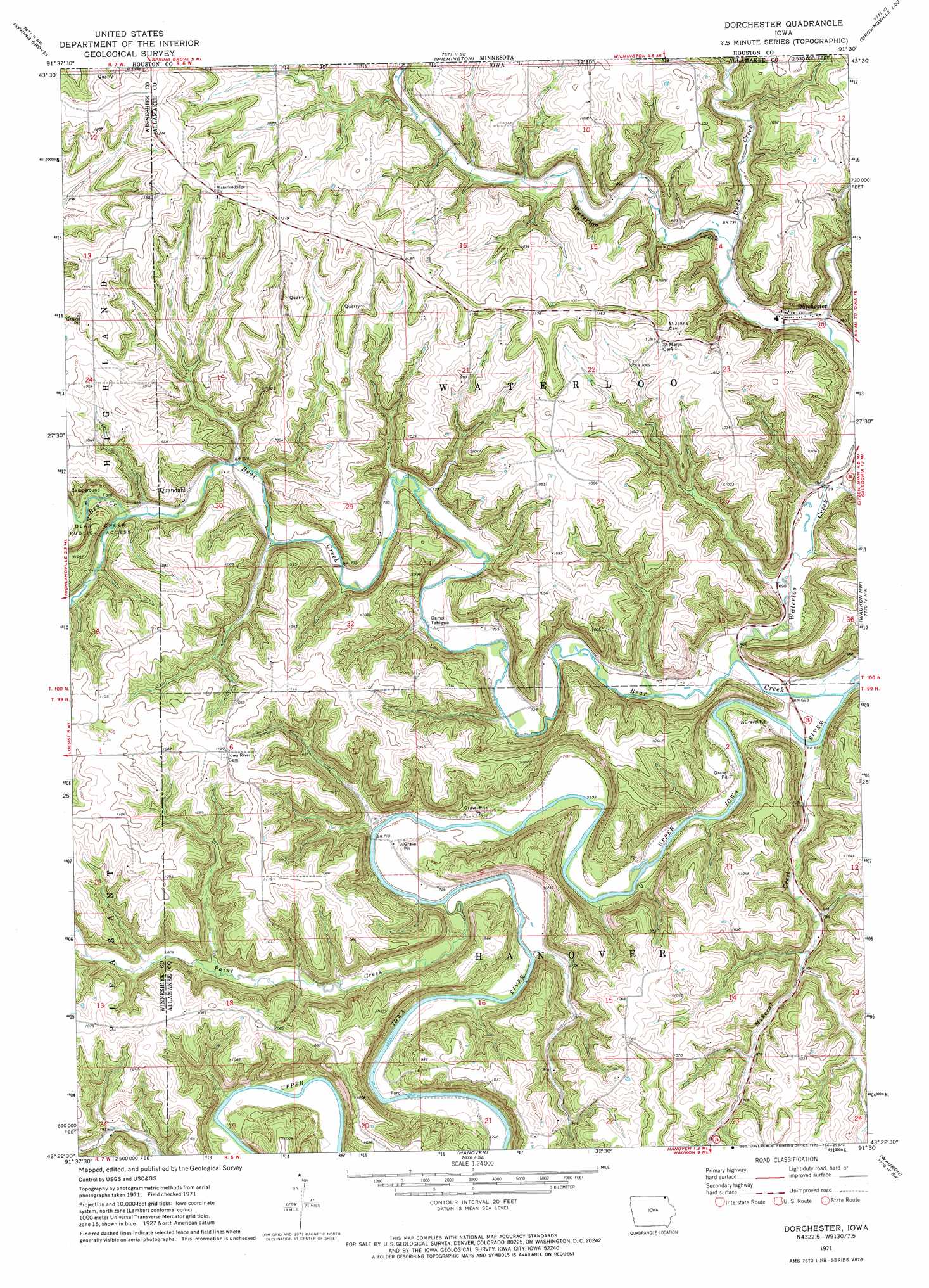
Dorchester Topo Map Iowa
To zoom in, hover over the map of Dorchester
USGS Topo Quad 43091d5 - 1:24,000 scale
| Topo Map Name: | Dorchester |
| USGS Topo Quad ID: | 43091d5 |
| Print Size: | ca. 21 1/4" wide x 27" high |
| Southeast Coordinates: | 43.375° N latitude / 91.5° W longitude |
| Map Center Coordinates: | 43.4375° N latitude / 91.5625° W longitude |
| U.S. State: | IA |
| Filename: | o43091d5.jpg |
| Download Map JPG Image: | Dorchester topo map 1:24,000 scale |
| Map Type: | Topographic |
| Topo Series: | 7.5´ |
| Map Scale: | 1:24,000 |
| Source of Map Images: | United States Geological Survey (USGS) |
| Alternate Map Versions: |
Dorchester IA 1971, updated 1973 Download PDF Buy paper map Dorchester IA 2010 Download PDF Buy paper map Dorchester IA 2013 Download PDF Buy paper map Dorchester IA 2015 Download PDF Buy paper map |
1:24,000 Topo Quads surrounding Dorchester
Bratsberg |
Yucatan |
Sheldon |
Caledonia |
Brownsville |
Mabel |
Spring Grove |
Wilmington |
Eitzen |
Reno |
Burr Oak |
Highlandville |
Dorchester |
Waukon Nw |
New Albin |
Decorah |
Freeport |
Hanover |
Waukon |
Church |
Calmar |
Postville Nw |
Frankville |
Rossville |
Waterville |
> Back to 43091a1 at 1:100,000 scale
> Back to 43090a1 at 1:250,000 scale
> Back to U.S. Topo Maps home
Dorchester topo map: Gazetteer
Dorchester: Airports
Camp Tahigwa Landing Site Heliport elevation 228m 748′Dorchester: Parks
Bear Creek Public Access elevation 297m 974′Iverson Bottoms Wildlife Management Area elevation 303m 994′
Pine Creek Wildlife Management Area elevation 248m 813′
Waterloo Creek Wildlife Management Area elevation 267m 875′
Dorchester: Populated Places
Dorchester elevation 225m 738′Quandahl elevation 250m 820′
Dorchester: Post Offices
Bergen Post Office (historical) elevation 315m 1033′Dorchester Post Office elevation 230m 754′
New Galena Post Office (historical) elevation 268m 879′
Quandahl Post Office (historical) elevation 250m 820′
Dorchester: Streams
Bear Creek elevation 202m 662′Duck Creek elevation 235m 770′
Duck Creek elevation 235m 770′
Mineral Creek elevation 205m 672′
North Bear Creek elevation 275m 902′
Paint Creek elevation 212m 695′
South Bear Creek elevation 256m 839′
Waterloo Creek elevation 205m 672′
Dorchester digital topo map on disk
Buy this Dorchester topo map showing relief, roads, GPS coordinates and other geographical features, as a high-resolution digital map file on DVD: