Brownsville Topo Map Minnesota
To zoom in, hover over the map of Brownsville
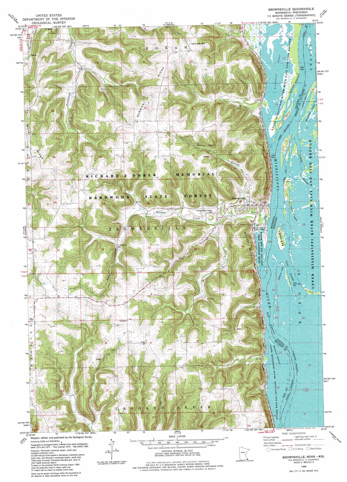
USGS Topo Quad 43091f3 - 1:24,000 scale
| Topo Map Name: | Brownsville |
| USGS Topo Quad ID: | 43091f3 |
| Print Size: | ca. 21 1/4" wide x 27" high |
| Southeast Coordinates: | 43.625° N latitude / 91.25° W longitude |
| Map Center Coordinates: | 43.6875° N latitude / 91.3125° W longitude |
| U.S. States: | MN, WI |
| Filename: | o43091f3.jpg |
| Download Map JPG Image: | Brownsville topo map 1:24,000 scale |
| Map Type: | Topographic |
| Topo Series: | 7.5´ |
| Map Scale: | 1:24,000 |
| Source of Map Images: | United States Geological Survey (USGS) |
| Alternate Map Versions: |
Brownsville MN 1980, updated 1980 Download PDF Buy paper map Brownsville MN 2010 Download PDF Buy paper map Brownsville MN 2013 Download PDF Buy paper map Brownsville MN 2016 Download PDF Buy paper map |
1:24,000 Topo Quads surrounding Brownsville
Witoka |
Pickwick |
Holmen |
Onalaska |
West Salem |
Houston |
Mound Prairie |
La Crescent |
La Crosse |
Saint Joseph |
Sheldon |
Caledonia |
Brownsville |
Stoddard |
Coon Valley |
Wilmington |
Eitzen |
Reno |
Genoa |
Newton |
Dorchester |
Waukon Nw |
New Albin |
De Soto |
Retreat |
> Back to 43091e1 at 1:100,000 scale
> Back to 43090a1 at 1:250,000 scale
> Back to U.S. Topo Maps home
Brownsville topo map: Gazetteer
Brownsville: Channels
Raft Channel elevation 192m 629′Brownsville: Cliffs
Wildcat Bluff elevation 301m 987′Brownsville: Islands
Browns Island elevation 192m 629′Brownsville: Lakes
Lawrence Lake elevation 192m 629′Brownsville: Populated Places
Brownsville elevation 215m 705′Ward Lee Mobile Home Park elevation 215m 705′
Brownsville: Post Offices
Brownsville Post Office elevation 215m 705′Brownsville: Ridges
German Ridge elevation 354m 1161′Miller Ridge elevation 340m 1115′
Brownsville: Streams
Brownsville Creek elevation 195m 639′Spring Branch elevation 196m 643′
Wildcat Creek elevation 194m 636′
Brownsville digital topo map on disk
Buy this Brownsville topo map showing relief, roads, GPS coordinates and other geographical features, as a high-resolution digital map file on DVD: