Lone Rock Topo Map Iowa
To zoom in, hover over the map of Lone Rock
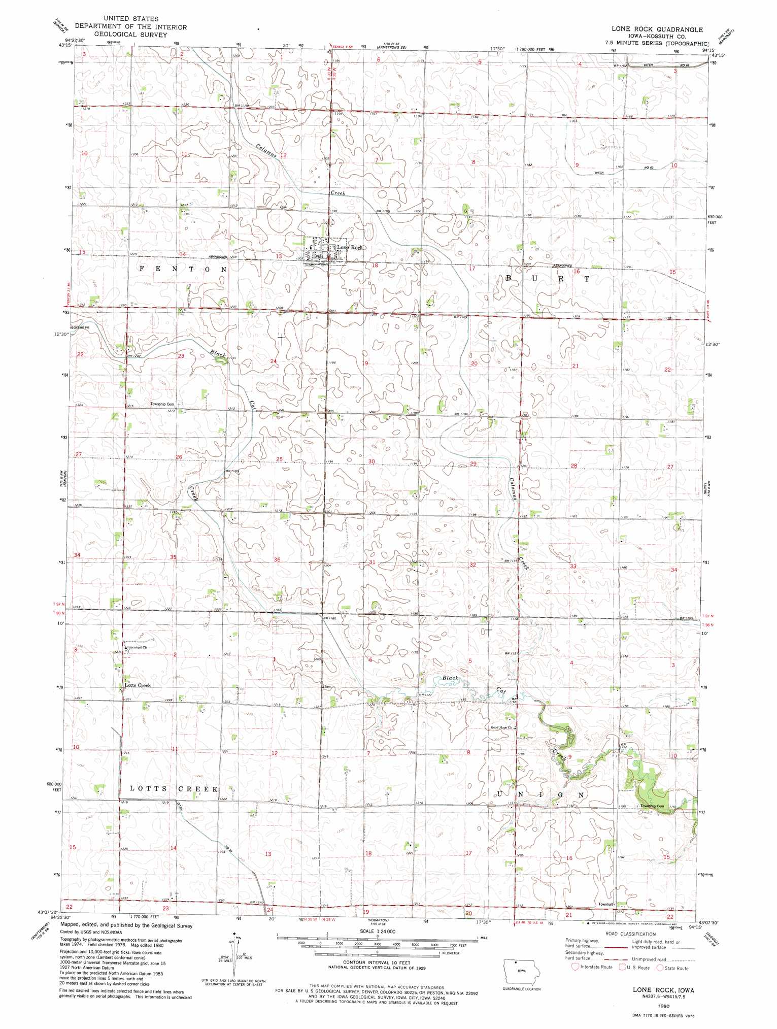
USGS Topo Quad 43094b3 - 1:24,000 scale
| Topo Map Name: | Lone Rock |
| USGS Topo Quad ID: | 43094b3 |
| Print Size: | ca. 21 1/4" wide x 27" high |
| Southeast Coordinates: | 43.125° N latitude / 94.25° W longitude |
| Map Center Coordinates: | 43.1875° N latitude / 94.3125° W longitude |
| U.S. State: | IA |
| Filename: | o43094b3.jpg |
| Download Map JPG Image: | Lone Rock topo map 1:24,000 scale |
| Map Type: | Topographic |
| Topo Series: | 7.5´ |
| Map Scale: | 1:24,000 |
| Source of Map Images: | United States Geological Survey (USGS) |
| Alternate Map Versions: |
Lone Rock IA 1980, updated 1980 Download PDF Buy paper map Lone Rock IA 2010 Download PDF Buy paper map Lone Rock IA 2013 Download PDF Buy paper map Lone Rock IA 2015 Download PDF Buy paper map |
1:24,000 Topo Quads surrounding Lone Rock
Dolliver |
Armstrong |
Swea City |
Ledyard |
Lakota |
Ringsted |
Seneca |
Armstrong Se |
Bancroft |
German Valley |
Depew |
Fenton |
Lone Rock |
Burt |
Titonka |
Cylinder |
Whittemore |
Hobarton |
Algona |
Sexton |
Plover |
Unique |
West Bend Ne |
Saint Joseph |
Lu Verne |
> Back to 43094a1 at 1:100,000 scale
> Back to 43094a1 at 1:250,000 scale
> Back to U.S. Topo Maps home
Lone Rock topo map: Gazetteer
Lone Rock: Populated Places
Lone Rock elevation 366m 1200′Lotts Creek elevation 372m 1220′
Lone Rock: Post Offices
Johnson's Settlement Post Office elevation 362m 1187′Lone Rock Post Office elevation 370m 1213′
Lotts Creek Post Office (historical) elevation 372m 1220′
Lone Rock: Streams
Calamus Creek elevation 359m 1177′Lone Rock digital topo map on disk
Buy this Lone Rock topo map showing relief, roads, GPS coordinates and other geographical features, as a high-resolution digital map file on DVD: