Timber Creek Topo Map Wyoming
To zoom in, hover over the map of Timber Creek
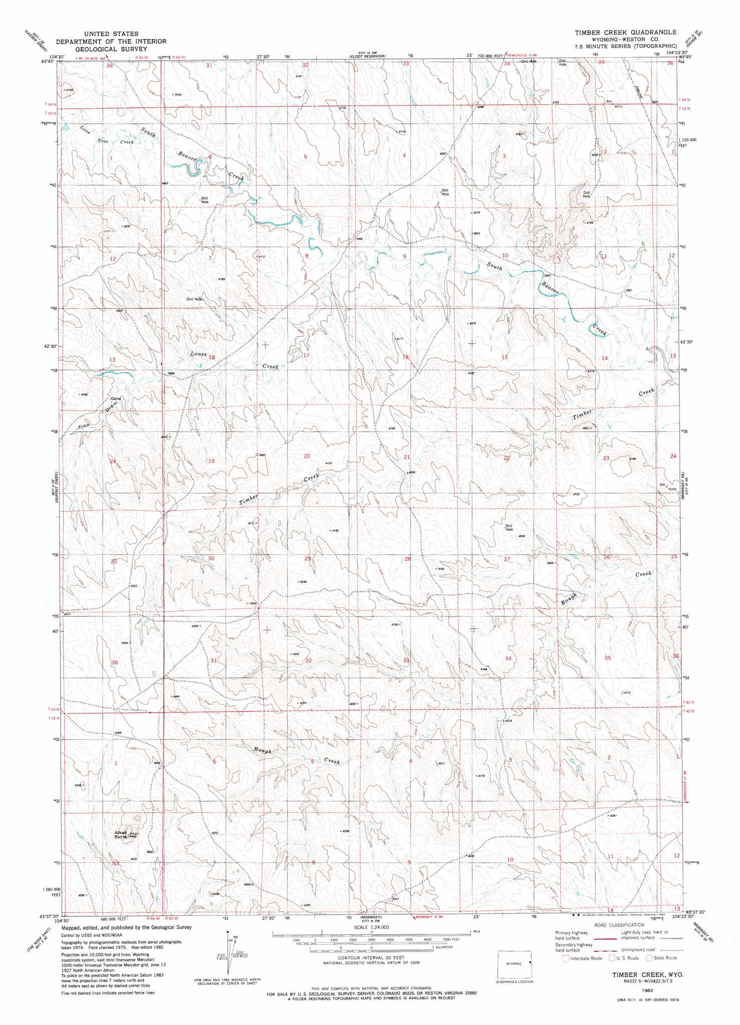
USGS Topo Quad 43104f4 - 1:24,000 scale
| Topo Map Name: | Timber Creek |
| USGS Topo Quad ID: | 43104f4 |
| Print Size: | ca. 21 1/4" wide x 27" high |
| Southeast Coordinates: | 43.625° N latitude / 104.375° W longitude |
| Map Center Coordinates: | 43.6875° N latitude / 104.4375° W longitude |
| U.S. State: | WY |
| Filename: | o43104f4.jpg |
| Download Map JPG Image: | Timber Creek topo map 1:24,000 scale |
| Map Type: | Topographic |
| Topo Series: | 7.5´ |
| Map Scale: | 1:24,000 |
| Source of Map Images: | United States Geological Survey (USGS) |
| Alternate Map Versions: |
Timber Creek WY 1982, updated 1982 Download PDF Buy paper map Timber Creek WY 2012 Download PDF Buy paper map Timber Creek WY 2015 Download PDF Buy paper map |
| FStopo: | US Forest Service topo Timber Creek is available: Download FStopo PDF Download FStopo TIF |
1:24,000 Topo Quads surrounding Timber Creek
Sheep Canyon Creek West |
Sheep Canyon Creek East |
Osage |
Pedro |
Cambria |
Fairview |
Lassen Creek |
Klodt Reservoir |
Osage Se |
Newcastle |
Clareton |
Dupont Creek |
Timber Creek |
Morrisey Ne |
Owens |
The Nose West |
The Nose East |
Morrisey |
Morrisey Se |
Dewey Sw |
Garland Draw |
Horseshoe Bend |
Threemile Butte |
Little Alkali Creek |
Riverview |
> Back to 43104e1 at 1:100,000 scale
> Back to 43104a1 at 1:250,000 scale
> Back to U.S. Topo Maps home
Timber Creek topo map: Gazetteer
Timber Creek: Streams
Louse Creek elevation 1209m 3966′North Fork Lone Tree Creek elevation 1234m 4048′
South Fork Lone Tree Creek elevation 1226m 4022′
Timber Creek elevation 1187m 3894′
Timber Creek: Summits
Alkali Butte elevation 1349m 4425′Timber Creek: Valleys
Coyote Draw elevation 1219m 3999′Finn Draw elevation 1237m 4058′
Timber Creek digital topo map on disk
Buy this Timber Creek topo map showing relief, roads, GPS coordinates and other geographical features, as a high-resolution digital map file on DVD:
Eastern Wyoming & Western South Dakota
Buy digital topo maps: Eastern Wyoming & Western South Dakota