Whipple Hollow Topo Map Wyoming
To zoom in, hover over the map of Whipple Hollow
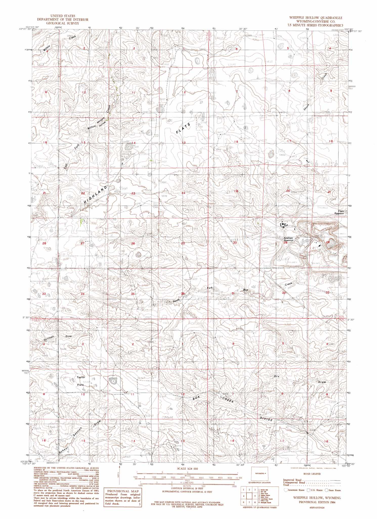
USGS Topo Quad 43105a5 - 1:24,000 scale
| Topo Map Name: | Whipple Hollow |
| USGS Topo Quad ID: | 43105a5 |
| Print Size: | ca. 21 1/4" wide x 27" high |
| Southeast Coordinates: | 43° N latitude / 105.5° W longitude |
| Map Center Coordinates: | 43.0625° N latitude / 105.5625° W longitude |
| U.S. State: | WY |
| Filename: | o43105a5.jpg |
| Download Map JPG Image: | Whipple Hollow topo map 1:24,000 scale |
| Map Type: | Topographic |
| Topo Series: | 7.5´ |
| Map Scale: | 1:24,000 |
| Source of Map Images: | United States Geological Survey (USGS) |
| Alternate Map Versions: |
Whipple Hollow WY 1984, updated 1984 Download PDF Buy paper map Whipple Hollow WY 2012 Download PDF Buy paper map Whipple Hollow WY 2015 Download PDF Buy paper map |
1:24,000 Topo Quads surrounding Whipple Hollow
Thompson Draw |
Bear Creek |
Coal Draw South |
Alta Creek |
Dugout Creek South |
South Fork Reservoir |
Suicide Hill |
Red Hill |
Patsy Draw |
Bill |
Coal Hill |
Holdup Hollow |
Whipple Hollow |
Bobby Draw |
Bill Se |
Hylton Ranch |
Leuenberger Ranch |
Gilbert Lake |
Sundquist Ranch |
Clausen Ranch |
Glenrock |
Careyhurst |
Orpha |
Douglas |
Antelope Creek |
> Back to 43105a1 at 1:100,000 scale
> Back to 43104a1 at 1:250,000 scale
> Back to U.S. Topo Maps home
Whipple Hollow topo map: Gazetteer
Whipple Hollow: Dams
Buck Dam elevation 1602m 5255′Whipple Hollow: Flats
Highland Flats elevation 1660m 5446′Taylor Flats elevation 1671m 5482′
Whipple Hollow: Mines
Buffalo Shaft Mine elevation 1630m 5347′Highland Open Pit elevation 1593m 5226′
North Morton Mine elevation 1659m 5442′
Whipple Hollow: Populated Places
Whipple Hollow elevation 1623m 5324′Whipple Hollow: Reservoirs
Buck Reservoir elevation 1602m 5255′Whipple Hollow: Ridges
Box Creek Divide elevation 1691m 5547′Whipple Hollow digital topo map on disk
Buy this Whipple Hollow topo map showing relief, roads, GPS coordinates and other geographical features, as a high-resolution digital map file on DVD:
Eastern Wyoming & Western South Dakota
Buy digital topo maps: Eastern Wyoming & Western South Dakota