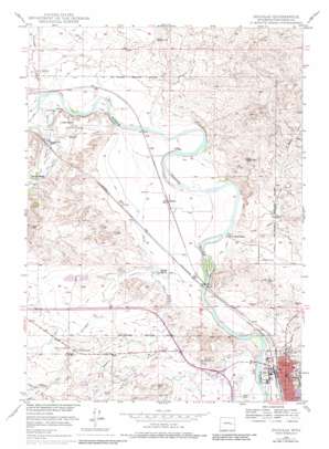
Douglas Topo Map Wyoming
To zoom in, hover over the map of Douglas
USGS Topo Quad 42105g4 - 1:24,000 scale
| Topo Map Name: | Douglas |
| USGS Topo Quad ID: | 42105g4 |
| Print Size: | ca. 21 1/4" wide x 27" high |
| Southeast Coordinates: | 42.75° N latitude / 105.375° W longitude |
| Map Center Coordinates: | 42.8125° N latitude / 105.4375° W longitude |
| U.S. State: | WY |
| Filename: | o42105g4.jpg |
| Download Map JPG Image: | Douglas topo map 1:24,000 scale |
| Map Type: | Topographic |
| Topo Series: | 7.5´ |
| Map Scale: | 1:24,000 |
| Source of Map Images: | United States Geological Survey (USGS) |
| Alternate Map Versions: |
Douglas WY 1949, updated 1971 Download PDF Buy paper map Douglas WY 1949, updated 1977 Download PDF Buy paper map Douglas WY 1949, updated 1983 Download PDF Buy paper map Douglas WY 1950 Download PDF Buy paper map Douglas WY 2012 Download PDF Buy paper map Douglas WY 2015 Download PDF Buy paper map |
1:24,000 Topo Quads surrounding Douglas
> Back to 42105e1 at 1:100,000 scale
> Back to 42104a1 at 1:250,000 scale
> Back to U.S. Topo Maps home
Douglas topo map: Gazetteer
Douglas: Airports
Converse County Airport elevation 1499m 4917′Douglas: Canals
Morton Ditch elevation 1481m 4858′Douglas: Dams
Douglas Fishing Lake Number 1 Dam elevation 1538m 5045′Warner Dam elevation 1508m 4947′
Warner Number 2 Dam elevation 1507m 4944′
Douglas: Mines
Albert Sims Fee Land Mine elevation 1467m 4812′Anderson Pit elevation 1465m 4806′
Carmen Pit elevation 1465m 4806′
Fort Fetterman Pit elevation 1491m 4891′
Lisco Pit elevation 1464m 4803′
Miner Sand and Gravel Pit elevation 1470m 4822′
Recluse Pit elevation 1495m 4904′
Wintermote Pit elevation 1464m 4803′
Douglas: Parks
Bill Hooker Monument elevation 1541m 5055′Bozeman Trail Marker elevation 1490m 4888′
Douglas: Populated Places
Douglas elevation 1474m 4835′Douglas: Reservoirs
Douglas Fishing Lake Number 1 elevation 1538m 5045′Warner Reservoir elevation 1508m 4947′
Warner Reservoir Number 2 elevation 1507m 4944′
Douglas: Streams
Antelope Creek elevation 1463m 4799′East Antelope Creek elevation 1465m 4806′
Fetterman Creek elevation 1478m 4849′
Fivemile Creek elevation 1458m 4783′
La Prele Creek elevation 1482m 4862′
Sixmile Creek elevation 1458m 4783′
Douglas: Valleys
Harvey Gulch elevation 1469m 4819′Douglas digital topo map on disk
Buy this Douglas topo map showing relief, roads, GPS coordinates and other geographical features, as a high-resolution digital map file on DVD:
Eastern Wyoming & Western South Dakota
Buy digital topo maps: Eastern Wyoming & Western South Dakota


