Alturas Lake Topo Map Idaho
To zoom in, hover over the map of Alturas Lake
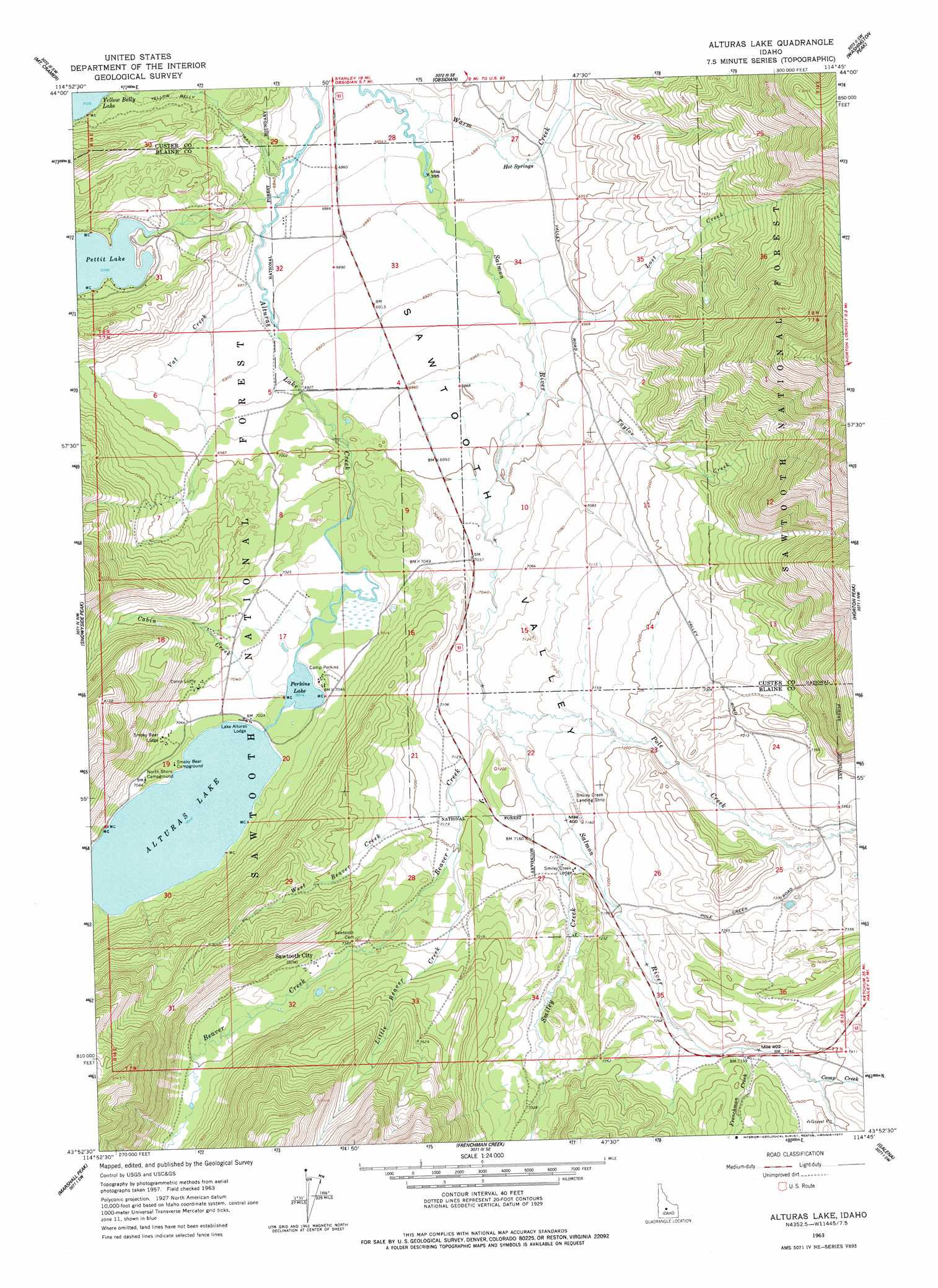
USGS Topo Quad 43114h7 - 1:24,000 scale
| Topo Map Name: | Alturas Lake |
| USGS Topo Quad ID: | 43114h7 |
| Print Size: | ca. 21 1/4" wide x 27" high |
| Southeast Coordinates: | 43.875° N latitude / 114.75° W longitude |
| Map Center Coordinates: | 43.9375° N latitude / 114.8125° W longitude |
| U.S. State: | ID |
| Filename: | o43114h7.jpg |
| Download Map JPG Image: | Alturas Lake topo map 1:24,000 scale |
| Map Type: | Topographic |
| Topo Series: | 7.5´ |
| Map Scale: | 1:24,000 |
| Source of Map Images: | United States Geological Survey (USGS) |
| Alternate Map Versions: |
Alturas Lake ID 1963, updated 1965 Download PDF Buy paper map Alturas Lake ID 1963, updated 1977 Download PDF Buy paper map Alturas Lake ID 1963, updated 1977 Download PDF Buy paper map Alturas Lake ID 2011 Download PDF Buy paper map Alturas Lake ID 2013 Download PDF Buy paper map |
| FStopo: | US Forest Service topo Alturas Lake is available: Download FStopo PDF Download FStopo TIF |
1:24,000 Topo Quads surrounding Alturas Lake
Stanley Lake |
Stanley |
Casino Lakes |
Robinson Bar |
Livingston Creek |
Warbonnet Peak |
Mount Cramer |
Obsidian |
Washington Peak |
Boulder Chain Lakes |
Mount Everly |
Snowyside Peak |
Alturas Lake |
Horton Peak |
Galena Peak |
Atlanta East |
Marshall Peak |
Frenchman Creek |
Galena |
Easley Hot Springs |
Ross Peak |
Newman Peak |
Paradise Peak |
Baker Peak |
Boyle Mountain |
> Back to 43114e1 at 1:100,000 scale
> Back to 43114a1 at 1:250,000 scale
> Back to U.S. Topo Maps home
Alturas Lake topo map: Gazetteer
Alturas Lake: Airports
Smiley Creek Airport elevation 2182m 7158′Alturas Lake: Canals
Pole Creek Ditch elevation 2216m 7270′Alturas Lake: Dams
Pettit Lake Fish Barrier Dam elevation 2134m 7001′Alturas Lake: Lakes
Alturas Lake elevation 2140m 7020′Perkins Lake elevation 2141m 7024′
Alturas Lake: Populated Places
Sawtooth City elevation 2238m 7342′Alturas Lake: Springs
Hot Springs elevation 2104m 6902′Alturas Lake: Streams
Beaver Creek elevation 2164m 7099′Cabin Creek elevation 2141m 7024′
Camp Creek elevation 2247m 7372′
Frenchman Creek elevation 2231m 7319′
Little Beaver Creek elevation 2195m 7201′
Lost Creek elevation 2124m 6968′
Pole Creek elevation 2162m 7093′
Smiley Creek elevation 2176m 7139′
Taylor Creek elevation 2135m 7004′
Vat Creek elevation 2092m 6863′
Warm Creek elevation 2086m 6843′
West Beaver Creek elevation 2182m 7158′
Alturas Lake: Trails
Yellow Belly Trail elevation 2146m 7040′Alturas Lake digital topo map on disk
Buy this Alturas Lake topo map showing relief, roads, GPS coordinates and other geographical features, as a high-resolution digital map file on DVD: