Deer Haven Mountain Topo Map Idaho
To zoom in, hover over the map of Deer Haven Mountain
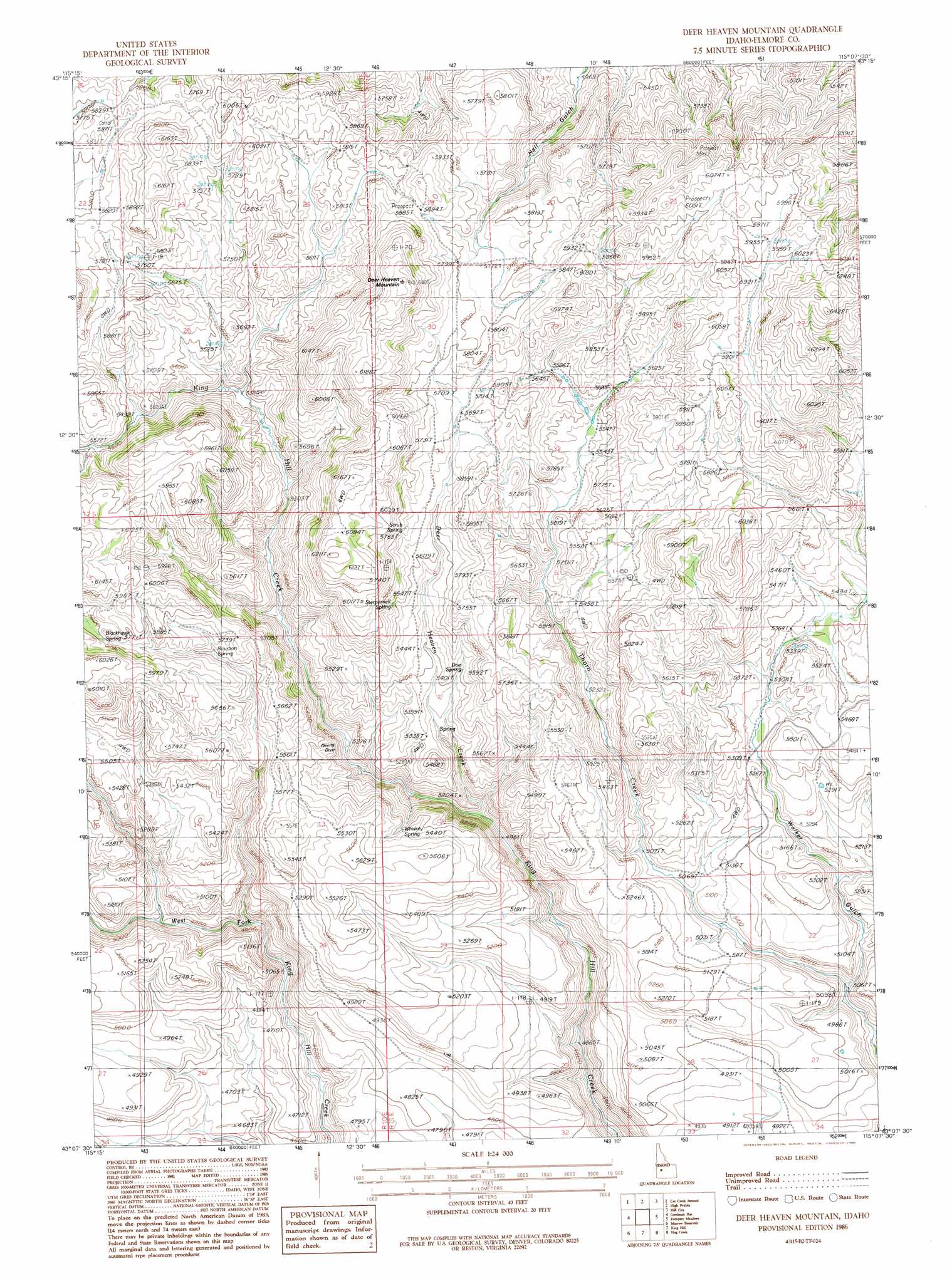
USGS Topo Quad 43115b2 - 1:24,000 scale
| Topo Map Name: | Deer Haven Mountain |
| USGS Topo Quad ID: | 43115b2 |
| Print Size: | ca. 21 1/4" wide x 27" high |
| Southeast Coordinates: | 43.125° N latitude / 115.125° W longitude |
| Map Center Coordinates: | 43.1875° N latitude / 115.1875° W longitude |
| U.S. State: | ID |
| Filename: | o43115b2.jpg |
| Download Map JPG Image: | Deer Haven Mountain topo map 1:24,000 scale |
| Map Type: | Topographic |
| Topo Series: | 7.5´ |
| Map Scale: | 1:24,000 |
| Source of Map Images: | United States Geological Survey (USGS) |
| Alternate Map Versions: |
Deer Heaven Mountain ID 1986, updated 1986 Download PDF Buy paper map Deer Heaven Mountain ID 1986, updated 1986 Download PDF Buy paper map Deer Heaven Mountain ID 2010 Download PDF Buy paper map Deer Heaven Mountain ID 2013 Download PDF Buy paper map |
1:24,000 Topo Quads surrounding Deer Haven Mountain
House Mountain |
Pine |
Sprout Mountain |
Deer Mountain |
Smoky Dome |
Anderson Ranch Dam |
Cat Creek Summit |
High Prairie |
Hill City |
Corral |
Bennett Mountain |
Goodman Flat |
Deer Haven Mountain |
Dempsey Meadows |
Davis Mountain |
Hot Springs Creek Reservoir |
Morrow Reservoir |
King Hill |
Hog Creek |
Davis Mountain Sw |
Hammett |
Glenns Ferry |
Pasadena Valley |
Ticeska |
Bliss |
> Back to 43115a1 at 1:100,000 scale
> Back to 43114a1 at 1:250,000 scale
> Back to U.S. Topo Maps home
Deer Haven Mountain topo map: Gazetteer
Deer Haven Mountain: Springs
Blackhawk Spring elevation 1762m 5780′Bourbon Spring elevation 1701m 5580′
Doe Spring elevation 1655m 5429′
Ground Hog Spring elevation 1488m 4881′
Scrub Spring elevation 1760m 5774′
Sterpernell Spring elevation 1728m 5669′
Thoroughbred Spring elevation 1587m 5206′
Whiskey Spring elevation 1685m 5528′
Deer Haven Mountain: Streams
Deer Heaven Creek elevation 1511m 4957′Deer Haven Mountain: Summits
Deer Heaven Mountain elevation 1942m 6371′Deer Haven Mountain: Valleys
Walker Gulch elevation 1469m 4819′Deer Haven Mountain digital topo map on disk
Buy this Deer Haven Mountain topo map showing relief, roads, GPS coordinates and other geographical features, as a high-resolution digital map file on DVD: