Hill City Topo Map Idaho
To zoom in, hover over the map of Hill City
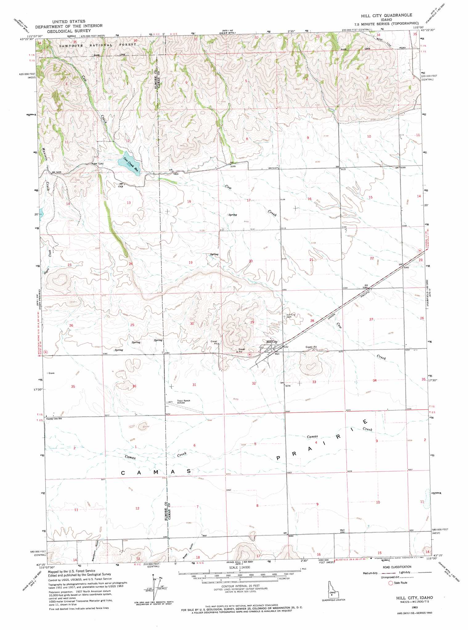
USGS Topo Quad 43115c1 - 1:24,000 scale
| Topo Map Name: | Hill City |
| USGS Topo Quad ID: | 43115c1 |
| Print Size: | ca. 21 1/4" wide x 27" high |
| Southeast Coordinates: | 43.25° N latitude / 115° W longitude |
| Map Center Coordinates: | 43.3125° N latitude / 115.0625° W longitude |
| U.S. State: | ID |
| Filename: | o43115c1.jpg |
| Download Map JPG Image: | Hill City topo map 1:24,000 scale |
| Map Type: | Topographic |
| Topo Series: | 7.5´ |
| Map Scale: | 1:24,000 |
| Source of Map Images: | United States Geological Survey (USGS) |
| Alternate Map Versions: |
Hill City ID 1963, updated 1965 Download PDF Buy paper map Hill City ID 2011 Download PDF Buy paper map Hill City ID 2013 Download PDF Buy paper map |
| FStopo: | US Forest Service topo Hill City is available: Download FStopo PDF Download FStopo TIF |
1:24,000 Topo Quads surrounding Hill City
Featherville |
Grouse Butte |
Jumbo Mountain |
Boardman Creek |
Sydney Butte |
Pine |
Sprout Mountain |
Deer Mountain |
Smoky Dome |
Phillips Creek |
Cat Creek Summit |
High Prairie |
Hill City |
Corral |
Fairfield |
Goodman Flat |
Deer Haven Mountain |
Dempsey Meadows |
Davis Mountain |
Fir Grove Mountain |
Morrow Reservoir |
King Hill |
Hog Creek |
Davis Mountain Sw |
Mckinney Butte |
> Back to 43115a1 at 1:100,000 scale
> Back to 43114a1 at 1:250,000 scale
> Back to U.S. Topo Maps home
Hill City topo map: Gazetteer
Hill City: Airports
Tracy Ranch Airport elevation 1546m 5072′Hill City: Dams
Cow Creek Dam elevation 1596m 5236′Hill City: Populated Places
Hill City elevation 1554m 5098′Hill City: Reservoirs
Cow Creek Reservoir elevation 1596m 5236′Hill City: Streams
Maniece Creek elevation 1633m 5357′Monument Gulch Creek elevation 1543m 5062′
Hill City: Valleys
Blackburn Gulch elevation 1551m 5088′Boyer Gulch elevation 1551m 5088′
Hill City digital topo map on disk
Buy this Hill City topo map showing relief, roads, GPS coordinates and other geographical features, as a high-resolution digital map file on DVD: