Davis Mountain Topo Map Idaho
To zoom in, hover over the map of Davis Mountain
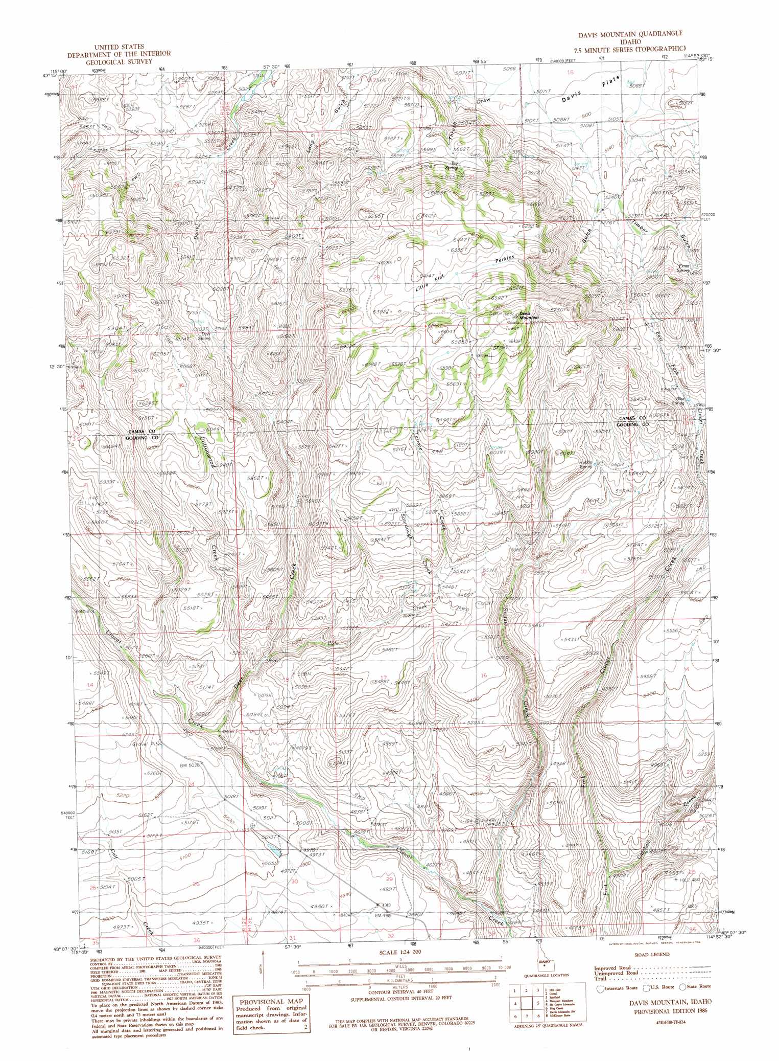
USGS Topo Quad 43114b8 - 1:24,000 scale
| Topo Map Name: | Davis Mountain |
| USGS Topo Quad ID: | 43114b8 |
| Print Size: | ca. 21 1/4" wide x 27" high |
| Southeast Coordinates: | 43.125° N latitude / 114.875° W longitude |
| Map Center Coordinates: | 43.1875° N latitude / 114.9375° W longitude |
| U.S. State: | ID |
| Filename: | o43114b8.jpg |
| Download Map JPG Image: | Davis Mountain topo map 1:24,000 scale |
| Map Type: | Topographic |
| Topo Series: | 7.5´ |
| Map Scale: | 1:24,000 |
| Source of Map Images: | United States Geological Survey (USGS) |
| Alternate Map Versions: |
Davis Mountain ID 1986, updated 1986 Download PDF Buy paper map Davis Mountain ID 2010 Download PDF Buy paper map Davis Mountain ID 2013 Download PDF Buy paper map |
1:24,000 Topo Quads surrounding Davis Mountain
Sprout Mountain |
Deer Mountain |
Smoky Dome |
Phillips Creek |
Cannonball Mountain |
High Prairie |
Hill City |
Corral |
Fairfield |
Spring Creek Reservoir |
Deer Haven Mountain |
Dempsey Meadows |
Davis Mountain |
Fir Grove Mountain |
Mchan Reservoir |
King Hill |
Hog Creek |
Davis Mountain Sw |
Mckinney Butte |
Thorn Creek Sw |
Pasadena Valley |
Ticeska |
Bliss |
Gooding Butte |
Gooding |
> Back to 43114a1 at 1:100,000 scale
> Back to 43114a1 at 1:250,000 scale
> Back to U.S. Topo Maps home
Davis Mountain topo map: Gazetteer
Davis Mountain: Flats
Little Flat elevation 1931m 6335′Davis Mountain: Springs
Big Spring elevation 1754m 5754′Deer Spring elevation 1737m 5698′
Erma Spring elevation 1701m 5580′
Hobby Spring elevation 1734m 5688′
Davis Mountain: Streams
Catchall Creek elevation 1318m 4324′Cottonwood Creek elevation 1508m 4947′
Deer Creek elevation 1469m 4819′
Pole Creek elevation 1513m 4963′
Sourdough Creek elevation 1670m 5479′
Squaw Creek elevation 1309m 4294′
Terrace Creek elevation 1676m 5498′
Davis Mountain: Summits
Davis Mountain elevation 2070m 6791′Davis Mountain: Valleys
Long Gulch elevation 1571m 5154′Perkins Gulch elevation 1612m 5288′
Thaw Draw elevation 1568m 5144′
Timber Gulch elevation 1600m 5249′
Davis Mountain digital topo map on disk
Buy this Davis Mountain topo map showing relief, roads, GPS coordinates and other geographical features, as a high-resolution digital map file on DVD: