Bear River Topo Map Idaho
To zoom in, hover over the map of Bear River
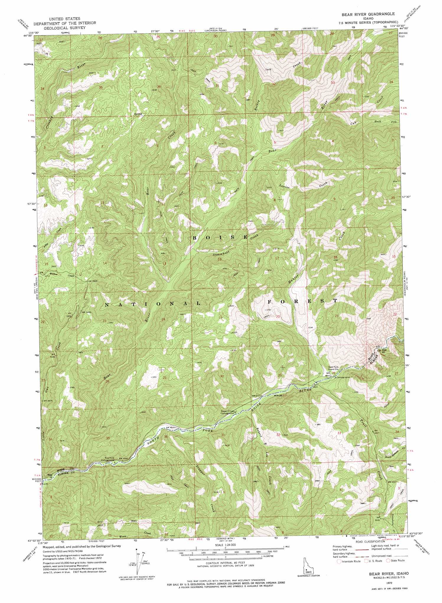
USGS Topo Quad 43115h4 - 1:24,000 scale
| Topo Map Name: | Bear River |
| USGS Topo Quad ID: | 43115h4 |
| Print Size: | ca. 21 1/4" wide x 27" high |
| Southeast Coordinates: | 43.875° N latitude / 115.375° W longitude |
| Map Center Coordinates: | 43.9375° N latitude / 115.4375° W longitude |
| U.S. State: | ID |
| Filename: | o43115h4.jpg |
| Download Map JPG Image: | Bear River topo map 1:24,000 scale |
| Map Type: | Topographic |
| Topo Series: | 7.5´ |
| Map Scale: | 1:24,000 |
| Source of Map Images: | United States Geological Survey (USGS) |
| Alternate Map Versions: |
Bear River ID 1972, updated 1976 Download PDF Buy paper map Bear River ID 2011 Download PDF Buy paper map Bear River ID 2013 Download PDF Buy paper map |
| FStopo: | US Forest Service topo Bear River is available: Download FStopo PDF Download FStopo TIF |
1:24,000 Topo Quads surrounding Bear River
Scott Creek |
Miller Mountain West |
Miller Mountain East |
Eightmile Mountain |
Grandjean |
Pine Flat |
Lowman |
Jackson Peak |
Tyee Mountain |
Edaho Mountain |
Sunset Mountain |
Big Owl Creek |
Bear River |
Swanholm Peak |
Nahneke Mountain |
Rabbit Creek Summit |
Barber Flat |
Grand Mountain |
Phifer Creek |
Atlanta West |
Twin Springs |
Sheep Creek |
Little Trinity Lake |
Rocky Bar |
Cayuse Point |
> Back to 43115e1 at 1:100,000 scale
> Back to 43114a1 at 1:250,000 scale
> Back to U.S. Topo Maps home
Bear River topo map: Gazetteer
Bear River: Streams
Bear Creek elevation 1497m 4911′Bear River elevation 1380m 4527′
Cub Creek elevation 1692m 5551′
Horse Heaven Creek elevation 1578m 5177′
Hunter Creek elevation 1467m 4812′
Louise Creek elevation 1576m 5170′
Robert E Lee Creek elevation 1426m 4678′
Rockey Creek elevation 1581m 5187′
Silver Creek elevation 1529m 5016′
South Fork Cub Creek elevation 1888m 6194′
Steamboat Creek elevation 1519m 4983′
Trail Creek elevation 1463m 4799′
Trapper Creek elevation 1399m 4589′
Bear River digital topo map on disk
Buy this Bear River topo map showing relief, roads, GPS coordinates and other geographical features, as a high-resolution digital map file on DVD: