China Hat Topo Map Oregon
To zoom in, hover over the map of China Hat
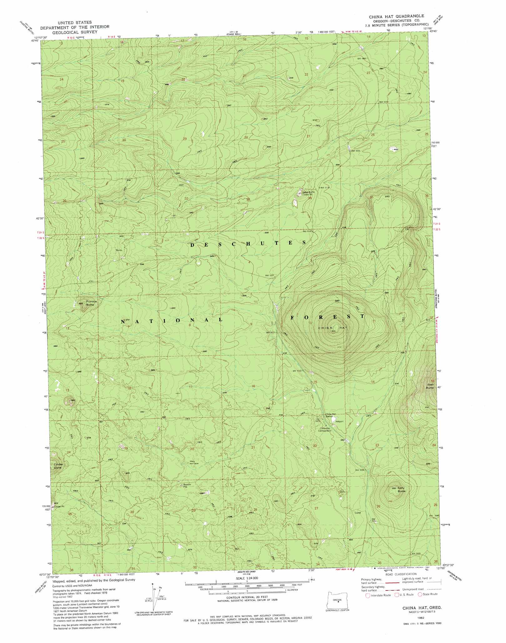
USGS Topo Quad 43121f1 - 1:24,000 scale
| Topo Map Name: | China Hat |
| USGS Topo Quad ID: | 43121f1 |
| Print Size: | ca. 21 1/4" wide x 27" high |
| Southeast Coordinates: | 43.625° N latitude / 121° W longitude |
| Map Center Coordinates: | 43.6875° N latitude / 121.0625° W longitude |
| U.S. State: | OR |
| Filename: | o43121f1.jpg |
| Download Map JPG Image: | China Hat topo map 1:24,000 scale |
| Map Type: | Topographic |
| Topo Series: | 7.5´ |
| Map Scale: | 1:24,000 |
| Source of Map Images: | United States Geological Survey (USGS) |
| Alternate Map Versions: |
China Hat OR 1982, updated 1982 Download PDF Buy paper map China Hat OR 2011 Download PDF Buy paper map China Hat OR 2014 Download PDF Buy paper map |
| FStopo: | US Forest Service topo China Hat is available: Download FStopo PDF Download FStopo TIF |
1:24,000 Topo Quads surrounding China Hat
Lava Butte |
Kelsey Butte |
Horse Ridge |
Millican |
West Butte |
Lava Cast Forest |
Fuzztail Butte |
Evans Well |
Pine Mountain |
Millican Se |
Paulina Peak |
East Lake |
China Hat |
Firestone Butte |
Plot Butte |
Spring Butte |
Indian Butte |
South Ice Cave |
Sixteen Butte |
Fox Butte |
Big Hole |
Hole In The Ground |
Cabin Lake |
Cougar Mountain |
Hogback Butte |
> Back to 43121e1 at 1:100,000 scale
> Back to 43120a1 at 1:250,000 scale
> Back to U.S. Topo Maps home
China Hat topo map: Gazetteer
China Hat: Summits
China Hat elevation 2004m 6574′Ground Hog Butte elevation 1612m 5288′
Kelly Butte elevation 1660m 5446′
Pumice Butte elevation 1807m 5928′
China Hat digital topo map on disk
Buy this China Hat topo map showing relief, roads, GPS coordinates and other geographical features, as a high-resolution digital map file on DVD: