Massena Topo Map New York
To zoom in, hover over the map of Massena
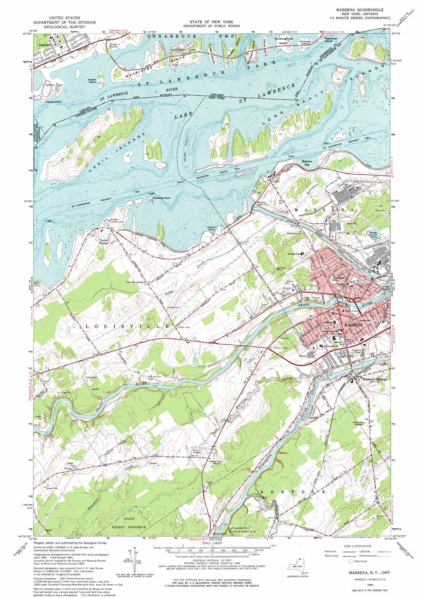
USGS Topo Quad 44074h8 - 1:24,000 scale
| Topo Map Name: | Massena |
| USGS Topo Quad ID: | 44074h8 |
| Print Size: | ca. 21 1/4" wide x 27" high |
| Southeast Coordinates: | 44.875° N latitude / 74.875° W longitude |
| Map Center Coordinates: | 44.9375° N latitude / 74.9375° W longitude |
| U.S. State: | NY |
| Filename: | o44074h8.jpg |
| Download Map JPG Image: | Massena topo map 1:24,000 scale |
| Map Type: | Topographic |
| Topo Series: | 7.5´ |
| Map Scale: | 1:24,000 |
| Source of Map Images: | United States Geological Survey (USGS) |
| Alternate Map Versions: |
Massena NY 1942, updated 1961 Download PDF Buy paper map Massena NY 1964, updated 1966 Download PDF Buy paper map Massena NY 1964, updated 1976 Download PDF Buy paper map Massena NY 1964, updated 1976 Download PDF Buy paper map Massena NY 2010 Download PDF Buy paper map Massena NY 2013 Download PDF Buy paper map Massena NY 2016 Download PDF Buy paper map |
1:24,000 Topo Quads surrounding Massena
Cornwall West |
||||
Morrisburg |
Louisville |
Massena |
Raquette River |
Hogansburg |
Waddington |
Chase Mills |
Norfolk |
Brasher Falls |
North Lawrence |
Morley |
West Potsdam |
Potsdam |
Parishville |
Nicholville |
> Back to 44074e1 at 1:100,000 scale
> Back to 44074a1 at 1:250,000 scale
> Back to U.S. Topo Maps home
Massena topo map: Gazetteer
Massena: Airports
Thomas E Perdue Heliport elevation 79m 259′Massena: Bars
Delany Shoal elevation 73m 239′Massena: Bays
Hopsons Bay elevation 73m 239′Massena: Beaches
Massena Beach elevation 74m 242′Massena: Canals
Massena Power Canal elevation 59m 193′Massena: Capes
DeVaults Point (historical) elevation 73m 239′Talcotts Point elevation 79m 259′
Massena: Channels
Big Sny elevation 73m 239′Little Sny elevation 73m 239′
Saint Lawrence Seaway elevation 73m 239′
Massena: Dams
Massena Intake Dam elevation 73m 239′Massena: Forests
Saint Lawrence State Forest Number 15 elevation 66m 216′Massena: Islands
Croil Island elevation 91m 298′Delany Island (historical) elevation 73m 239′
Long Sault Islands elevation 78m 255′
Richards Point elevation 75m 246′
Massena: Levees
Dike Number 1 elevation 78m 255′Massena: Parks
Alcoa Park elevation 68m 223′Elm Park elevation 70m 229′
Massena Springs Park elevation 55m 180′
Massena: Populated Places
Massena elevation 70m 229′Massena Springs elevation 64m 209′
Tucker Terrace elevation 79m 259′
Massena: Rapids
Long Sault Rapids (historical) elevation 73m 239′South Sault Rapids (historical) elevation 73m 239′
Massena: Streams
Dodge Creek elevation 73m 239′Hutchins Creek elevation 50m 164′
McConnell Creek elevation 54m 177′
Plum Brook elevation 52m 170′
Massena digital topo map on disk
Buy this Massena topo map showing relief, roads, GPS coordinates and other geographical features, as a high-resolution digital map file on DVD:
New York, Vermont, Connecticut & Western Massachusetts
Buy digital topo maps: New York, Vermont, Connecticut & Western Massachusetts