Massena Topo Map New York
To zoom in, hover over the map of Massena
USGS Topo Map 44074e1 - 1:100,000 scale
| Topo Map Name: | Massena |
| USGS Topo Quad ID: | 44074e1 |
| Print Size: | ca. 39" wide x 24" high |
| Southeast Coordinates: | 44.5° N latitude / 74° W longitude |
| Map Center Coordinates: | 44.75° N latitude / 74.5° W longitude |
| U.S. State: | NY |
| Filename: | 44074e1.jpg |
| Download Map JPG Image: | Massena topo map 1:100,000 scale |
| Map Type: | Topographic |
| Topo Series: | 30´x60´ |
| Map Scale: | 1:100,000 |
| Source of Map Images: | United States Geological Survey (USGS) |
| Alternate Map Versions: |
Massena NY 1985, updated 1985 Download PDF Buy paper map Massena NY 1994, updated 1994 Download PDF Buy paper map |
1:100,000 Topos surrounding Massena
North Of Massena |
North Of Lake Champlain North |
|
Ogdensburg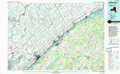 |
Massena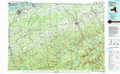 |
Lake Champlain North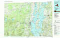 |
Gouverneur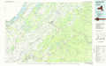 |
Tupper Lake |
Lake Champlain South |
> Back to 44074a1 at 1:250,000 scale
> Back to U.S. Topo Maps home
1:24,000 Topo Quads covered by the spatial extent of this 100k map (Massena)
|
Massena 
|
Raquette River 
|
Hogansburg 
|
Bombay 
|
Fort Covington 
|
Constable 
|
Burke 
|
Chateaugay 
|
|
Norfolk 
|
Brasher Falls 
|
North Lawrence 
|
Brushton 
|
Bangor 
|
Malone 
|
Chasm Falls 
|
Brainardsville 
|
|
Potsdam 
|
Parishville 
|
Nicholville 
|
Saint Regis Falls 
|
Santa Clara 
|
Lake Titus 
|
Owls Head 
|
Ragged Lake 
|
|
Colton 
|
Rainbow Falls 
|
Sylvan Falls 
|
Lake Ozonia 
|
Meno 
|
Meacham Lake 
|
Debar Mountain 
|
Loon Lake 
|
