Wakeley Lake Topo Map Michigan
To zoom in, hover over the map of Wakeley Lake
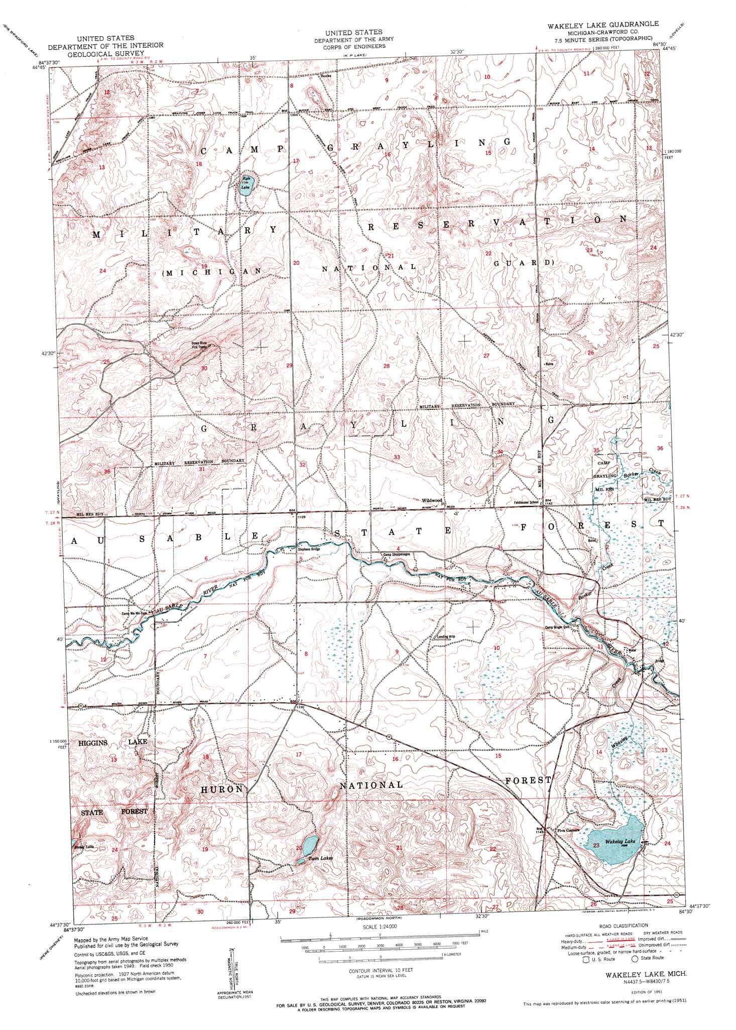
USGS Topo Quad 44084f5 - 1:24,000 scale
| Topo Map Name: | Wakeley Lake |
| USGS Topo Quad ID: | 44084f5 |
| Print Size: | ca. 21 1/4" wide x 27" high |
| Southeast Coordinates: | 44.625° N latitude / 84.5° W longitude |
| Map Center Coordinates: | 44.6875° N latitude / 84.5625° W longitude |
| U.S. State: | MI |
| Filename: | o44084f5.jpg |
| Download Map JPG Image: | Wakeley Lake topo map 1:24,000 scale |
| Map Type: | Topographic |
| Topo Series: | 7.5´ |
| Map Scale: | 1:24,000 |
| Source of Map Images: | United States Geological Survey (USGS) |
| Alternate Map Versions: |
Wakeley Lake MI 1951 Download PDF Buy paper map Wakeley Lake MI 1951 Download PDF Buy paper map Wakeley Lake MI 2012 Download PDF Buy paper map Wakeley Lake MI 2014 Download PDF Buy paper map Wakeley Lake MI 2017 Download PDF Buy paper map |
| FStopo: | US Forest Service topo Wakeley Lake is available: Download FStopo PDF Download FStopo TIF |
1:24,000 Topo Quads surrounding Wakeley Lake
Lake Arrowhead |
Otsego Lake |
Turtle Lake |
Johannesburg |
Lewiston |
Frederic |
Big Bradford Lake |
K P Lake |
Lovells |
Comstock Hills |
Lake Margrethe |
Grayling |
Wakeley Lake |
Luzerne Nw |
Red Oak |
Cote Dame Marie |
Pere Cheney |
Roscommon North |
Eldorado |
Luzerne |
Meads Landing |
Lyon Manor |
Roscommon South |
Saint Helen Nw |
Saint Helen Ne |
> Back to 44084e1 at 1:100,000 scale
> Back to 44084a1 at 1:250,000 scale
> Back to U.S. Topo Maps home
Wakeley Lake topo map: Gazetteer
Wakeley Lake: Bridges
Stephans Bridge elevation 328m 1076′Wakeley Lake: Lakes
Kneff Lakes elevation 343m 1125′Kyle Lake elevation 356m 1167′
Wakeley Lake elevation 334m 1095′
Wakeley Lake: Populated Places
Babbits Resort elevation 334m 1095′Bucks elevation 376m 1233′
Five Corners elevation 349m 1145′
Wildwood elevation 344m 1128′
Wakeley Lake: Post Offices
Sigsbee Post Office (historical) elevation 338m 1108′Wakeley Lake: Streams
Barker Creek elevation 320m 1049′Wakeley Creek elevation 319m 1046′
Wakeley Lake digital topo map on disk
Buy this Wakeley Lake topo map showing relief, roads, GPS coordinates and other geographical features, as a high-resolution digital map file on DVD: