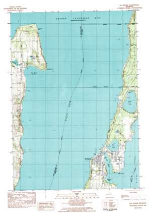
Elk Rapids Topo Map Michigan
To zoom in, hover over the map of Elk Rapids
USGS Topo Quad 44085h4 - 1:25,000 scale
| Topo Map Name: | Elk Rapids |
| USGS Topo Quad ID: | 44085h4 |
| Print Size: | ca. 21 1/4" wide x 27" high |
| Southeast Coordinates: | 44.875° N latitude / 85.375° W longitude |
| Map Center Coordinates: | 44.9375° N latitude / 85.4375° W longitude |
| U.S. State: | MI |
| Filename: | l44085h4.jpg |
| Download Map JPG Image: | Elk Rapids topo map 1:25,000 scale |
| Map Type: | Topographic |
| Topo Series: | 7.5´ |
| Map Scale: | 1:25,000 |
| Source of Map Images: | United States Geological Survey (USGS) |
| Alternate Map Versions: |
Elk Rapids MI 1983, updated 1984 Download PDF Buy paper map |
1:24,000 Topo Quads surrounding Elk Rapids
> Back to 44085e1 at 1:100,000 scale
> Back to 44084a1 at 1:250,000 scale
> Back to U.S. Topo Maps home
Elk Rapids topo map: Gazetteer
Elk Rapids: Bays
East Arm Grand Traverse Bay elevation 177m 580′Old Mission Harbor elevation 177m 580′
Spencer Bay elevation 178m 583′
Elk Rapids: Beaches
Haserot Beach elevation 178m 583′North Beach elevation 179m 587′
Elk Rapids: Capes
Leffingwell Point elevation 195m 639′Meguzee Point elevation 178m 583′
Old Mission Point elevation 181m 593′
Elk Rapids: Dams
Hydro Dam elevation 180m 590′Elk Rapids: Harbors
Edward C Grace Memorial Harbor elevation 177m 580′Elk Rapids: Lakes
Bagley Lake elevation 177m 580′Bass Lake elevation 179m 587′
Birch Lake elevation 180m 590′
Prescott Lake elevation 187m 613′
Elk Rapids: Parks
Elk Rapids Iron Company Historical Marker elevation 181m 593′Elk Rapids Park elevation 180m 590′
Hesler Log House Historical Marker elevation 183m 600′
Island House Historical Marker elevation 180m 590′
Library Park elevation 180m 590′
Old Mission Lighthouse Park elevation 183m 600′
Rotary Park elevation 180m 590′
Township Hall Historical Marker elevation 180m 590′
Elk Rapids: Populated Places
Elk Rapids elevation 182m 597′Old Mission elevation 179m 587′
Elk Rapids: Post Offices
Elk Rapids Post Office elevation 180m 590′Old Mission Post Office elevation 178m 583′
Elk Rapids: Streams
Elk River elevation 179m 587′Paradine Creek elevation 178m 583′
Elk Rapids digital topo map on disk
Buy this Elk Rapids topo map showing relief, roads, GPS coordinates and other geographical features, as a high-resolution digital map file on DVD:


