Four Corners Topo Map Wisconsin
To zoom in, hover over the map of Four Corners
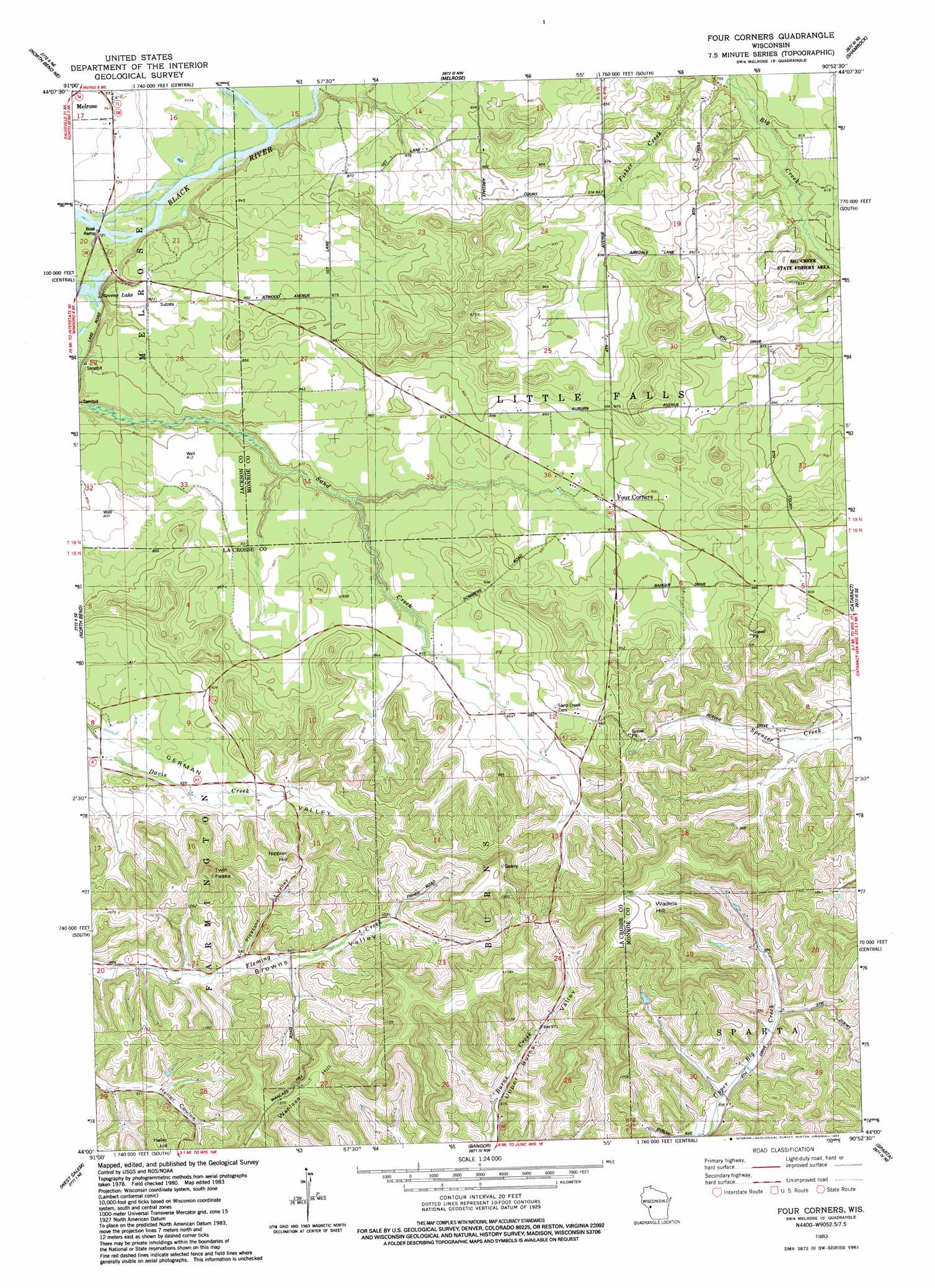
USGS Topo Quad 44090a8 - 1:24,000 scale
| Topo Map Name: | Four Corners |
| USGS Topo Quad ID: | 44090a8 |
| Print Size: | ca. 21 1/4" wide x 27" high |
| Southeast Coordinates: | 44° N latitude / 90.875° W longitude |
| Map Center Coordinates: | 44.0625° N latitude / 90.9375° W longitude |
| U.S. State: | WI |
| Filename: | o44090a8.jpg |
| Download Map JPG Image: | Four Corners topo map 1:24,000 scale |
| Map Type: | Topographic |
| Topo Series: | 7.5´ |
| Map Scale: | 1:24,000 |
| Source of Map Images: | United States Geological Survey (USGS) |
| Alternate Map Versions: |
Four Corners WI 1983, updated 1984 Download PDF Buy paper map Four Corners WI 2010 Download PDF Buy paper map Four Corners WI 2013 Download PDF Buy paper map Four Corners WI 2015 Download PDF Buy paper map |
1:24,000 Topo Quads surrounding Four Corners
Blair |
Taylor |
Stenulson Coulee |
Black River Falls |
Hatfield Sw |
Hegg |
North Bend Ne |
Melrose |
Shamrock |
Millston |
Stevenstown |
North Bend |
Four Corners |
Cataract |
Alderwood Lake |
Onalaska |
West Salem |
Bangor |
Sparta |
City Rock |
La Crosse |
Saint Joseph |
Middle Ridge |
Melvina |
Saint Marys |
> Back to 44090a1 at 1:100,000 scale
> Back to 44090a1 at 1:250,000 scale
> Back to U.S. Topo Maps home
Four Corners topo map: Gazetteer
Four Corners: Parks
Sand Creek Pines State Natural Area elevation 230m 754′Four Corners: Populated Places
Four Corners elevation 268m 879′Four Corners: Reservoirs
Stevens Lake elevation 216m 708′Four Corners: Streams
Printz Creek elevation 230m 754′Four Corners: Summits
Hippler Hill elevation 361m 1184′Twin Peaks elevation 368m 1207′
Wadels Hill elevation 428m 1404′
Wanless Hill elevation 414m 1358′
Four Corners: Valleys
Pleasant Valley elevation 287m 941′Upper Burns Valley elevation 285m 935′
Four Corners digital topo map on disk
Buy this Four Corners topo map showing relief, roads, GPS coordinates and other geographical features, as a high-resolution digital map file on DVD: