Saint Marys Topo Map Wisconsin
To zoom in, hover over the map of Saint Marys
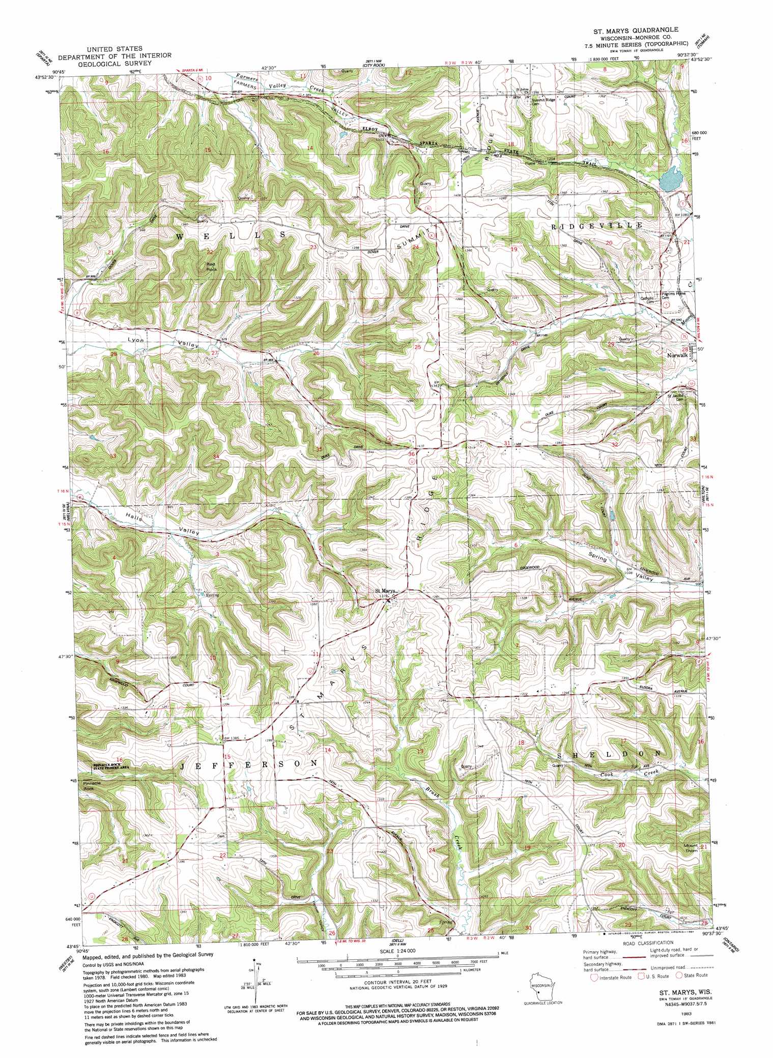
USGS Topo Quad 43090g6 - 1:24,000 scale
| Topo Map Name: | Saint Marys |
| USGS Topo Quad ID: | 43090g6 |
| Print Size: | ca. 21 1/4" wide x 27" high |
| Southeast Coordinates: | 43.75° N latitude / 90.625° W longitude |
| Map Center Coordinates: | 43.8125° N latitude / 90.6875° W longitude |
| U.S. State: | WI |
| Filename: | o43090g6.jpg |
| Download Map JPG Image: | Saint Marys topo map 1:24,000 scale |
| Map Type: | Topographic |
| Topo Series: | 7.5´ |
| Map Scale: | 1:24,000 |
| Source of Map Images: | United States Geological Survey (USGS) |
| Alternate Map Versions: |
St. Marys WI 1983, updated 1984 Download PDF Buy paper map Saint Marys WI 2010 Download PDF Buy paper map Saint Marys WI 2013 Download PDF Buy paper map Saint Marys WI 2016 Download PDF Buy paper map |
1:24,000 Topo Quads surrounding Saint Marys
Four Corners |
Cataract |
Alderwood Lake |
Tunnel City |
Wyeville |
Bangor |
Sparta |
City Rock |
Tomah |
Oakdale |
Middle Ridge |
Melvina |
Saint Marys |
Wilton |
Kendall West |
Esofea |
Westby |
Dell |
Ontario |
Trippville |
Viroqua |
Avalanche |
La Farge |
West Lima |
Yuba |
> Back to 43090e1 at 1:100,000 scale
> Back to 43090a1 at 1:250,000 scale
> Back to U.S. Topo Maps home
Saint Marys topo map: Gazetteer
Saint Marys: Dams
Haldeman G5500 Dam elevation 385m 1263′Tri Creek Number One 3WR1378 Dam elevation 329m 1079′
Saint Marys: Populated Places
Saint Marys elevation 418m 1371′Saint Marys: Reservoirs
0.6 Reservoir elevation 385m 1263′McCrary Lake 4.61 elevation 329m 1079′
Saint Marys: Ridges
Saint Marys Ridge elevation 419m 1374′Summit Ridge elevation 429m 1407′
Saint Marys: Summits
Red Rock elevation 397m 1302′Saint Marys: Tunnels
Number Three Tunnel elevation 394m 1292′Saint Marys digital topo map on disk
Buy this Saint Marys topo map showing relief, roads, GPS coordinates and other geographical features, as a high-resolution digital map file on DVD: