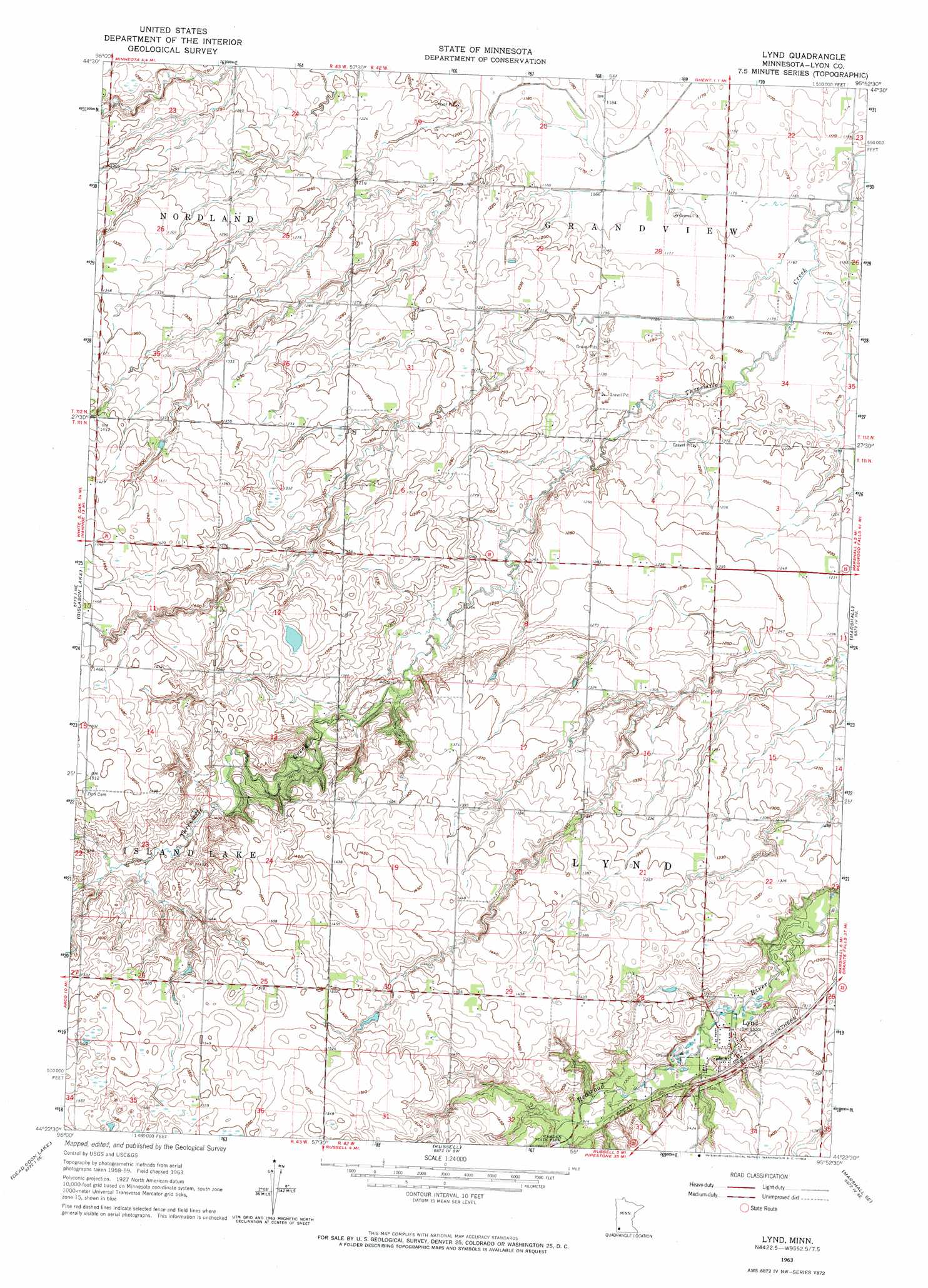
Lynd Topo Map Minnesota
To zoom in, hover over the map of Lynd
USGS Topo Quad 44095d8 - 1:24,000 scale
| Topo Map Name: | Lynd |
| USGS Topo Quad ID: | 44095d8 |
| Print Size: | ca. 21 1/4" wide x 27" high |
| Southeast Coordinates: | 44.375° N latitude / 95.875° W longitude |
| Map Center Coordinates: | 44.4375° N latitude / 95.9375° W longitude |
| U.S. State: | MN |
| Filename: | o44095d8.jpg |
| Download Map JPG Image: | Lynd topo map 1:24,000 scale |
| Map Type: | Topographic |
| Topo Series: | 7.5´ |
| Map Scale: | 1:24,000 |
| Source of Map Images: | United States Geological Survey (USGS) |
| Alternate Map Versions: |
Lynd MN 1963, updated 1964 Download PDF Buy paper map Lynd MN 2010 Download PDF Buy paper map Lynd MN 2013 Download PDF Buy paper map Lynd MN 2016 Download PDF Buy paper map |
1:24,000 Topo Quads surrounding Lynd
Porter |
Saint Leo |
Minneota Nw |
Normania |
Wood Lake Nw |
Porter Sw |
Taunton |
Minneota |
Green Valley |
Cottonwood |
Arco |
Gislason Lake |
Lynd |
Marshall |
Dudley |
Tyler |
Dead Coon Lake |
Russell |
Marshall Se |
Amiret |
Ruthton Nw |
Ruthton |
Current Lake |
Balaton |
Tracy West |
> Back to 44095a1 at 1:100,000 scale
> Back to 44094a1 at 1:250,000 scale
> Back to U.S. Topo Maps home
Lynd topo map: Gazetteer
Lynd: Dams
Runholt-Mellenthin Dam elevation 399m 1309′Lynd: Populated Places
Lynd elevation 402m 1318′Lynd Mobile Home Park elevation 403m 1322′
Lynd: Post Offices
Lynd Post Office elevation 401m 1315′Lynd digital topo map on disk
Buy this Lynd topo map showing relief, roads, GPS coordinates and other geographical features, as a high-resolution digital map file on DVD: