Small Topo Map Idaho
To zoom in, hover over the map of Small
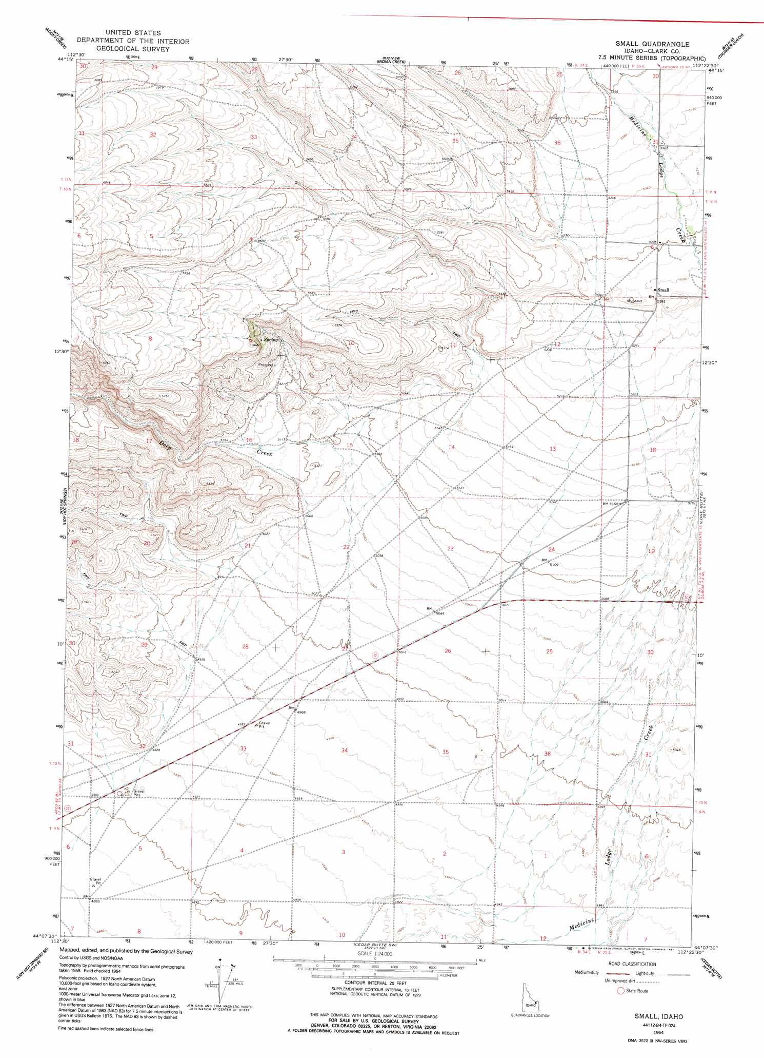
USGS Topo Quad 44112b4 - 1:24,000 scale
| Topo Map Name: | Small |
| USGS Topo Quad ID: | 44112b4 |
| Print Size: | ca. 21 1/4" wide x 27" high |
| Southeast Coordinates: | 44.125° N latitude / 112.375° W longitude |
| Map Center Coordinates: | 44.1875° N latitude / 112.4375° W longitude |
| U.S. State: | ID |
| Filename: | o44112b4.jpg |
| Download Map JPG Image: | Small topo map 1:24,000 scale |
| Map Type: | Topographic |
| Topo Series: | 7.5´ |
| Map Scale: | 1:24,000 |
| Source of Map Images: | United States Geological Survey (USGS) |
| Alternate Map Versions: |
Small ID 1964, updated 1965 Download PDF Buy paper map Small ID 1964, updated 1991 Download PDF Buy paper map Small ID 2010 Download PDF Buy paper map Small ID 2013 Download PDF Buy paper map |
1:24,000 Topo Quads surrounding Small
Fritz Peak |
Edie Creek |
Tepee Draw |
Paul Reservoir |
Spencer North |
Heart Mountain |
Rocky Creek |
Indian Creek |
Thunder Gulch |
Spencer South |
Shamrock Gulch |
Lidy Hot Springs |
Small |
Lone Butte |
Dubois |
Snaky Canyon |
Lidy Hot Springs Se |
Cedar Butte Sw |
Cedar Butte |
Camas |
Circular Butte Nw |
Monteview |
Mud Lake Nw |
Rays Lake |
Hamer |
> Back to 44112a1 at 1:100,000 scale
> Back to 44112a1 at 1:250,000 scale
> Back to U.S. Topo Maps home
Small digital topo map on disk
Buy this Small topo map showing relief, roads, GPS coordinates and other geographical features, as a high-resolution digital map file on DVD: