Bell Mountain Topo Map Idaho
To zoom in, hover over the map of Bell Mountain
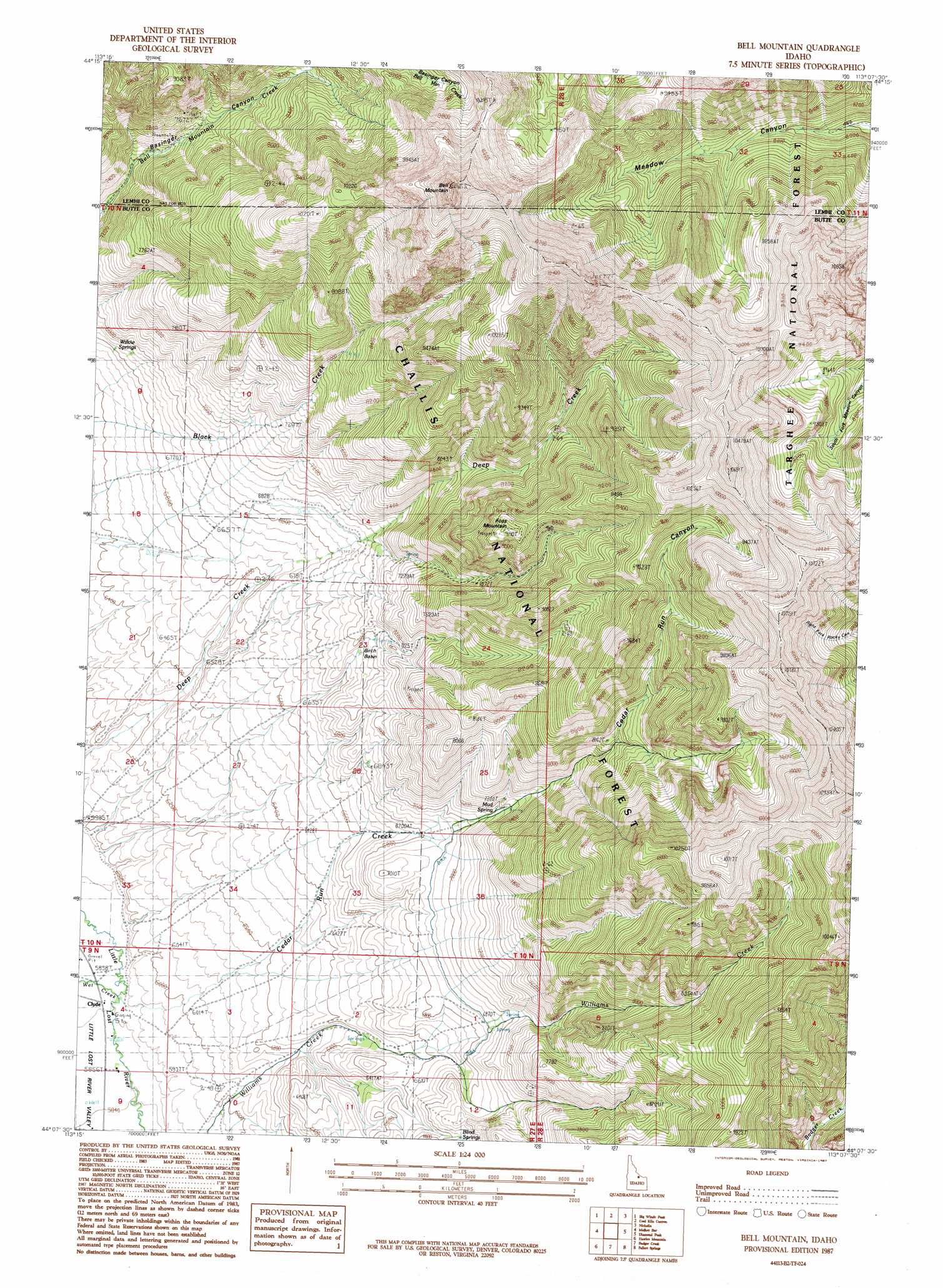
USGS Topo Quad 44113b2 - 1:24,000 scale
| Topo Map Name: | Bell Mountain |
| USGS Topo Quad ID: | 44113b2 |
| Print Size: | ca. 21 1/4" wide x 27" high |
| Southeast Coordinates: | 44.125° N latitude / 113.125° W longitude |
| Map Center Coordinates: | 44.1875° N latitude / 113.1875° W longitude |
| U.S. State: | ID |
| Filename: | o44113b2.jpg |
| Download Map JPG Image: | Bell Mountain topo map 1:24,000 scale |
| Map Type: | Topographic |
| Topo Series: | 7.5´ |
| Map Scale: | 1:24,000 |
| Source of Map Images: | United States Geological Survey (USGS) |
| Alternate Map Versions: |
Bell Mountain ID 1987, updated 1987 Download PDF Buy paper map Bell Mountain ID 2011 Download PDF Buy paper map Bell Mountain ID 2013 Download PDF Buy paper map |
| FStopo: | US Forest Service topo Bell Mountain is available: Download FStopo PDF Download FStopo TIF |
1:24,000 Topo Quads surrounding Bell Mountain
Iron Creek Point |
Gilmore |
Gilmore Summit |
Cottonwood Creek |
Eighteenmile Peak |
Moffett Springs |
Big Windy Peak |
Coal Kiln Canyon |
Nicholia |
Italian Canyon |
Red Hills |
Mulkey Bar |
Bell Mountain |
Diamond Peak |
Blue Dome |
Warren Mountain |
Hawley Mountain |
Badger Creek |
Fallert Springs |
Eightmile Canyon |
Methodist Creek |
Sunset Peak |
Howe Nw |
Howe Ne |
Tyler Peak |
> Back to 44113a1 at 1:100,000 scale
> Back to 44112a1 at 1:250,000 scale
> Back to U.S. Topo Maps home
Bell Mountain topo map: Gazetteer
Bell Mountain: Basins
Birch Basin elevation 2055m 6742′Bell Mountain: Populated Places
Clyde elevation 1790m 5872′Bell Mountain: Springs
Blind Springs elevation 2090m 6856′Mud Spring elevation 2206m 7237′
Bell Mountain: Streams
Cedar Run Creek elevation 1796m 5892′Wet Creek elevation 1796m 5892′
Bell Mountain: Summits
Bell Mountain elevation 3431m 11256′Foss Mountain elevation 2768m 9081′
Bell Mountain: Valleys
Cedar Run Canyon elevation 2019m 6624′Bell Mountain digital topo map on disk
Buy this Bell Mountain topo map showing relief, roads, GPS coordinates and other geographical features, as a high-resolution digital map file on DVD: