Magalloway Mountain Topo Map New Hampshire
To zoom in, hover over the map of Magalloway Mountain
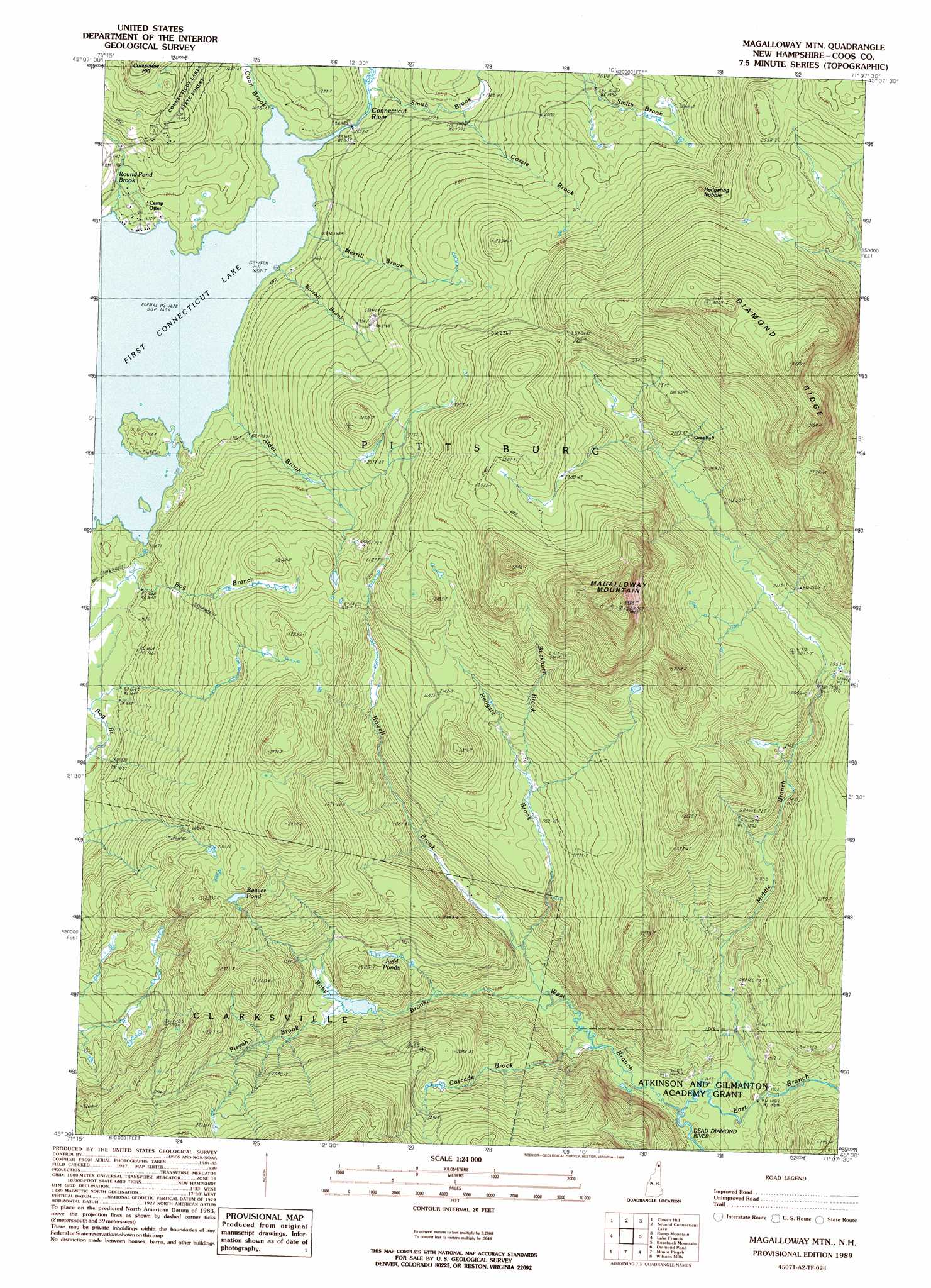
USGS Topo Quad 45071a2 - 1:24,000 scale
| Topo Map Name: | Magalloway Mountain |
| USGS Topo Quad ID: | 45071a2 |
| Print Size: | ca. 21 1/4" wide x 27" high |
| Southeast Coordinates: | 45° N latitude / 71.125° W longitude |
| Map Center Coordinates: | 45.0625° N latitude / 71.1875° W longitude |
| U.S. State: | NH |
| Filename: | o45071a2.jpg |
| Download Map JPG Image: | Magalloway Mountain topo map 1:24,000 scale |
| Map Type: | Topographic |
| Topo Series: | 7.5´ |
| Map Scale: | 1:24,000 |
| Source of Map Images: | United States Geological Survey (USGS) |
| Alternate Map Versions: |
Magalloway Mtn NH 1989, updated 1989 Download PDF Buy paper map Magalloway Mtn NH 1997, updated 2000 Download PDF Buy paper map Magalloway Mountain NH 2012 Download PDF Buy paper map Magalloway Mountain NH 2015 Download PDF Buy paper map |
1:24,000 Topo Quads surrounding Magalloway Mountain
Bellefeuille |
Chartierville |
Moose Bog |
Twin Peaks |
|
Malvina |
Cowen Hill |
Second Connecticut Lake |
Rump Mountain |
Parmachenee Lake |
Pittsburg |
Lake Francis |
Magalloway Mountain |
Bosebuck Mountain |
Lincoln Pond |
Lovering Mountain |
Diamond Pond |
Mount Pisgah |
Wilsons Mills |
Richardson Pond |
Blue Mountain |
Dixville Notch |
Errol |
Umbagog Lake North |
Middle Dam |
> Back to 45071a1 at 1:100,000 scale
> Back to 45070a1 at 1:250,000 scale
> Back to U.S. Topo Maps home
Magalloway Mountain topo map: Gazetteer
Magalloway Mountain: Dams
Shehan Pond Dam elevation 544m 1784′Magalloway Mountain: Lakes
Beaver Pond elevation 676m 2217′Connecticut Lakes elevation 500m 1640′
Judd Pond elevation 536m 1758′
Judds Ponds elevation 533m 1748′
Magalloway Mountain: Reservoirs
Shehan Pond elevation 544m 1784′Magalloway Mountain: Ridges
Diamond Ridge elevation 841m 2759′Magalloway Mountain: Streams
Alder Brook elevation 499m 1637′Barrel Brook elevation 499m 1637′
Buckhorn Brook elevation 570m 1870′
Cascade Brook elevation 443m 1453′
Coon Brook elevation 499m 1637′
Cozzie Brook elevation 542m 1778′
Hellgate Brook elevation 491m 1610′
Merrill Brook elevation 500m 1640′
Middle Branch Dead Diamond River elevation 438m 1437′
Pisgah Brook elevation 510m 1673′
Roby Brook elevation 454m 1489′
Round Pond Brook elevation 499m 1637′
Rowell Brook elevation 495m 1624′
Smith Brook elevation 550m 1804′
West Branch Dead Diamond elevation 438m 1437′
Magalloway Mountain: Summits
Hedgehog Nubble elevation 737m 2417′Magalloway Mountain elevation 1020m 3346′
Magalloway Mountain digital topo map on disk
Buy this Magalloway Mountain topo map showing relief, roads, GPS coordinates and other geographical features, as a high-resolution digital map file on DVD:
Maine, New Hampshire, Rhode Island & Eastern Massachusetts
Buy digital topo maps: Maine, New Hampshire, Rhode Island & Eastern Massachusetts