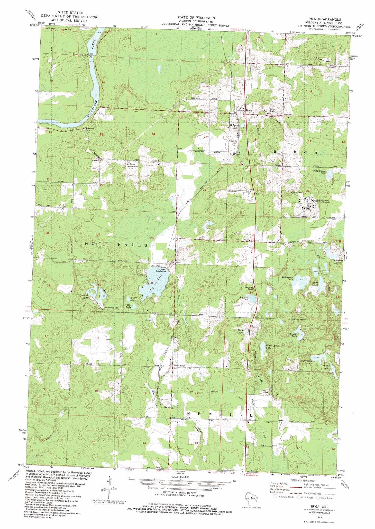
Irma Topo Map Wisconsin
To zoom in, hover over the map of Irma
USGS Topo Quad 45089c6 - 1:24,000 scale
| Topo Map Name: | Irma |
| USGS Topo Quad ID: | 45089c6 |
| Print Size: | ca. 21 1/4" wide x 27" high |
| Southeast Coordinates: | 45.25° N latitude / 89.625° W longitude |
| Map Center Coordinates: | 45.3125° N latitude / 89.6875° W longitude |
| U.S. State: | WI |
| Filename: | o45089c6.jpg |
| Download Map JPG Image: | Irma topo map 1:24,000 scale |
| Map Type: | Topographic |
| Topo Series: | 7.5´ |
| Map Scale: | 1:24,000 |
| Source of Map Images: | United States Geological Survey (USGS) |
| Alternate Map Versions: |
Irma WI 1982, updated 1983 Download PDF Buy paper map Irma WI 2010 Download PDF Buy paper map Irma WI 2013 Download PDF Buy paper map Irma WI 2015 Download PDF Buy paper map |
1:24,000 Topo Quads surrounding Irma
Tripoli |
Bradley |
Heafford Junction |
Woodboro |
Lake Julia |
Spirit Falls |
Coffee Creek |
Tomahawk |
Harrison |
Parrish |
Natzke Camp |
Grandfather Falls |
Irma |
Bloomville |
Gleason |
Fromm Lookout Tower |
Alexander Lake |
Merrill |
Pine Dells |
Doering |
Hamburg |
Little Chicago |
Brokaw |
Nutterville |
Kalinke |
> Back to 45089a1 at 1:100,000 scale
> Back to 45088a1 at 1:250,000 scale
> Back to U.S. Topo Maps home
Irma topo map: Gazetteer
Irma: Airports
Circle k Airport elevation 456m 1496′Knight Aire Airport elevation 467m 1532′
Irma: Dams
Grandmother Dam elevation 431m 1414′Grandmother Falls WP185 Dam elevation 431m 1414′
Irma: Lakes
Ackerman Lake elevation 454m 1489′Black Alder Lake elevation 437m 1433′
Hat Lake elevation 445m 1459′
Heart Lake elevation 445m 1459′
Horgen Lake elevation 457m 1499′
Horn Lake elevation 463m 1519′
Horseshoe Lake elevation 465m 1525′
Knight Lake elevation 453m 1486′
Larson Lake elevation 466m 1528′
Mud Lake elevation 440m 1443′
Nelson Lake elevation 454m 1489′
Olivotti Lake elevation 452m 1482′
Thompson Lake elevation 464m 1522′
Tug Lake elevation 442m 1450′
Irma: Parks
Tug Lake County Park elevation 445m 1459′Irma: Populated Places
Irma elevation 466m 1528′Otis elevation 418m 1371′
Irma: Reservoirs
Grandmother Flowage 2269 elevation 431m 1414′Irma: Summits
Chase Hill elevation 534m 1751′Irma Hill elevation 536m 1758′
Irma digital topo map on disk
Buy this Irma topo map showing relief, roads, GPS coordinates and other geographical features, as a high-resolution digital map file on DVD: