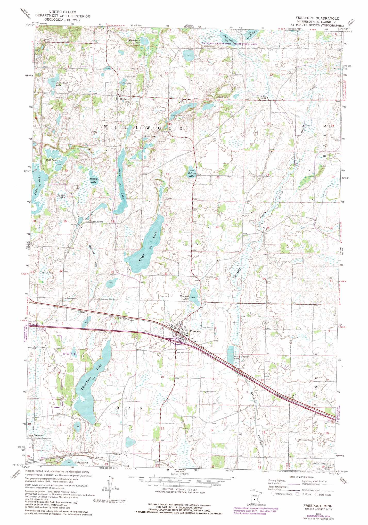
Freeport Topo Map Minnesota
To zoom in, hover over the map of Freeport
USGS Topo Quad 45094f6 - 1:24,000 scale
| Topo Map Name: | Freeport |
| USGS Topo Quad ID: | 45094f6 |
| Print Size: | ca. 21 1/4" wide x 27" high |
| Southeast Coordinates: | 45.625° N latitude / 94.625° W longitude |
| Map Center Coordinates: | 45.6875° N latitude / 94.6875° W longitude |
| U.S. State: | MN |
| Filename: | o45094f6.jpg |
| Download Map JPG Image: | Freeport topo map 1:24,000 scale |
| Map Type: | Topographic |
| Topo Series: | 7.5´ |
| Map Scale: | 1:24,000 |
| Source of Map Images: | United States Geological Survey (USGS) |
| Alternate Map Versions: |
Freeport MN 1965, updated 1966 Download PDF Buy paper map Freeport MN 1965, updated 1980 Download PDF Buy paper map Freeport MN 1965, updated 1981 Download PDF Buy paper map Freeport MN 2010 Download PDF Buy paper map Freeport MN 2013 Download PDF Buy paper map Freeport MN 2016 Download PDF Buy paper map |
1:24,000 Topo Quads surrounding Freeport
Round Prairie |
Long Prairie |
Swanville |
Flensburg |
Little Falls West |
Sauk Lake |
Ward Springs |
Burtrum |
Upsala |
Bowlus |
Sauk Centre |
Melrose |
Freeport |
Albany |
Holdingford |
Elrosa |
Greenwald |
Saint Martin |
Farming |
Avon |
Georgeville |
Lake Henry |
Paynesville |
Richmond |
Cold Spring |
> Back to 45094e1 at 1:100,000 scale
> Back to 45094a1 at 1:250,000 scale
> Back to U.S. Topo Maps home
Freeport topo map: Gazetteer
Freeport: Crossings
Interchange 140 elevation 378m 1240′Freeport: Lakes
Cedar Lake elevation 367m 1204′Freeport Lake elevation 370m 1213′
Kings Lake elevation 367m 1204′
Long Lake elevation 367m 1204′
McKenney Lake elevation 382m 1253′
Mud Lake elevation 367m 1204′
Rolling Lake elevation 382m 1253′
Swamp Lake elevation 367m 1204′
Tamarack Lake elevation 370m 1213′
Uhlenkolts Lake elevation 361m 1184′
Wolf Lake elevation 367m 1204′
Freeport: Populated Places
Freeport elevation 379m 1243′Saint Rosa elevation 389m 1276′
Freeport: Post Offices
Freeport Post Office elevation 379m 1243′Freeport: Swamps
Millwood Lake elevation 369m 1210′Stone Lake elevation 367m 1204′
Freeport digital topo map on disk
Buy this Freeport topo map showing relief, roads, GPS coordinates and other geographical features, as a high-resolution digital map file on DVD: