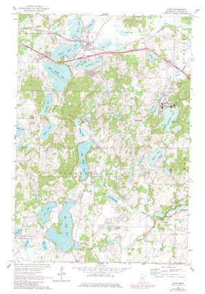
Avon Topo Map Minnesota
To zoom in, hover over the map of Avon
USGS Topo Quad 45094e4 - 1:24,000 scale
| Topo Map Name: | Avon |
| USGS Topo Quad ID: | 45094e4 |
| Print Size: | ca. 21 1/4" wide x 27" high |
| Southeast Coordinates: | 45.5° N latitude / 94.375° W longitude |
| Map Center Coordinates: | 45.5625° N latitude / 94.4375° W longitude |
| U.S. State: | MN |
| Filename: | o45094e4.jpg |
| Download Map JPG Image: | Avon topo map 1:24,000 scale |
| Map Type: | Topographic |
| Topo Series: | 7.5´ |
| Map Scale: | 1:24,000 |
| Source of Map Images: | United States Geological Survey (USGS) |
| Alternate Map Versions: |
Avon MN 1965, updated 1967 Download PDF Buy paper map Avon MN 1965, updated 1980 Download PDF Buy paper map Avon MN 2010 Download PDF Buy paper map Avon MN 2013 Download PDF Buy paper map Avon MN 2016 Download PDF Buy paper map |
1:24,000 Topo Quads surrounding Avon
> Back to 45094e1 at 1:100,000 scale
> Back to 45094a1 at 1:250,000 scale
> Back to U.S. Topo Maps home
Avon topo map: Gazetteer
Avon: Canals
County Ditch Number Twentyfive elevation 339m 1112′Avon: Crossings
Interchange 153 elevation 345m 1131′Interchange 156 elevation 347m 1138′
Avon: Lakes
Achman Lake elevation 363m 1190′Big Fish Lake elevation 363m 1190′
Big Watab Lake elevation 360m 1181′
Dullinger Lake elevation 363m 1190′
Eagle Lake elevation 363m 1190′
Island Lake elevation 363m 1190′
Kalla Lake elevation 348m 1141′
Kepper Lake elevation 342m 1122′
Ketten Lake elevation 339m 1112′
Kreighle Lake elevation 348m 1141′
Lake Anna elevation 339m 1112′
Linneman Lake elevation 342m 1122′
Little Watab Lake elevation 351m 1151′
Long Lake elevation 363m 1190′
Long Lake elevation 363m 1190′
Lower Spunk Lake elevation 339m 1112′
Merden Lake elevation 351m 1151′
Middle Spunk Lake elevation 339m 1112′
Minnie Lake elevation 342m 1122′
Minnie Lake elevation 348m 1141′
Mud Lake elevation 363m 1190′
Ochotto Lake elevation 342m 1122′
Pflueger Lake elevation 345m 1131′
Sagatagan Lake elevation 354m 1161′
Schmid Lake elevation 360m 1181′
Schuman Lake elevation 360m 1181′
Upper Spunk Lake elevation 345m 1131′
Zimmer Lake elevation 339m 1112′
Avon: Parks
Benedictines in Minnesota Historical Marker elevation 355m 1164′Charles Lindbergh's Minnesota Roots Historical Marker elevation 340m 1115′
Clemens Stadium elevation 354m 1161′
Monastery Garden elevation 357m 1171′
Saint John's Abbey and University Historical Marker elevation 355m 1164′
Student Beach elevation 356m 1167′
Avon: Populated Places
Avon elevation 345m 1131′Avon: Post Offices
Avon Post Office elevation 345m 1131′Avon: Reservoirs
Stump Lake elevation 347m 1138′Avon: Streams
Spunk Branch elevation 339m 1112′Avon digital topo map on disk
Buy this Avon topo map showing relief, roads, GPS coordinates and other geographical features, as a high-resolution digital map file on DVD:


